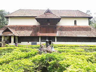
Nedumangad is an important town and municipality in Thiruvananthapuram metropolitan area of Thiruvananthapuram district in the Indian state of Kerala, and is the headquarters of Nedumangad tehsil and Nedumangad Revenue Division (RDO). It is a suburb of the extended metropolitan region of Thiruvananthapuram city. It is located around 16 km to the north-east of Thiruvananthapuram city centre on the Thiruvananthapuram – Shenkottah. It is an important hillside commercial center in the district. It is a growing commercial and educational hub and all important government institutions are situated in the town. Nedumangadu Market is important in South Kerala.

Aluva is a region in the city of Kochi in Kerala, India. It is a part of the Kochi metropolitan area and is situated around 15 km (9.3 mi) from the city center on the banks of Periyar River. A major transportation hub, with easy access to all major forms of transportation, Aluva acts as a corridor which links the highland districts to the rest of Kerala. Cochin International Airport at Nedumbassery is 11.7 km from Aluva. Aluva is accessible through rail, air, metro along with major highways and roadlines. Aluva KSRTC bus station is an important transport hub in Kerala and one of the busiest stations in central part of the state.

Vypin is one of the group of islands that form part of the city of Kochi (Cochin), in the Indian state of Kerala. Vypin forms a barrier island which lies between the Arabian Sea in the west and the Cochin backwaters formed by the various distributaries of Periyar river, in the east. The northernmost end of the island lies on the estuary of the Periyar river in Muziris (Kodungallur), and the southernmost end in the mouth of the Cochin Backwaters in Kalamukku near Fort Vypin. The island is about 27 kilometres (17 mi) long and is connected to mainland Kochi by a series of bridges known as the Goshree bridges, which start at Kalamukku in Vypin, touch other two islands and then finish at Marine Drive covering a total distance of around three km (1.9 mi). Vypin is 58th most densely populated islands in the world. Njarakkal is one of the most densely populated locations within Vypin.
North Paravur. formerly known as Paravur or Parur, is a municipality in Ernakulam district in the Indian state of Kerala. It is a northern suburb of the city of Kochi and is situated around 20 km from the city centre. It is also the first place in India to use electronic voting machine during the by-elections in 1982.
Piravom is a Municipality in Ernakulam district and a suburb of Kochi in the Indian state of Kerala. It is located with in 31 km southeast of Kochi city center, at the boundary of the Ernakulam and Kottayam districts. Piravom is famous for its Hindu temples and Christian churches. Piravom has a river-front, verdant hills, and paddy fields.
Pukkattupady is a suburb of the City of Kochi, in Ernakulam District, Kerala, India. It is in intersection of major bus route from Aluva Town via F.A.C.T and BPCL to Thrippunithura and Kolenchery via Kizhakkambalam and the routes from Perumbavoor to Ernakulam via NPOL or Edappally.

Nayarambalam is a suburb of Cochin city and coastal village on Vypin island in Ernakulam District in the state of Kerala, India.
Chellanam is a village and a suburb of Kochi city in the Indian state of Kerala.
Pothencode, is a rapidly developing town and a developing area of Thiruvananthapuram District in the Indian state of Kerala. Spiritual leaders Brahmasree Jagadguru Swami Sathyananda Saraswathi, Sree Rama Dasa Mission, Karunakara Guru and founder of Punnyabhumi Daily hail from the village. Pothencode is 18 km (11 mi) from East Fort.
Ezhikkara is a panchayat in Paravur Taluk of Ernakulam District, Kerala. The North Paravur, Chathanad road (9 km) passes through this village. Ezhikkara is situated close to Ernakulam. Ezhikkara is famous for its pokkali fields and prawn farms.
Paravur Taluk, IPA: [pɐrɐʋuːr], is a taluk of Ernakulam District in the Indian State of Kerala. North Paravur is the capital of the taluk. Paravur Taluk lies in the north western part of Ernakulam district bordering Thrissur district. The surrounding taluks are Kochi to the west consisting of Vypin Island, Kodungallur to the north, Chalakudy to the north consisting of Mala, Aluva to the east consisting of Angamaly, Nedumbassery and Aluva, Kanayanur to the south consisting of Cochin City. Paravur is a part of Kochi urban agglomeration area. The western parts of taluk are coastal areas with cultivations like prawn and pokkali rice. The eastern parts are fertile lands. The heavy industries of Kochi is located in Udyogmandal area of the taluk.
Thirumarady is situated in the eastern part of Ernakulam District in Kerala, South India. Thirumarady is the headquarters of Thirumarady Grama Panchayath which won an award for the "Best Panchayat in the State" two times for its commendable achievements in the rural area.
Karunagappally is a municipality in the Kollam district of Kerala, India. It is 24 km north of Kollam and 60 km (37 mi) south of Alappuzha. Karunagappally taluk consists of Alappad, Ochira, Adinad, Karunagappally, Thazhava, Pavumba, Thodiyoor, Kallalibhagom, Thevalakkara, Chavara, Neendakara, Clappana, Kulasekharapuram, Thekkumbhagam, Ayanivelikulangara, Panmana, Ponmana and Vadakumthala. The taluk is bound on the north by Kayamkulam, on the east by Kunnathur taluk, on the south by Kollam and on the west by the Arabian Sea. It is one of the fastest developing towns in Kerala and is part of Kollam metropolitan area.

Pallippuram is a village on Vypeen island, in Kochi, Kerala, south India. The village is located approximately 25 km from Ernakulam and 20 km from Cochin International Airport. The east border is Periyar River, and the Arabian Sea in the west.

Thycattusserry is a village in the Cherthala taluk of the Alappuzha district in the Indian state of Kerala.
Marady is a village in Ernakulam district in the Indian state of Kerala.
Chirakkara is a village in Kollam district in the state of Kerala, India. Chirakkara is 16 km away from the City of Kollam and 8 km away from Paravur Town, which is famous for festivals, estuary, backwaters and beaches.

Thuravoor is a Gram Panchayat in Aluva Taluk of Ernakulam District in the South Indian state of Kerala. Thuravoor Grama Panchayath is nearly 5 km from Angamaly Town. The Panchayat covers 12.13 km2 in area. The borders of this panchayat are Mookkannoor and Manjapra Panchayat in the north, Manjapra, Malayattoor-Neeleeswaram Panchayat in the East. Kalady panchayat and Angamaly Municipality in the south, and Karukutty and Mookkannoor Panchayat on the west.
Kidangoor is a small village in Thuravoor Panchayath near Angamaly in Eranakulam district in the Indian state of Kerala.
Kakkoor is a village situated in the eastern part of Ernakulam district in Kerala, south of India. Kakkoor is famously known for Kakkoor Kalavayal the agricultural fest conducted every year in the month of Kumbham in the Malayalam calendar.

