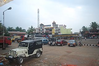
Ernakulam is a district of Kerala, India, that takes its name from the eponymous city division in Kochi. It is situated in the central part of the state, spans an area of about 3,000 square kilometres (1,200 sq mi), and is home to over 9% of Kerala's population. Its headquarters are located at Kakkanad. The district includes Kochi, also known as the IT and commercial capital of Kerala, which is famous for its ancient Hindu temples, churches, and mosques. The district includes the largest metropolitan region of the state: Greater Cochin. Ernakulam is the district that yields the most revenue and the largest number of industries in the state. It contributes to around 60% of the annual state revenue, and is the third most populous district in Kerala, after Malappuram and Thiruvananthapuram. The district also hosts the highest number of international and domestic tourists in Kerala state.

Kodanad is a rural riverside village of Ernakulam district in Kerala, South India. Kodanad is situated on the south bank of Periyar river, about 42 kilometers east of Kochi. The nearest airport is Cochin International Airport which is about 20 km (12 mi) by road. The village is a major tourist destination because it houses an Elephant training center.

Anchal is a town located in the centre of the Kollam district of Kerala, India, between National Highway 744 and Main Central Road.

Kizhakkambalam is an eastern suburb of the city of Kochi in Ernakulam district, Kerala, India. It is regarded as a model panchayat for its various development activities and is a part of the Kunnathunad tehsil of the Ernakulam district.

.

Mazhuvannoor is a panchayat village in the Ernakulam district of Kerala, India. It is located in the Kunnathunad taluk. It is located near the town of Kolenchery. The panchayat headquarters are located at Airapuram.

Arakapady is a village in the Ernakulam district of Kerala, India. It is located in the Kunnathunad taluk.

Asamannoor is a village in the Ernakulam district of Kerala, India. It is located in the Kunnathunad taluk.

Edakkattuvayal is a village in the Ernakulam district of Kerala, India. It is located in the Kanayannur taluk. Toc H Institute of Science and Technology, AP Varkky Mission Hospital and Chinmaya Mission are major institutions in the area.

Irapuram is a village in the Ernakulam district of Kerala, India. It is located in the Kunnathunad taluk. It lies 9 km away from Perumbavoor towards Muvattupuzha.
Kombanad is a village in Ernakulam district in the Indian state of Kerala.

Kuttampuzha is a gram panchayat in Ernakulam district in the Indian state of Kerala. Situated 71km east of Kochi, Kuttampuzha panchayat is home to the 17.7% of total area of the Ernakulam District.

Mulavoor is a panchayath in Muvattupuzha in Ernakulam district in the Indian state of Kerala. It is a semi urban area in Muvattupuzha town. Mulavoor panchayath has many educational institutions like Ilahia engineering college, Ilahiya College of Management Studies, Govt U.P. School Mulavoor, MSM U.P School etc. The panchayath have many business organisation like KNS Timbers Mulavoor, marangattu cashews, mulattu cashews etc. Mulavoor chandanakkudam, Ulsavam of Arecadu Bhagavathi temple are the festivals of Mulavoor.

Neriamangalam is a village in Ernakulam district in the Indian state of Kerala. Neriamangalam is on the banks of Periyar River. It is on the border of Ernakulam and Idukki districts. Agriculture is the predominant occupation in this area. The Neriamangalam Bridge, Ranikallu etc. are of historical importance. The Neriamangalam Bridge, built across the Periyar river, is often referred as 'The Gateway to the Highranges' as it is on the way to the higher regions of Idukki district, especially Munnar. The bridge was made by the Maharaja of Travancore in 1935. Now the bridge is a part of National Highway 49 which leads to Dhanushkodi in Tamil Nadu. The St Joseph's church, Neriamangalam is a major place of worship for Syro-Malabar Christians of this region. The Jawahar Navodaya Vidyalaya, Neriamangalam is an important educational institution in this region. Neriamangalam gets one of the highest average rainfall in the state of Kerala. So this place is aptly hailed as 'The Cherrapunjee of Kerala'. The nearest town is Kothamangalam, which is about 17.6 km (11 mi) from Neriamangalam.

Pothanikkad or Pothanicad is a village in Ernakulam district in the Indian state of Kerala. It's also the first village to achieve 100% literacy in India. The name derives from the Malayalam words poth, meaning buffalo, anaa, meaning elephant, and kaddu, meaning forest, as it was originally a forest with wild buffalos and elephants. Now, this small village has developed into one of the most educated and culturally advanced villages in Kerala. St. Mary's High School is the oldest high school in Pothanicad, where very prominent people in the society and many local politicians have been educated. St. John's Higher Secondary school Pulinthanam is a pioneering educational institution in the village. A government Lower Primary school and two other private Senior Secondary High schools, following CBSE curriculum, also provides better educational opportunities for the young community.

Thiruvaniyoor is an eastern suburb of the city of Kochi in the state of Kerala, India. Situated around 15 km south-east from the city centre, it is a part of Kunnathunad taluk.

Vengoor is a village in the Ernakulam district of Kerala, India. It is located in the Angamaly Municipality.

Vengoor West is a village in the Ernakulam district of Kerala, India. It is located in the Kunnathunad taluk.

Valakam, also known as Valakom is a village in the Ernakulam district of Kerala, India. It is located in the Muvattupuzha taluk, 8 kilometres (5 mi) west of the Muvattupuzha town. The [[National Highway 85 {BJ construction}(India)|National Highway 85]] passes through Valakom.


