Edathala

Last updated

Edathala
Grama panchayat
India Kerala location map.svg
Red pog.svg
Edathala
Location in Kerala, India
Coordinates: 10°01′47″N76°19′11″E / 10.0297°N 76.3197°E / 10.0297; 76.3197 Coordinates: 10°01′47″N76°19′11″E / 10.0297°N 76.3197°E / 10.0297; 76.3197
CountryFlag of India.svg  India
State Kerala
District Ernakulam
Government
  BodyGrama panchayath
Area
  Total34.99 km2 (13.51 sq mi)
Population
 (2011)
  Total77,811
  Density2,200/km2 (5,800/sq mi)
Languages
  Official Malayalam, English
Time zone UTC+5:30 (IST)
Vehicle registration KL-41 Aluva

Edathala is a gram panchayat near Aluva town. It is also a village in Aluva taluk of Ernakulam district, in the state of Kerala, India.

Contents

History

About 300 years ago, Padamattam was the place where the Lord King of Edappally fought against Kalathil Kartha. The South Indian Armory of the Indian Navy is located near the battlefield. The Pengatussery mosque and Kuzhivelippady Juma masjid which was established 172 years ago are the places of worship of the Muslim community. There are many masjids here. Launched in 1928, the Scab Fence Math and its adjacent destitute house are services. The Yattikhana, founded by Kurupali Mustafa Sahib in honor of his father, is one of the prominent religious institutions in the region. Ayurvedic physicians Pukkottil Madhava Vaidyar and SD Pharmacy have worked in their respective fields. Ayurvedic Unani Homeopathic Allopathic Medical Center is located here. Various rituals, such as untouchability, and superstitions, such as myths, existed. Serpents can be seen in most Nair homes. There is a form of worship called the frequent version. There are folk art forms like Pulluvanpattu, Onapattu, Nattuppattu, Thigh-throbbing Sastham Pattu, Kokkali and Oppana. With the advent of concrete buildings, the old architectural style of architecture has gone. There are only a handful of old-fashioned squares, and the family still lives on the floor. The legendary Pinot temple associated with the Chottanikkara Temple, the Kurumbakkavu, Kunjattu, Mukkottil, Kuzikkattu, Thottiyil, Potachira, Karukapilli, Mattappilli, Valliyamman, Puthupara Ayyappaswamy and many other old temple festivals are served by the panchayat. Once upon a time, a very big festival was held at the Pinat Bhagwati Temple. Situated at the confluence of Muslim warriors who fought with their enemies, the Peyangattussery Shaheedanar Siyaram is still a place of pilgrimage. The Centennial Mosque is home to several mosques in Mulepally, Nochima, Kodikuthumala and St. Jude Church in eight acres. [1]

Demographics

As of 2011 India census, [2] Edathala had a total population of 77,811. Males constitute 38,454 (49.41%) of the population and females 39,357 (50.58%). Edathala has an average literacy rate of 82%; 64,450 of 77,811 are literate. The literacy rate is higher than the national average of 59.5% and male literacy is 84%, female literacy is 81%. In Edathala, 11% (8,772) of the population is under 6 years of age. 70% of population belongs to the middle class.

Chunangamvely is a village located near Edathala. Pukkattupady is one of the most popular and busy junctions in Edathala.

Educational institutions

There are many schools in Edathala. Swamy gopalananda Theertha Saraswathy Vidyanikethan, Al Hind Public School, Al-Ameen International Public School, St. Joseph Public School, Manalimukku, Abdulla Haji Ahmed Sait Memorial KMEA Al-Manar Higher Secondary School, KNM MES high school, Govt Higher secondary school Kunjattukara are some among them.

MES College For Advanced Studies is a college in Edathala. KMEA engineering college, is also situated in Kuzhivelipady in Edathala. The KMEA College of Architecture and the KMEA College of Arts And Science is also located on the Kuzhivelipady campus. AL-Ameen College is also located in Edathala.

Facilities

Edathala service co-op bank, State Bank of India (formerly State Bank of Travancore) and Federal Bank provide all the necessary banking facilities.

SOS and MES orphanage are some charity organizations operating in Edathala.

Cochin International Airport is hardly 20 km away from Edathala.

Rajagiri Hospital is situated in Edathala panchayath.

Industries

Royal Plastic Industries, a leader in plastic flower pots; Hi-Tech Engineering, a forerunner in structural fabrication situated at Pukkattupady. Tollins tyres, Vysali pharmaceuticals, Karothukuzhi plastics, PEEJAY Tubes are also situated in Edathala.

Worship places

Kuzhivelipady Muslim Jamaath, MalayilPalli Muslim Jamaath and Pengattusseri Muslim Jammaath are the main Jama Masji in Edathala Panachayath.

There are a lot of masjids situated in Edathala Grama Panchayat. A few of them are:

  1. Hayatul Islam Masjid, Njarakkattumoola
  2. Mahdanul Islam Masjid, Maidanimugal
  3. Central Juma Masjid, Malekkapady
  4. Juma Masjid, kuzhikkattukara
  5. Huda Muslim Jama ath, Nalammile

Edathala Panchayath has many Devi Temples. Some of them are
Edathala Sree Painaatu Durga Temple
Sree Kurumbakkavu Bhagavathy Temple Edathala [3]
Edathala Sree Kunjatu Bhagavathy Temple
Edathala Sree Koothanali Bhagavathy temple
Edathala Sree Mattapilly Bhagavathy Temple
Edathala Sree Karukapilly Bhagavathy Temple
Edathala Sree Vettakkorumakan Temple
Edathala Sree Thuruthi Bhagavathy Temple
Edathala Pirali Sree Dharma Sastha Bhagavathy Temple
Edathala Sree Kuzhikattukavu Bhagavathy Temple
Edathala Mukkottil Temple
Valliyamma kovil (Sree Subrahmanya Temple)

Related Research Articles

<span class="mw-page-title-main">Nedumangad</span> Town in Kerala, India

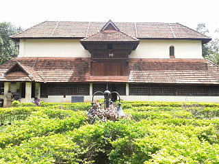
Nedumangad is a town and municipality in Thiruvananthapuram metropolitan area of Thiruvananthapuram district in the Indian state of Kerala, and is the headquarters of Nedumangad tehsil and Nedumangad Revenue Division (RDO). It is a suburb of the extended metropolitan region of Thiruvananthapuram city. It is located around 16 km to the north-east of Thiruvananthapuram city on the Thiruvananthapuram – Shenkottah. It is an important commercial center in the district. It is a growing commercial and educational hub and all important government institutions are situated in the town. Nedumangadu Market is important in South Kerala.

<span class="mw-page-title-main">Aluva</span> Region in Kochi, Kerala, India

Aluva is a region in the city of Kochi in Kerala, India. It is a part of the Kochi metropolitan area and is situated around 15 km (9.3 mi) from the city center on the banks of Periyar River. A major transportation hub, with easy access to all major forms of transportation, Aluva acts as a corridor which links the highland districts to the rest of Kerala. Cochin International Airport at Nedumbassery is 11.7 km from Aluva. Aluva is accessible through rail, air, metro along with major highways and roadlines. Aluva KSRTC bus station is an important transport hub in Kerala and one of the busiest stations in central part of the state.

<span class="mw-page-title-main">Perumbavoor</span> Neighbourhood in Ernakulam, Kerala, India +91

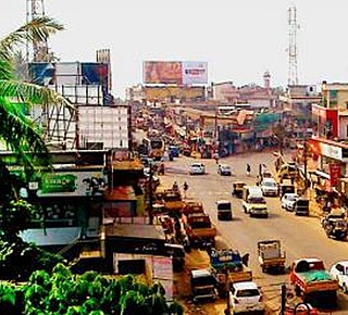
Perumbavoor is a historic place located at Bank of Periyar in Ernakulam District in the Indian state of Kerala. It is a part of the Kochi metropolitan area It lies in the north-eastern tip of the Greater Cochin area and is also the headquarters of Kunnathunad Taluk. Perumbavoor is famed in the state for wood industries and small-scale industries. Ernakulam lies 30 km southwest of Perumbavoor. The town lies between Angamaly and Muvattupuzha on the Main Central Road (MC), which connects Thiruvananthapuram to Angamaly through the old Travancore part of Kerala. Perumbavoor lies in the banks of river Periyar.

Eloor is a suburb of Kochi and a municipality in Paravur Taluk, Ernakulam District in the Indian state of Kerala, India. It is an industrial area situated around 13 kilometres north of the city centre. It is an island of 14.21 km2 formed between two distributaries of river Periyar and is the largest industrial belt in Kerala. The neighbouring places of Eloor are Kalamassery industrial hub, Aluva, Cheranalloor and Paravur.

<span class="mw-page-title-main">Kadungalloor</span> Village in Kerala, India

Kadungalloor, IPA: [kɐɖuŋːɐlːuːr], is a village situated near Aluva. The village belongs to the Paravur Taluk of the Ernakulam district in the Indian state of Kerala. The industrial estates of Muppathadam and Edayar are located in Kadungalloor.

<span class="mw-page-title-main">Kalliasseri</span> Census Town in Kerala, India

Kalliasseri is a census town in Kannur district in the Indian state of Kerala. Kalliaseri Panchayat comprises two villages: Kalliasseri and Irinave.

Kottuvally is a census town in Paravoor.It is also a village in Paravur Taluk, Ernakulam district in the Indian state of Kerala. The village is situated in the south of the taluk. The nearest town is North Paravur, 4 km away. The Kottuvally panchayath is spread out on both sides of NH-66 road.

<span class="mw-page-title-main">Peralasseri</span> Census Town in Kerala, India

Peralasseri is a census town and Panchayat headquarters in Kannur district in the Indian state of Kerala, situated on the Kannur-Kuthuparamba State Highway 38 (Kerala), 12 km from Kannur city, on the bank of Anjarakandy river.

<span class="mw-page-title-main">Kunnukara</span> Town in Kerala, India

Kunnukara is a census town and panchayat in Paravur Taluk of Ernakulam district, Kerala, India. The village is situated on the airport road connecting North Paravur (NH66) and Nedumbassery (NH544). North Paravur is the nearest town, 7 km from this village. Aluva (10 km) and Angamaly (12 km) are also near to Kunnukara. Its administrative headquarters is in Kunnukara Town itself. The Mini Civil Station has four hospitals, all the Govt. offices, a Khadi Unit Supermarkets etc.

<span class="mw-page-title-main">Idimuzhikkal</span> Census town in Kerala, India

Idimuzhikkal or Chelembra is a town in Malappuram district, Kerala, India. Chelembra is the Panchayath and Idimuzhikal is the capital of this Panchayath. Chelembra grama panchayat in the district.

Kizhuparamba or Keezhuparamba is a village and Panchayath on the northern boundary of Malappuram District In Kerala State of India.

Mannancherry is a village in Alappuzha district in Kerala, India. It is situated about 10 km north of Alappuzha town. Vembanad Lake forms the eastern boundary of the village. In governance, Mannancherry is a Panchayat. In parliamentary representation, it is part of the Alappuzha Assembly constituency, as well as the Alappuzha LokSabha constituency. The primary occupation of the village's inhabitants has been coir-making for the past several decades.

Rajakkad is a town in the Idukki district in the Indian state of Kerala situated in the Western Ghats.

<span class="mw-page-title-main">Athavanad</span> Village in Kerala, India

Athavanad is a village in the Tirur Taluk, in the Malappuram District of the state of Kerala, India. The town lies on the National Highway 17, between Kuttippuram and Valanchery. Puthanathani is the main town of the Athavanad village and the village office is located in Athavanad Para & Kurumbathoor. Nearby towns include Valanchery, Kalpakanchery, Tavanur, Tirunavaya, Kuttippuram, Irimbiliyam, and Edayur.

Polpully is a village and gram panchayat in Palakkad district in the state of Kerala, India. The village is located 10 km from Palakkad city, and 5 km from Chittur.

<span class="mw-page-title-main">Thuravoor, Angamaly</span> Village in Kerala, India

Thuravoor is a Gram Panchayat in Aluva Taluk of Ernakulam District in the South Indian state of Kerala. Thuravoor Grama Panchayath is nearly 5 km from Angamaly Town. The Panchayat covers 12.13 km2 in area. The borders of this panchayat are Mookkannoor and Manjapra Panchayat in the north, Manjapra, Malayattoor-Neeleeswaram Panchayat in the East. Kalady panchayat and Angamaly Municipality in the south, and Karukutty and Mookkannoor Panchayat on the west.

<span class="mw-page-title-main">Muttom, Thodupuzha</span> Gram Panchayat in Kerala, India

Muttom is a rural area in Idukki district in the Indian state of Kerala. This place is 66 km away from Cochin. Geographically this place is part of Midland or Idanad region of Kerala. Hindus, Christians and Muslims are living peacefully in the area.

Narippatta is a village and a Grama Panchayath in the north of Kozhikode district, Kerala, India.

Perumbavoor has many Hindu temples, Muslim mosques and Christian churches. As the area is dominated by expatriate north Indian workers, some places of worship cater to the taste of North Indian devotees.

Kuzhivelipady is a small village/hamlet in the Vazhakkulam block in the Ernakulam District of the Indian state of Kerala. The village belongs to the Central Kerala Division and is located 28 km due east from district headquarters Kakkanad.

References

  1. "ചരിത്രം « എടത്തല ഗ്രാമപഞ്ചായത്ത് (Edathala Grama Panchayat)" . Retrieved 6 September 2022.
  2. "Census of India: Search Details". Archived from the original on 17 April 2021. Retrieved 2 January 2019.
  3. Kurumbakkavu Bhagavathy Temple Edathala