
Ernakulam is one of the 14 districts in the Indian state of Kerala, and takes its name from the eponymous city division in Kochi. It is situated in the central part of the state, spans an area of about 2,924 square kilometres (1,129 sq mi), and is home to over 9% of Kerala's population. Its headquarters are located at Kakkanad. The district includes Kochi, also known as the commercial capital of Kerala, which is famous for its ancient churches, Hindu temples, synagogues and mosques.

Angamaly is a municipality in the Ernakulam district of Kerala, India. It is located 20 km (12.4 mi) north of the district collectorate in Thrikkakara and about 203 km (126.1 mi) north of the state capital Thiruvananthapuram. Angamaly is part of the Kochi metropolitan area and is located 24 km (14.9 mi) northeast of the Kochi city centre. As per the 2011 Indian census, Angamaly has a population of 33,465 people, and a population density of 1,633/km2 (4,230/sq mi).
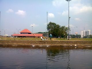
Aluva, is a municipality in the Ernakulam district of Kerala, India. It is part of the Kochi metropolitan area, 15 km (9.3 mi) north of the Kochi city centre. As per the 2011 Indian census, Aluva has a population of 22,428.

Perumbavoor is a municipality in the Ernakulam district of Kerala, India. It is located 18 km (11.2 mi) north of the district collectorate in Thrikkakara and about 187 km (116.2 mi) north of the state capital Thiruvananthapuram. Perumbavoor is part of the Kochi metropolitan area and is located 26 km (16.2 mi) northeast of the Kochi city centre. As per the 2011 Indian census, Perumbavoor has a population of 28,110 people, and a population density of 2,065/km2 (5,350/sq mi).
Kothamangalam is a municipality at the foot of the Western Ghats in the Ernakulam district of Kerala, India. It is located 41 km (25.5 mi) east of the district collectorate in Thrikkakara and about 218 km (135.5 mi) north of the state capital Thiruvananthapuram. As per the 2011 Indian census, Kothamangalam has a population of 38,837 people, and a population density of 969/km2 (2,510/sq mi).
Edappally is a ward of Kochi, Kerala. The name is also used to refer to adjacent wards of Kalamassery and Thrikkakkara municipalities. Edappally is a major commercial centre as well as a prominent residential region. Edappally junction is one of the busiest junctions in the city.
Cheranallur or Cheranellore or Cheranelloor is a suburb of Kochi city in the state of Kerala, India and lies on the banks of the Periyar River. According to tradition, the area was named by its earlier inhabitants who found this place very fertile and beautiful. The name in its local language Malayalam means "Good Village of Cheras".
Edathala is a gram panchayat near Aluva town. It is also a village in Aluva taluk of Ernakulam district, in the state of Kerala, India.

Kodanad is a rural riverside village of Ernakulam district in Kerala, South India. It is 18 km from Angamaly. Kodanad is situated on the south bank of Periyar river, about 42 kilometers east of Kochi. The village is a major tourist destination because it houses an Elephant training center.
Ernakulam refers to the western part of the mainland of Kochi city in Kerala, India. Ernakulam is the most urbanised part of Kochi and has lent its name to Ernakulam District.
This is a list of pilgrimage centres in Ernakulam district in Kerala, India.

This article lists the various old and ancient churches that exist among the Saint Thomas Christians in Kerala.

Rayamangalam is a village in the Ernakulam district of Kerala state, India.

South Vazhakulam is a small town in between Aluva and Perumbavoor on Aluva-Munnar State Highway(SH-16). South Vazhakulam represents Vazhakulam Village, Vazhakulam Panchayat & Vazhakulam Block.

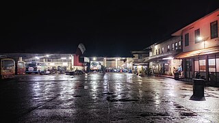
Aluva railway station is an NSG–3 category Indian railway station in Thiruvananthapuram railway division of Southern Railway zone. It is a railway station in the city of Aluva in the Ernakulam district in the Indian state of Kerala. The station lies in the Shoranur–Cochin Harbour section of Thiruvananthapuram railway division. It is located right aside Aluva KSRTC bus stand, one of the main bus terminals in Ernakulam district, and a kilometre away from Aluva metro station of the Kochi Metro.
Perumbavoor has many Hindu temples, Muslim mosques and Christian churches. As the area is dominated by expatriate north Indian workers, some places of worship cater to the taste of North Indian devotees.
Malayidomthuruth is a town in Kizhakkambalam panchayath near city of Kochi, India. Malayidomthuruth is where road from Oorakkad and Thamarachal make a junction on road from Pukkattupadi to Chembarakky.
Thamarachal is a town in Kizhakkambalam panchayath near city of Kochi, India. Thamarachal is where road from Oorakkad and Malayidomthuruth make a junction on road from Pukkattupadi to Kizhakkambalam.

