
Ernakulam, IPA: [erɐɳɐːguɭɐm]; IAST: Eṟaṇākuḷaṁ, in Malayalam: എറണാകുളം) is a district of Kerala, India, that takes its name from the eponymous city division in Kochi. It is situated in the central part of the state, spans an area of about 3,000 square kilometres (1,200 sq mi), and is home to over 9% of Kerala's population. Its headquarters are located at Kakkanad. The district includes Kochi, also known as the commercial capital of Kerala, which is famous for its ancient Hindu temples, churches, and mosques. The district includes the largest metropolitan region of the state: Greater Cochin. Ernakulam is the district that yields the most revenue and the largest number of industries in the state. Ernakulam is the third most populous district in Kerala, after Malappuram and Thiruvananthapuram. The district also hosts the highest number of international and domestic tourists in Kerala state.

Aluva, IPA: [ɐːluʋɐ], is a part of the city of Kochi in Kerala, India. It is also a part of the Kochi Metropolitan area and is situated around 15 km (9.3 mi) from the city center on the banks of Periyar River. A major transportation hub, with easy access to all major forms of transportation, Aluva acts as a corridor which links the highland districts to the rest of the state. Cochin International Airport at Nedumbassery is 11.7 km from Aluva. Aluva is accessible through rail, air, metro along with major highways and roadlines.
Perumbavoor, IPA: [peɾumbɐːʋuːr], is a historic place located at Bank of Periyar in Ernakulam District in the Indian state of Kerala. It lies in the north-eastern tip of the Greater Cochin area and is also the headquarters of Kunnathunad Taluk. Perumbavoor is famed in the state for wood industries and small-scale industries. Ernakulam lies 30 km southwest of Perumbavoor. The town lies between Angamaly and Muvattupuzha on the Main Central Road (MC), which connects Thiruvananthapuram to Angamaly through the old Travancore part of Kerala. Perumbavoor lies in the banks of river Periyar.
Puthenvelikkara is a village in the Paravur Taluk Ernakulam district of Kerala, India. The Chalakkudy River merges with the Periyar River at Elenthikara in the village of Puthenvelikkara. Puthenvelikkara is on the banks of the river Periyar, Chalakudy and Kottapuram lagoon. It is a centre of agricultural production in the region with its many rice paddy fields.
North Paravur, formerly known as Parur, is a municipality in Ernakulam district in the Indian state of Kerala. It is a northern suburb of the city of Kochi and is situated around 20 km from the city centre. It is also the first place in India to use electronic voting machine during the by-elections in 1982.

Eloor is a suburb of Kochi and a municipality in Paravur Taluk, Ernakulam District in the Indian state of Kerala, India. It is an industrial area situated around 13 kilometres north of the city centre. It is an island of 14.21 km2 formed between two distributaries of river Periyar and is the largest industrial belt in Kerala.The neighbouring places of Eloor are Kalamassery industrial hub, Aluva, Cheranalloor and Paravur.

Kadungalloor, IPA: [kɐɖuŋːɐlːuːr], is a village situated near Aluva. The village belongs to the Paravur Taluk of the Ernakulam district in the Indian state of Kerala. The industrial estates of Muppathadam and Edayar are located in Kadungalloor.

Kodanad is a rural riverside village of Ernakulam district in Kerala, South India. It is 18 km from Angamaly. Kodanad is situated on the south bank of Periyar river, about 42 kilometers east of Kochi. The nearest airport is Cochin International Airport which is about 20 km (12 mi) by road. The village is a major tourist destination because it houses an Elephant training center.
Ezhikkara is a panchayat in Paravur Taluk of Ernakulam District, Kerala. The North Paravur, Chathanad road (9 km) passes through this village. Ezhikkara is situated close to Ernakulam. Ezhikkara is famous for its pokkali fields and prawn farms.
Kunnukara is a census town and panchayat in Paravur Taluk of Ernakulam district, Kerala, India. The village is situated on the Airport road connecting North Paravur (NH66) and Nedumbassery (NH544). North Paravur is the nearest town, 7 km from this village. Aluva (10 km) and Angamaly (12 km) are also near to Kunnukara. Its administrative headquarters is in Kunnukara Town itself. The Mini Civil Station has four hospitals, all the Govt. offices, a Khadi Unit Supermarkets etc.
Kulanada is a village in Pandalam, that is located in the district of Pathanamthitta bordering with Alappuzha district in Kerala state within India. Kulanada assumed its name from the combination of words "Kulam" and "Nada". Kulam meaning pond and Nada meaning the temple where the king of Pandalam worshiped.

Kizhakkambalam is an eastern suburb of the city of Kochi in Ernakulam district, Kerala, India. It is regarded as a model panchayat for its various development activities and is a part of the Kunnathunad tehsil of the Ernakulam district.
Kuruppampady is situated about five kilometers from Perumbavoor on the Aluva-Munnar road, in Kunnathunad Taluk, Ernakulam district, Kerala, India.
Edayar is a small village of Koothattukulam panchyat in Ernakulam district and located at a distance of 5 km from Koothattukulam town and 6 km from Piravom in Kerala, India.

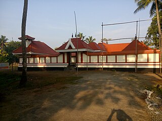
Blandevar is a small village in the North Mazhuvannoor area of the Ernakulam district of India. The renowned Blandevar Mahavishnu Temple is located here.
Mazhuvannoor is a panchayat village in the Ernakulam district of Kerala, India. It is located in the Kunnathunad taluk. It is located near the town of Kolenchery. The panchayat headquarters are located at Airapuram.
Kidangoor is a small village in Thuravoor Panchayath near Angamaly in Eranakulam district in the Indian state of Kerala.
Pulluvazhy is a small village in Rayamangalam Grama punchyathu in the Ernakulam district of Kerala state, India. It is close to the towns Perumbavoor, Muvattupuzha and Kothamangalam.
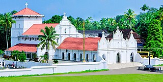
Perumbavoor has many Hindu temples, Muslim mosques and Christian churches. As the area is dominated by expatriate north Indian workers, some places of worship cater to the taste of North Indian devotees.

Athani is a village in Nedumbasery Panchayat in Aluva Taluk. Athani is between Angamaly and Aluva in Eranakulam district in the Indian state of Kerala.
