Kaliyakkavilai

Last updated

Kaliyakkavilai
Town
India Tamil Nadu location map.svg
Red pog.svg
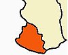
Kaliyakkavilai
Location in Tamil Nadu, India
Coordinates: 8°19′22″N77°09′14″E / 8.32278°N 77.15389°E / 8.32278; 77.15389
CountryFlag of India.svg  India
State Tamil Nadu
District Kanyakumari
Population
 (2001)
  Total
13,307
Languages
  Official Tamil
  Minority Malayalam
Time zone UTC+5:30 (IST)
Vehicle registration TN-75

Kaliyakkavilai is a town panchayat in Kanyakumari district in the Indian state of Tamil Nadu, close to the Tamil Nadu-Kerala border. It lies on the Kochi-Thiruvananthapuram-Kanyakumari National Highway 47.

Demographics

As of the 2011 India census, [1] , Kaliyakkavilai had a population of 15,625, with an average literacy of 81.4%. 10.1% of the population were children at the time of the census.

Related Research Articles

<span class="mw-page-title-main">Kanyakumari</span> Town in Tamil Nadu, India

Kanyakumari is a city in Kanyakumari district in the state of Tamil Nadu, India. It is the southernmost tip of the Indian subcontinent and the southernmost city in mainland India, and thus referred to as "The Land's End". The city is situated 90 kilometres (56 mi) south of Thiruvananthapuram city, and about 20 kilometres (12 mi) south of Nagercoil, the headquarters of Kanyakumari district.

<span class="mw-page-title-main">Nagercoil</span> City in Tamil Nadu, India

Nagercoil, also spelt as Nagarkovil, is a city and the administrative headquarters of Kanyakumari District in Tamil Nadu state, India. Situated close to the tip of the Indian peninsula, it lies on an undulating terrain between the Western Ghats and the Arabian Sea.

<span class="mw-page-title-main">Padmanabhapuram</span> Municipality in Tamil Nadu, India

Padmanabhapuram is a town and a municipality near Thuckalay in Kanyakumari district in the Indian state of Tamil Nadu. As of 2011, the town had a population of 21,342. Padmanabhapuram was the capital of Travancore state in the past. In 1795, the King of Travancore, Rama Varma (known as Dharma Raja moved the capital from Padmanabhapuram to Thruvananthapuram. At that time the boundaries of Travancore state included half the area of modem Kerala state. In 1947, after independence, Padmanabhapuram became part of Travancore-Cochin state When Indian states ware reorganized on the basis of language. In 1957, Padmanabhapuram along with other Tamil-speaking areas were ceded to Madras State, while the Malayalam-speaking areas became part of Kerala. Later the name of Madras State was changed to Tamil Nadu.

<span class="mw-page-title-main">Rajapalayam</span> Town in Tamil Nadu, India

Rajapalayam is a town in the Indian state of Tamil Nadu. It is the largest municipality in the Virudhunagar district. Rajapalayam is located on the Madurai to Quilon National Highway at a distance of 562 km south of the state capital Chennai. The economy is primarily industrial with several mills for spinning and weaving. The town is known for its mango and the Rajapalayam breed of dogs.

<span class="mw-page-title-main">Kanyakumari district</span> District of Tamil Nadu in India

Kanyakumari district, officially Kanniyakumari district, is one of the 38 districts of Tamil Nadu state and the southernmost district in mainland India. It stands second in terms of population density among the districts of Tamil Nadu. It is also the richest district in Tamil Nadu in terms of per capita income, and also tops the state in Human Development Index (HDI), literacy, and education. The district's headquarters is Nagercoil.

<span class="mw-page-title-main">Azhagiapandiapuram</span> Village in Tamil Nadu, India

Azhagiapandiapuram is a second grade town panchayat in Kanniyakumari district in the state of Tamil Nadu, India. It is located at the centre of Pazhayar valley. It is one of the four town panchayat's in Thovalai taluk.

<span class="mw-page-title-main">Colachel</span> Town in Tamil Nadu, India

Colachel is a coastal town in the far south of India, located in the Kanyakumari district of Tamil Nadu. It is a natural harbor on the Malabar coast, located 20 km north-west of Kanyakumari, the southernmost tip of India. As of 2011 the municipality had a population of 23,227 and a metropolitan population of 47,007.

Kollemcode is a municipality in Kanyakumari district, India. Kollencode is situated in Tamil Nadu-Kerala border. It has 33 wards. It is a coastal village on the shores of the Arabian Sea. Kollamcode is located 41 kilometres from Nagercoil and 36 kilometres from Thiruvananthapuram, the capital of Kerala, and also 64 kilometres from Kanyakumari.

Kumarapuram is a panchayat town in the southern Kanyakumari district of Tamil Nadu, India.

Nallur (Nalloor) is a panchayat town in Kanniyakumari district in the Indian state of Tamil Nadu.

Sathankulam is a panchayat town in Thoothukudi district in the Indian state of Tamil Nadu.

<span class="mw-page-title-main">Suchindram</span> Town in Tamil Nadu, India

Suchindram is a panchayat town in Kanyakumari district in the Indian state of Tamil Nadu with Indian postal code as 629704. It is an important pilgrim centre and the site of the famous Thanumalayan Temple. There is an Anjaneya,, statue which stands at 22 feet and is carved of a single granite block.

Thiruvithamcode, is a small panchayat town located in the Kanyakumari district of the Indian state of Tamil Nadu. Thiruvithamcode is about 20 km from Nagercoil and 2 km from Thuckalay.

Mylaudy is one of the town panchayats in Kanniyakumari district in the Indian state of Tamil Nadu. It is a municipality rich in fields, mountains, rivers and natural resources. Before 1950, Mylaudy was part of South Travancore. Now it is in Kanniyakumari district of Tamil Nadu.

Azhagappapuram is a panchayat town in Kanyakumari district in the Indian state of Tamil Nadu. It is located about five miles northwest of Kanyakumari, the southern tip of India. It is one of the beautiful and model towns in the Kanyakumari district. It falls under the Agastheeswaram taluk of Tamil Nadu. St. Antony's church stands in the middle, which is the major site of attraction of Azhagai.

Agasteeswaram taluk is a taluk located in Kanyakumari district, Tamil Nadu, India. The headquarters of the taluk is the town of Nagercoil. The taluk was among several in Thiruvananthapuram district that with the passage of the States Reorganisation Act of 1956 were transferred from Thiruvananthapuram district, Travancore-Cochin State to the newly created Kanyakumari district of Madras State.

Vilavancode taluk is a taluk located in Kanyakumari district, Tamil Nadu, India. The headquarters of the taluk is the town of Vilavancode. The taluk was among several in Thiruvananthapuram district that with the passage of the States Reorganisation Act of 1956 were transferred from Thiruvananthapuram district, Travancore-Cochin State to the newly created Kanyakumari district of Madras State. The present Tahsildar of Vilavancode is Mr. Abraham Denny

<span class="mw-page-title-main">Nithiravilai</span> Village in Tamil Nadu, India

Nithiravilai is a village in Kollemcode Municipalilty in Kanyakumari district, Tamil Nadu, India. It is a business town bordering the state of Kerala. The Kerala border is approximately 3 km (1.9 mi) from the village. Nithiravilai is about 14 km (8.7 mi) from Marthandam and 9 km (5.6 mi) north of Kaliyakkavilai.

Madichel is a village in Vilavancode taluk, Kanniyakumari district, Tamil Nadu, India. The village is near Kuzhithurai, a historical seaport where merchants came from across the Arabian sea in ancient times.

References

  1. "PCA TV: Primary census abstract at town, village and ward level, Tamil Nadu - District Kanniyakumari - 2011". Office of the Registrar General & Census Commissioner, India. Retrieved 29 December 2024.