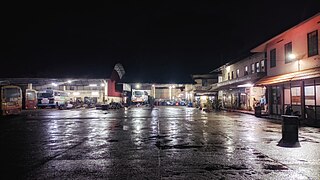
Tiruvallur is a Grade I municipality in the Indian state of Tamil Nadu. It is located on the banks of Coovum river about 46 km (29 mi) from downtown Chennai (Madras) and just 5 km from megacity border, in the western part of the Chennai Metropolitan Area (CMA). It is a satellite town of Chennai and is the administrative headquarters of Tiruvallur District. The town is known for the Veeraraghava Swamy Temple, one of the 108 sacred shrines of Vaishnavites. The tank festival is held at a pond near this temple. A Shiva temple near this shrine which is popular among the locals. There is also a 40-foot (12 m) tall Viswaroopa Panchamukha Hanuman temple, where the murti is made of a single green granite stone.

Nahan is a town in Himachal Pradesh in India and is the headquarters of the Sirmaur District. It was the capital of the former Sirmur princely state. Nahan is also known as the "town of ponds".

Kothamangalam is a municipality at the foot of the Western Ghats in the Ernakulam district of Kerala, India. It is located 41 km (25.5 mi) east of the district collectorate in Thrikkakara and about 218 km (135.5 mi) north of the state capital Thiruvananthapuram. As per the 2011 Indian census, Kothamangalam has a population of 38,837 people, and a population density of 969/km2 (2,510/sq mi).

Tikamgarh district is one of the 55 districts of Madhya Pradesh state in central India. Tikamgarh town is the district headquarters. The district is part of Sagar Division.

Puduvayal is a town in Karaikudi taluk, Sivaganga district in the Indian state of Tamil Nadu. It is a town located in the Chettinad region of the Sivagangai district. On road, it is 12 km away from Karaikudi and 21 km away from Aranthangi. This town is famous for its rice mills. Puduvayal is the 2nd largest rice producer in Tamil Nadu. Puduvayal is an important commercial centre for trade in the Sivaganga district and part of the suburban region of Karaikudi. The town is famous for its Veerasekara Umaiyambigai Temple. Nearby Kandanur is famous for Kandanur Sivan Kovil—which is a replica of the Madurai Meenakshi Temple—built by Nagarthars.

Poonamallee is a town and suburb of Chennai, India under the Chennai Metropolitan Area. It was historically called Pushpagirimangalam, later renamed in Tamil as Poovirundhavalli, and now colloquially called as Poondhamalli. It is the headquarters of the Poonamallee taluk of the Tiruvallur district in the Indian state of Tamil Nadu. The nearest Railway station is at Avadi. It acts as the gateway to the city from its western side. It is a town with rich cultural heritage and also a fast-growing areas in the city. As of 2011, the town had a population of 57,224. There are plans to merge the areas under Poonamallee Municipality with Avadi Municipal Corporation.

Thiruverkadu is a Western suburb of Chennai, Tamil Nadu. It comes under Thiruvallur district administration. It is famous for its Devi Karumariamman Temple. There is also Vedapureeswarar Temple in Thiruverkadu, where Lord Shiva and Goddess Parvathi are seen in their wedding pose inside the sanctum sanctorum. As of 2011, the town had a population of 62,289. It is a town with rich cultural heritage and also a fast-growing areas in the city.
Authoor is a panchayat town in Thoothukudi district of the Indian state of Tamil Nadu.
Edappadi is a municipality in the Salem district in the state of Tamil Nadu, India. Edappadi was once known for its thriving power loom industry. The economy is diversified by agriculture, heavy truck transport, granite, entertainment and foundries.
Edathala is a gram panchayat near Aluva town. It is also a village in Aluva taluk of Ernakulam district, in the state of Kerala, India.
Gormi is a block and a nagar panchayat in Bhind district in the Indian state of Madhya Pradesh. Gormi is located at 26.6°N 78.52°E..
Kumhari is located in Bhilai-3 Tehsil of Durg district in the Indian state of Chhattisgarh. Kumhari is a Nagar Palika Parishad and situated at Durg district and Raipur district border beside Kharun River. It is situated at 21°27'N 81°52' and has an average elevation of 284 meters above the sea level.

Mallasamudram is a Panchayath town in Thiruchengode taluk, Namakkal district in the Indian state of Tamil Nadu. It is the headquarter of the Mallasamudram block. Mallasamudram is also known as "Mallai Managaram", "Mallai".
Moolakaraipatti is a Panchayat town in Tirunelveli district in the Indian state of Tamil Nadu.
Nainwan is a tehsil of Bundi district and a municipality in the Hadoti region of the state of Rajasthan in India.

Tharamangalam is a municipality in Salem district in the Indian state of Tamil Nadu.
Unnamalaikadai is a panchayat town in Kanya Kumari district in the Indian state of Tamil Nadu.
Kulasekharam is a town located in the district of Kanyakumari, Tamil Nadu, India. It is one of the most important business centres in the district, after Marthandam.
Vellarada is a border village situated in Thiruvananthapuram district in the state of Kerala, India. It is 42 km from Thiruvananthapuram. It is the southernmost part of Kerala state, sharing its border with Tamil Nadu. Vellarada is said to be the threshold to the high-range areas of the eastern part of Thiruvananthapuram district. The southernmost point of Western Ghats in Kerala is near Vellarada.
Patanvav is a large village 23 km from Dhoraji Town, 13 km from Upleta, 21 km from Manavadar, and 115 km from Rajkot by good motorable roads. It is in Dhoraji taluka of Rajkot district in Gujarat. Patanvav is at an elevation of 68 meters above mean sea level. Postal code is 360430. Dhoraji and Upleta towns are connected by railways on Rajkot-Jetalsar-Porbandar line. Village is situated in the foothills of the Osam Hills.


