Aralvaimozhi Pass was a strategically important gap or mountain pass in the southernmost end of the Western Ghats. It connected erstwhile Travancore with the Madras Presidency. Many of the invasions faced by the Chera and the successor kingdoms came via this ghat.
The name "Aral" was derived from the fort built and maintained by the rulers of Venad and later by the kingdom of Travancore to defend the kingdom from invasions from the eastern regions. It is also said that Aralvaimozhi means whispering wind. The whistling sound of wind in the region might have led to such a name.
Aralvaimozhi Fort was one of the most important forts of Travancore. It was constructed around 1740 by Eustachius De Lannoy along with Udayagiri Fort, Vattakottai Fort and Travancore lines.[1] The fort was captured by the English East India Company in 1809 from the soldiers loyal to Velu Thampi Dalawa. The remains of the fort can be seen near railway station, but neglected by both railway and archeology departments.
Demographics
According to the 2011 census, Aralvaimozhi had an estimated population of 22,846, of which 11,373 were males and 11,473 were females, meaning a female-male ratio of 1.01, above the Tamil Nadu state average of 0.996 and well above the national average of 0.929 females/male. The child sex ratio of Aralvaimozhi is 1.012, higher than the state average of 9.43.[2][3] Aralvaimozhi has a literacy rate of 89.26%. In Aralvaimozhi, Male literacy is around 92.34% while female literacy rate is 86.20%. Aralvaimozhi Town Panchayat has total administration over 6,206 houses to which it supplies basic amenities like water and sewage. 71.24% of people in Aralvaimozhi are Hindu, 28.08% are Christian, and 0.42% are Muslim.[2]
Culture
During the invasion of Sultan Alauddin Khilji of Delhi in 1311 AD by Malik Kapoor, Meenakshi Amman and Sundareeswarar were brought from Madurai to Venadu and hid in Parakodi Kandan Shasta temple near Aralvaaimozhi. Until 1368, Meenakshi Amman remained in Aralvaimozhi. From there she was taken back to Madurai.
Economy
Muppandal Wind Farm is located in Aralvaimozhi Town Panchayat. This farm is the largest in Asia and supplies the villagers with electricity for their needs.[4][5] It is well known for being the greatest source of wind energy in Asia.
Poigai Dam, constructed in the year 2000 is serving water for irrigation purposes around the area. For the first time the dam was completely filled with water in 5 nov 2021 making it a wonderful place to visit.
Wind energy
The 1,500 megawatts (MW) Muppandal wind farm is the country's largest onshore wind farm which is the Asia's second largest windfarm.[citation needed] The project features a large number of wind turbines of varying sizes from 200 kilowatts (KW) to 1650KW.[citation needed]
Transportation
A railway station spelled "Aralvaimozhi", with station code AAY is situated here, and is served by Indian Railways. It is connecting many employees of ISRO_ Mahendragiri campus.
Gallery
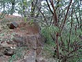
Remains of Aralvaimozhi fort found near railway station
Remains of Aralvaimozhi fort found near railway station
Aralvaimozhi railway station, with the wind-power mills in the background
↑ "Census Info 2011 Final population totals". Office of The Registrar General and Census Commissioner, Ministry of Home Affairs, Government of India. 2013. Retrieved 26 January 2014.
This page is based on this Wikipedia article Text is available under the CC BY-SA 4.0 license; additional terms may apply. Images, videos and audio are available under their respective licenses.