Nagercoil, also spelt as Nagarkovil, is a city and the administrative headquarters of Kanyakumari District in Tamil Nadu state, India. Situated close to the tip of the Indian peninsula, it lies on an undulating terrain between the Western Ghats and the Arabian Sea.

Sholavaram aeri, or Sholavaram lake, is located in Ponneri taluk of Thiruvallur district, Tamil Nadu, India. It is one of the rain-fed reservoirs from where water is drawn for supply Chennai city from this lake to Puzhal lake through canals.
Pulhal aeri, or Pulhal lake, sometimes spelled Puzhal lake, also known as the Red Hills Lake, is located in Red Hills, Chennai, India. It lies in Thiruvallur district of Tamil Nadu state. It is one of the two rain-fed reservoirs from where water is drawn for supply to Chennai City, the other one being the Chembarambakkam Lake and Porur Lake.

Pechiparai Reservoir is the largest dam in Kanyakumari district. It is located in the foothills of the Western Ghats in the Kanyakumari district of Tamil Nadu at Pachiparai. It is located 43 kilometers (27 mi) from the district capital Nagercoil. This dam is built across the Kotai river. This dam was built during the period 1897-1906 by the European engineer Mr. Minchin by the then Maharaja of Travancore during the Thirunal period. This dam fulfills the agricultural and drinking water needs of Kanyakumari district. This river is the Western GhatsBuilt at the base. The height of this dam was originally 42 feet. Then in 1964 it was decided to add 6 more feet and in 1969 the height of the dam was 48 feet. stone pool, Agatheeswaram, Thovalai and Radhapuram circles are benefited by this. About 50 thousand acres of land gets irrigation facility. The Pachiparai Dam, which was 42 feet, was raised to 48 feet. 6 feet of raised water and Radhapuram was raised for this purpose. An additional 3.75 TMC of water is added after the dam is raised. The 42 feet Pachipara dam was raised to 48 feet by Kamaraj. 6 feet of raised water was also raised for Radhapuram area. An additional 3.75 TMC of water is added after the dam is raised.

Kanniyakumari district is one of the 38 districts of Tamil Nadu state and the southernmost district in mainland India. It stands second in terms of population density among the districts of Tamil Nadu. It is also the richest district in Tamil Nadu in terms of per capita income, and also tops the state in Human Development Index (HDI), literacy, and education. The district's headquarters is Nagercoil.

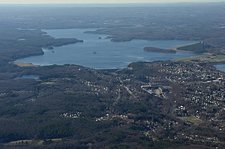
The Wachusett Reservoir is the second largest body of water in the state of Massachusetts. It is located in central Massachusetts, northeast of Worcester. It is part of the water supply system for metropolitan Boston maintained by the Massachusetts Water Resources Authority (MWRA). It has an aggregate capacity of 65 billion US gallons (250,000,000 m3) and an area of almost 7 square miles (18 km2). Water from the reservoir flows to the covered Norumbega Storage Facility via the Cosgrove Tunnel and the MetroWest Water Supply Tunnel. The reservoir has a maximum depth of 120 feet (37 m) and a mean depth of 48 feet (15 m).

Nizam Sagar Dam is an Indian dam named after the Nizam of Hyderabad. It is a reservoir constructed across the Manjira River, a tributary of the Godavari River, between Achampet and BanjePally villages of the Kamareddy district in Telangana, India. It is located at about 144 km (89 mi) north-west of Hyderabad. Nizam Sagar is the oldest dam in the state of Telangana.
Kulasekharam is a town located in the district of Kanyakumari, Tamil Nadu, India. It is one of the most important business centres in the district, after Marthandam.

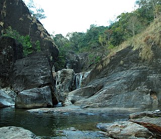
Vattaparai Falls are located at: 8°15.919′N77°27.062′E, elevation 40 m (130 ft), in the Keeriparai reserve forest near Bhoothapandi village (Pin:629852) on the Pazhayar River in Kanyakumari district, Tamil Nadu state, South India. It is 25 km (16 mi) N of Nagercoil) and 32 km (20 mi) NW of Kanyakumari. This 20 km2 (7.7 sq mi) area is proposed to be a Wildlife Sanctuary.

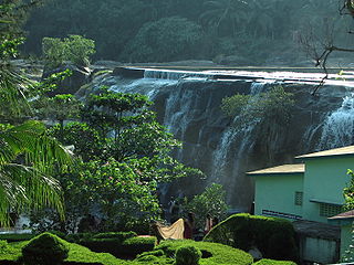
Thirparappu Waterfalls is located near Kulasekharam town in Kanyakumari district, Tamil Nadu state, India.

The Vaigai Dam is built across the Vaigai River near Andipatti, in the Theni district of Tamil Nadu, southern India. Near the dam, the Government of Tamil Nadu has constructed an Agricultural Research Station for researching the growing of a variety of crops, including rice, sorghum, blackgram, cowpea and cotton.

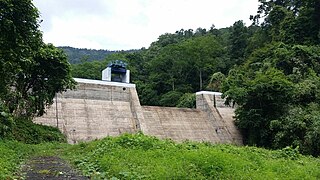
Perunchani Dam is an irrigation dam at Perunchani, in Kalkulam Taluk, Kanyakumari District, in the state of Tamil Nadu, India. It is one of the dams of the Kodayar Irrigation System. As there was water deficiency in the Kodayar Irrigation System, Perunchani Dam was constructed in December 1952 to store flood water of the Paralayar River as an extension. It was built about 1 km (0.62 mi) upstream of the Puthen dam on the Paralayar River. The irrigation system became operational on 2 September 1953. It feeds the left bank irrigation canal system of the Puthen dam, which is the terminal structure of the system.

Sholayar Dam is a concrete dam built across the Chalakkudi River in Malakkappara in Thrissur district, Kerala of India. The dam consists of main Sholayar Dam, Sholayar Flanking and Sholayar Saddle Dam. It also contains Sholayar Hydro Electric Power Project of KSEB who owns the dam. Total installed capacity of the project is 54MW with 3 penstock pipes. The maximum storage capacity is 2663 feet. Sholayar is 65 km from Chalakudy town. The dam above Sholayar dam was Upper Solaiyar Dam owned by Tamil Nadu.

Thirparappu is a town located in the Kanyakumari District in the Indian state of Tamil Nadu. It is a popular tourist destination. It is 42 km (26 mi) from Nagercoil, headquarters of the Kanyakumari District, and 55 km (34 mi) from Thiruvananthapuram, the capital of the Indian state of Kerala. It is famous for its falls on the Kodayar (Kothai) River and the Pechiparai Dam, located 13 km (8.1 mi) away.
Upparu River is a river flowing in the Tirupur district of the Indian state of Tamil Nadu.
The coastal city of Chennai has a metropolitan population of 10.6 million as per 2019 census. As the city lacks a perennial water source, catering the water requirements of the population has remained an arduous task. On 18 June 2019, the city's reservoirs ran dry, leaving the city in severe crisis.

Poondi Reservoir or Sathyamoorthy reservoir is the reservoir across Kotralai River in Tiruvallur district of Tamil Nadu State. It acts as the important water source for Chennai city which is 60 km away.

Anayirangal Dam is a dam built on the Panniyar River in Chinnakanal and Shanthampara panchayats, 22 km from Munnar in Idukki district of Kerala, India The dam is surrounded on one side by forest and on the other by Tata Tea Plantation. The dam is located near the Kumily-Munnar road. The water flowing from the dam reaches Kuthungal and Ponmudi dams through the Panniyar river. Power is generated at Kuthungal and Panniyar powerhouses. The dam stores water from small streams flowing from Bealram and rainwater flowing from the hills on the Tamil Nadu border. The reservoir usually fills up in June and July. The height of the dam is 34.14 metres (112.0 ft) and Length is 326.13 metres (1,070.0 ft).

Erattayar Dam is a small diversion dam built on the Erattayar river in Erattayar Grama Panchayat near Kattappana town in Idukki district of Kerala, India. It acts mainly as a diversion dam to supply water to the Idukki Dam. Diversion of water from Erattayar forebay to Idukki reservoir is through a tunnel called Anchuruli tunnel which is 3771.9m long. Construction of the dam was completed in the year 1989.

Veluthodu dam is a part of Kakkad Hydro Electric Project and is located in Seethathode panchayath of Ranni Taluk in Pathanamthitta District of Kerala, India. Its a Concrete-Gravity dam built across the Veluthodu river, a tributary of Kakkad River which is again a tributary of Pamba River The dam is built primarily for electricity. This diversion dam diverts water to the water conductor system from Moozhiyar reservoir to Kakkad Power Station. This power station utilises the tail race water from Sabarigiri power station and flow received from moozhiyar and velluthode rivers. After power generation, water from Kakkad power station is released to the Kakkad River. Taluks through which release flow are Ranni, Konni, Kozhencherry, Thiruvalla, Chengannur, Kuttanadu, Mavelikara and Karthikappally It is operated by Kerala State Electricity Board.


