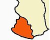
Kanyakumari district, officially Kanniyakumari district, is one of the 38 districts of Tamil Nadu state and the southernmost district in mainland India. It stands second in terms of population density among the districts of Tamil Nadu. It is also the richest district in Tamil Nadu in terms of per capita income, and also tops the state in Human Development Index (HDI), literacy, and education. The district's headquarters is Nagercoil.
Thuckalay or Thakkalai is a town in Kanyakumari district of Tamil Nadu, India. Thuckalay comes under the Padmanabhapuram Municipality, and is the administrative headquarters of Kalkulam Taluk. The Revenue Divisional Office is located in Mettukadai.
Arumanai or Arumana is a Panchayat town in Kanyakumari district in the state of Tamil Nadu, India. In olden days it is known as Arumana. The plot of critically acclaimed Malayalam language movie Ozhimuri is set in the background of Arumanai.

Azhagiapandiapuram is a second grade town panchayat in Kanniyakumari district in the state of Tamil Nadu, India. It is located at the centre of Pazhayar valley. It is one of the four town panchayat's in Thovalai taluk.

Boothapandi is a panchayat town in Kanyakumari district in the state of Tamil Nadu, India.
Kaliyakkavilai is a town panchayat in Kanyakumari district in the Indian state of Tamil Nadu, close to the Tamil Nadu-Kerala border. It lies on the Kochi-Thiruvananthapuram-Kanyakumari National Highway 47.
Kollankodu is a municipality in Kanyakumari district, Tamil Nadu, India. Kollencode is situated on the Tamil Nadu-Kerala border. It has 33 wards. It is a coastal village on the shores of the Laccadive Sea. Kollamcode is located 41 kilometres from Nagercoil and 36 kilometres from Thiruvananthapuram, the capital of Kerala, and also 64 kilometres from Kanyakumari.
Kumarapuram is a panchayat town in the southern Kanyakumari district of Tamil Nadu, India.

Suchindram is a panchayat town in Kanyakumari district in the Indian state of Tamil Nadu with Indian postal code as 629704. It is an important pilgrim centre and the site of the famous Thanumalayan Temple. There is an Anjaneya,, statue which stands at 22 feet and is carved of a single granite block.
Verkilambi is an interior rural area the district of Kanyakumari at the state of Tamil Nadu. This is a grade – I Town panchayat spread in a total area of 15.7 Sq. km and consists of 18 wards, represented by 18 councilors. The Executive officer is the administrative head and the elected Chairman is the political head of this Town Panchayat. This was constituted as Kumarankudy Village, Pathmanapapuram MLA Constituency, Nagercoil MP Constituency. The town is located at a distance of 5 km from Ponmanai Town Panchayat on the East, 5 km from Thiruvattar Town Panchayat on the west. 3 km from Kothanalloor Town Panchayat on the South. This town is located along the Kanyakumari, Thiruvananthapuram, National High way and Colachel – Kulasekaram state high way Road through this TP. This TP Constitutes its village component to talking an area of 3.25 Sq. km up graded as town Panchayat
Thiruvithamcode, is a small panchayat town located in the Kanyakumari district of the Indian state of Tamil Nadu. Thiruvithamcode is about 20 km from Nagercoil and 2 km from Thuckalay.
Mylaudy is one of the town panchayats in Kanniyakumari district in the Indian state of Tamil Nadu. It is a town rich in fields, mountains, rivers and natural resources. Before 1950, Mylaudy was part of South Travancore. Now it is in Kanniyakumari district of Tamil Nadu.
Azhagappapuram is a panchayat town in Kanyakumari district in the Indian state of Tamil Nadu. It is located about five miles northwest of Kanyakumari, the southern tip of India. It is one of the beautiful and model towns in the Kanyakumari district. It falls under the Agastheeswaram taluk of Tamil Nadu. St. Antony's church stands in the middle, which is the major site of attraction of Azhagai.
Vilavancode, also spelt as Viḷavaṅgōḍu, is a town panchayat in Kanyakumari district in Tamil Nadu state, India. It is part of territory among several taluks that were with the Thiruvananthapuram district that with the passage of the States Reorganisation Act of 1956 transferred from Thiruvananthapuram district, Travancore-Cochin State to the newly created Kanyakumari district of Madras State.
Kurunthancode is a block or Panchayat Union of Kanyakumari district, India. It is one of the nine administrative divisions of the district of Kanyakumari. The present chairman of the Kurunthancode Panchayat union is [ANUSHA DEVI]. It includes the following Village Panchayats,
- Kakkottuthalai
- Kattimancode
- Kurunthencode
- Muttom
- Nettancode
- Simoncolony
- Thalakulam
- Tenkarai
- Vellichandai
Rajakkamangalam is a block or Panchayat Union of Kanyakumari district, India. It is one of the nine administrative divisions of the district of Kanyakumari. The current president of the Rajakkamangalam Panchayat is R.Ayyappan. It includes the following 15 village panchayats,
- Athikkattuvilai
- Elluvilai
- Ganapathipuram
- Kanyakulam
- Kesavanputhenthurai
- Melekrishnanputhoor
- Manakudi
- Northsoorankudy
- Putheri
- Peruvilai
- Parakkai
- Pallamthurai
- Melasankarankuzhi
- Pannaiyoor
- Rajakkamangalam Thurai
- Dharmapuram
- Azhathangarai
Choozhal, is a village in Tamil Nadu located nearly 60 kilometres (37 mi) from Kanyakumari and 40 kilometres (25 mi) from Thiruvananthapuram, Kerala. It is on the border between Tamil Nadu and Kerala, India.
Putheri is a village panchayat located in Rajakkamangalam block of Kanyakumari district, Tamil Nadu, India. The panchayat has total of seven panchayat constituencies. Out of these seven panchayat members are elected.
Nagercoil Corporation is located in Kanyakumari district. Nagercoil is the administrative headquarters of Kanyakumari district and it is located in southern Tamil Nadu. The corporation is located 18 km north of Kanyakumari. Nagercoil Corporation is a forum with 52 members. At present Kottar, Vadasery and Vetturnimadam are the important places in Nagercoil Corporation. The annual tax revenue of this corporation is 81 crore rupees.