Nagercoil, also spelt as Nagarkovil, is a city and the administrative headquarters of Kanyakumari District in Tamil Nadu state, India. Situated close to the tip of the Indian peninsula, it lies on an undulating terrain between the Western Ghats and the Arabian Sea.

Padmanabhapuram is a town and a municipality near Thuckalay in Kanyakumari district in the Indian state of Tamil Nadu. As of 2011, the town had a population of 21,342. Padmanabhapuram was the capital of Travancore state in the past. In 1795, the King of Travancore, Rama Varma (known as Dharma Raja moved the capital from Padmanabhapuram to Thruvananthapuram. At that time the boundaries of Travancore state included half the area of modem Kerala state. In 1947, after independence, Padmanabhapuram became part of Travancore-Cochin state When Indian states ware reorganized on the basis of language. In 1957, Padmanabhapuram along with other Tamil-speaking areas were ceded to Madras State, while the Malayalam-speaking areas became part of Kerala. Later the name of Madras State was changed to Tamil Nadu.
Marthandam is a major trade centre in Kuzhithurai municipality across National Highway in the Kanyakumari district of Tamil Nadu, India. Formerly known as Thoduvetty, it was a portion of Kanyakumari district which was added to the state of Tamil Nadu on 1 November 1956.

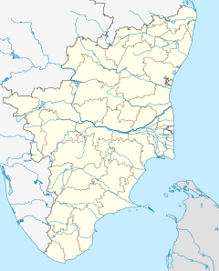
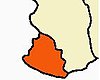
Kanyakumari district, officially Kanniyakumari district, is one of the 38 districts of Tamil Nadu state and the southernmost district in mainland India. It stands second in terms of population density among the districts of Tamil Nadu. It is also the richest district in Tamil Nadu in terms of per capita income, and also tops the state in Human Development Index (HDI), literacy, and education. The district's headquarters is Nagercoil.
Thuckalay or Thakkalai is a town in Kanyakumari district of Tamil Nadu, India. Thuckalay comes under the Padmanabhapuram Municipality, and is the administrative headquarters of Kalkulam Taluk. The Revenue Divisional Office is located in Mettukadai.
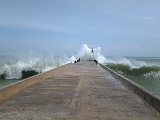
Colachel is a coastal town in the far south of India, located in the Kanyakumari district of Tamil Nadu. It is a natural harbor on the Malabar coast, located 20 km north-west of Kanyakumari, the southernmost tip of India. As of 2011 the municipality had a population of 23,227 and a metropolitan population of 47,007.

Suchindram is a panchayat town in Kanyakumari district in the Indian state of Tamil Nadu with Indian postal code as 629704. It is an important pilgrim centre and the site of the famous Thanumalayan Temple. There is an Anjaneya,, statue which stands at 22 feet and is carved of a single granite block.
Verkilambi is an interior rural area the district of Kanyakumari at the state of Tamil Nadu. This is a grade – I Town panchayat spread in a total area of 15.7 Sq. km and consists of 18 wards, represented by 18 councilors. The Executive officer is the administrative head and the elected Chairman is the political head of this Town Panchayat. This was constituted as Kumarankudy Village, Pathmanapapuram MLA Constituency, Nagercoil MP Constituency. The town is located at a distance of 5 km from Ponmanai Town Panchayat on the East, 5 km from Thiruvattar Town Panchayat on the west. 3 km from Kothanalloor Town Panchayat on the South. This town is located along the Kanyakumari, Thiruvananthapuram, National High way and Colachel – Kulasekaram state high way Road through this TP. This TP Constitutes its village component to talking an area of 3.25 Sq. km up graded as town Panchayat
Mylaudy is one of the town panchayats in Kanniyakumari district in the Indian state of Tamil Nadu. It is a municipality rich in fields, mountains, rivers and natural resources. Before 1950, Mylaudy was part of South Travancore. Now it is in Kanniyakumari district of Tamil Nadu.
Kulasekharam is a town located in the district of Kanyakumari, Tamil Nadu, India. It is one of the most important business centres in the district, after Marthandam.
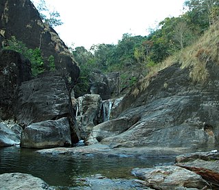
Vattaparai Falls are located at: 8°15.919′N77°27.062′E, elevation 40 m (130 ft), in the Keeriparai reserve forest near Bhoothapandi village (Pin:629852) on the Pazhayar River in Kanyakumari district, Tamil Nadu state, South India. It is 25 km (16 mi) N of Nagercoil) and 32 km (20 mi) NW of Kanyakumari. This 20 km2 (7.7 sq mi) area is proposed to be a Wildlife Sanctuary.
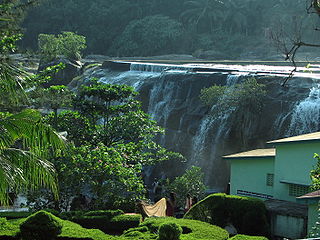
Thirparappu Waterfalls is located near Kulasekharam town in Kanyakumari district, Tamil Nadu state, India.

The Pothigai Hills, also known as Agasthiyar Mountain is a 1,866-metre (6,122 ft)-tall peak in the southern part of the Western Ghats or Sahyadri of South India. The peak lies in Tirunelveli District of Tamil Nadu near the border of Kerala.
Vellarada is a border village situated in Thiruvananthapuram district in the state of Kerala, India. It is 42 km from Thiruvananthapuram. It is the southernmost part of Kerala state, sharing its border with Tamil Nadu. Vellarada is said to be the threshold to the high-range areas of the eastern part of Thiruvananthapuram district. The southernmost point of Western Ghats in Kerala is near Vellarada.

Vadasery is an area/village of Nagercoil city in Kanyakumari district, Tamil Nadu. It is also famous for its Christopher (mofussil) bus stand, one of the two bus termini in Nagercoil is located here. Long route (mofussil) buses to other districts in Tamil Nadu and parts of Kerala starts here. It is a thriving region of Nagercoil with large vegetable, fish and meat markets.
Tirunelveli City being the district headquarters of Tirunelveli District in the Indian state of Tamil Nadu has a very extensive transport network. Tirunelveli district is a vital tourist destination with lot of religious places, monuments and hill stations. Tirunelveli is also a major junction for transportation around Tirunelveli, Thoothukudi and Kanyakumari Districts.

Swamithoppu Pathi is the primary pathi of the Ayyavazhi and the sacred venue of the Tavam. Swamithope is considered primary among the Pancha pathi and the primary centre of the incarnational activities of Vaikundar.

Muttom is a rural area in Idukki district in the Indian state of Kerala. This place is 8.5 km away from Thodupuzha and 66 km away from Kochi. Geographically this place is part of Midland or Idanad region of Kerala.
Karavilai is a place in Marthandam in Kanniyakumari district in the Indian state of Tamil Nadu. Karavilai comes under town panchayat of Nallur (Nalloor), Kanyakumari District. The area is full of greenery and there is passage of shallow of water in the region. Soil found around Marthandam is one of the most fertile lands of Tamil Nadu and the region has the climatic conditions of Kerala.

Keezha Sarakkalvilai is a small village in Kanniyakumari district in the Indian state of Tamil Nadu with Indian postal code 629002. It is an important pilgrimage and the site of the famous Bathirakali Amman Temple.