
Desur is a Town panchayat in Tiruvanamalai district in the Indian state of Tamil Nadu.

Hirapur is a census town in Balaghat district in the Indian state of Madhya Pradesh.

Jalalpur is a town and a municipal board in Ambedkar Nagar district in the Indian state of Uttar Pradesh.
Jatara is a town and a nagar panchayat in Tikamgarh district in the Indian state of Madhya Pradesh.
Kakrala is a city and municipal board in Badaun district in India state of Uttar Pradesh. It is located to the East of the district Headquarter. It is 12 km from Badaun. the term Kakrala originates from the apbhramsha Kakrabad. The most population of this town are consisting Muslims, as the Vibrant culture of India suggests, the town is also diverse in terms of religion, festivals etc. India has a unique culture of Unity in diversity, the same phenomenon has occurred in this town also. In the vista of towns of this state one distinguishes Kakrala as quite significant. In fact, Kakrala is the name of a city which has a well British era municipal board.It is situated approximately at 27.9 deg N 79.2 deg E. It has an average height of 160 meters or 524 feet. The discovery of Indian town or city becomes complete with the knowledge of its current demographic scenario. In order to meet the objectives, numerous demographers have organized surveys and research works and thus brought out significant information about Kakrala city. Regarding this, the Census report is praiseworthy. Data like population, literacy rate etc. can be deduced from this report. According to this report, Kakrala city has got a total population measurement of 40,380. Females are less in number than their male counterparts. This becomes obvious from the literacy rates of both males and females. In other words, male populace constitutes 53 %, while the total population of females comprises 57 %. Information about the children who are residing in Kakrala too can be deduced. Thus kids who are below six years of age constitute 20 % of the total population of Kakrala. Literacy rate adds to the information of this Kakrala city. The most of the population of the city belongs to the Muslim Rajputs. Kakrala has done a important great war with british government from 1914 to 1919.
Kallukoottam is a panchayat town in Kanniyakumari district in the Indian state of Tamil Nadu.
Kanakkampalayam is a suburb of Tiruppur on the eastern side, in the Indian state of Tamil Nadu. It is located near udumalpet and it is next to udumalpet municipality. According to 2016* records Mrs. K. Dhanabagyam Krishnaswamy, Msc., M.Phil. is the Panchayat President from 2011 and her husband Mr. Krishnaswamy gounder was ex-panchayat president.
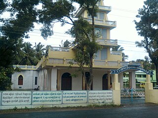
Karungal is a panchayat town in Kanniyakumari district in the Indian state of Tamil Nadu. Karungal is the localized name of this town from the word "Karingai" which was again derived from "Tharum kai".Tharumkai Bhagavathy Amman temple is a very ancient temple situated in Karungal on the roadside of Karungal-Chellamkonam road. Originally Tharumgai Bhagavathy Amman Temple was situated on the top of Karingai Malai,a hillock situated near Karingai.Still we can see traces of stone slabs and building materials of this old temple on the top of Karingaimalai. Legend has it that in due course of time, due to difficulty for a old aged women to have dharshan of Bhagavathy at top of Karingaimalai, Tharungai Bhagavathy descended and settled in the plain near Karungal town.

Khawhai is a census town in Champhai district in the Indian state of Mizoram.
Palera is a town and a nagar panchayat in Tikamgarh district in the Indian state of Madhya Pradesh.
Panagar is a town with municipality in Jabalpur district in the Indian state of Madhya Pradesh.
Pazhugal is a panchayat town in Kanniyakumari district in the Indian state of Tamil Nadu.

Peerkankaranai is a town in Southern part of the metropolitan city of Chennai in the Indian state of Tamil Nadu.

Shaktigarh is a town and a nagar panchayat in Udham Singh Nagar district in the Indian state of Uttarakhand.

Nira is a census town in Pune district in the Indian state of Maharashtra.
Vengathur is a census town in Thiruvallur district in the Indian state of Tamil Nadu.
Vilavur is a panchayat town in Kanniyakumari district in the Indian state of Tamil Nadu.
Shendurjana Ghat is a town of Warud Tehsil, Amravati district, Maharashtra, India.
Shahpura is a town and a nagar panchayat in Jabalpur district in the Indian state of Madhya Pradesh.
Rajnagar is a town and a nagar panchayat in Chhatarpur district in the Indian state of Madhya Pradesh. It is 4 km from Khajuraho.


