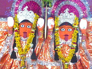
Theroor | |
---|---|
panchayat town | |
Country | |
State | Tamil Nadu |
District | Kanniyakumari |
Population (2012) | |
• Total | 100,000 |
Languages | |
• Official | Tamil |
Time zone | UTC+5:30 (IST) |
Theroor is a panchayat town in Kanniyakumari district in the Indian state of Tamil Nadu.
India, also known as the Republic of India, is a country in South Asia. It is the seventh largest country by area and with more than 1.3 billion people, it is the second most populous country and the most populous democracy in the world. Bounded by the Indian Ocean on the south, the Arabian Sea on the southwest, and the Bay of Bengal on the southeast, it shares land borders with Pakistan to the west; China, Nepal, and Bhutan to the northeast; and Bangladesh and Myanmar to the east. In the Indian Ocean, India is in the vicinity of Sri Lanka and the Maldives, while its Andaman and Nicobar Islands share a maritime border with Thailand and Indonesia.
Tamil Nadu is one of the 29 states of India. Its capital and largest city is Chennai. Tamil Nadu lies in the southernmost part of the Indian subcontinent and is bordered by the union territory of Puducherry and the South Indian states of Kerala, Karnataka, and Andhra Pradesh. It is bounded by the Eastern Ghats on the north, by the Nilgiri Mountains, the Meghamalai Hills, and Kerala on the west, by the Bay of Bengal in the east, by the Gulf of Mannar and the Palk Strait on the southeast, and by the Indian Ocean on the south. The state shares a maritime border with the nation of Sri Lanka.
As of 2011 [update] India census, [1] Theroor had a population of 100000. Males constitute 50% of the population and females 50%. Theroor has an average literacy rate of 86%, higher than the national average of 59.5%: male literacy is 89%, and female literacy is 83%. In Theroor, 8% of the population is under 6 years of age.
A census is the procedure of systematically acquiring and recording information about the members of a given population. The term is used mostly in connection with national population and housing censuses; other common censuses include agriculture, business, and traffic censuses. The United Nations defines the essential features of population and housing censuses as "individual enumeration, universality within a defined territory, simultaneity and defined periodicity", and recommends that population censuses be taken at least every 10 years. United Nations recommendations also cover census topics to be collected, official definitions, classifications and other useful information to co-ordinate international practice.
Coordinates: 33°10′N77°10′E / 33.167°N 77.167°E
A geographic coordinate system is a coordinate system that enables every location on Earth to be specified by a set of numbers, letters or symbols. The coordinates are often chosen such that one of the numbers represents a vertical position and two or three of the numbers represent a horizontal position; alternatively, a geographic position may be expressed in a combined three-dimensional Cartesian vector. A common choice of coordinates is latitude, longitude and elevation. To specify a location on a plane requires a map projection.
Kanakapura is a city and the headquarters of Kanakapura Taluk in the Ramanagara district in the state of Karnataka, India. Situated 55 km from the city Bengaluru, this city is famous for the production of silk and granite. It is located among the lush green forests of the state of Karnataka and The town is a tourism hotspot and an often visited tourist favorite in the entire state of Karnataka, as it has something for everyone ranging from avid trekkers to history buffs and wildlife enthusiasts.
Chas is a Municipal Corporation City in Bokaro district in the state of Jharkhand, India. Chas is the sub-urban area of Bokaro Steel City. Chas Nagar nigam area consists of 35 wards.Chas is notable for a large wholesale market.
Dakshin Jhapardaha is a census town in Domjur under Domjur police station in Sadar subdivision of Howrah district in the state of West Bengal, India.
Deuli is a census town in Narayangarh CD Block in Paschim Medinipur district in the state of West Bengal, India.
Dhali is a panchayat town in Tirupur district in the state of Tamil Nadu, India.
Gothra is a census town in Jhunjhunu district in the Indian state of Rajasthan.
Hirapur is a census town in Balaghat district in the Indian state of Madhya Pradesh.
Khantora is a census town in Domjur under Domjur police station in Sadar subdivision of Howrah district in the Indian state of West Bengal.
Kharimala Khagrabari is a census town in Koch Bihar district in the Indian state of West Bengal.
Nallur (Nalloor) is a panchayat town in Kanniyakumari district in the Indian state of Tamil Nadu.
Panara is a census town in Chhindwara district in the Indian state of Madhya Pradesh.
Pratitnagar is a census town in Dehradun district in the Indian state of Uttarakhand.
Thalakudi also read as Thazhakudy is a panchayat town in Kanniyakumari district in the Indian state of Tamil Nadu. This village is situated between 2 rivers "Puthanaar" and "Palaiyaar". There are also few temples in and around Thazhakudy. Avvaiyar Amman temple is one among them which is 2 km towards East from Thazhakudy.
Valvaithankoshtam is a panchayat town in Kanniyakumari district in the Indian state of Tamil Nadu.
Sultanpur is a town and a nagar panchayat in Raisen district in the Indian state of Madhya Pradesh.
Shahpur is a town and a nagar panchayat in Muzaffarnagar district in the Indian state of Uttar Pradesh.
Farah is a town and a nagar panchayat in Mathura district in the state of Uttar Pradesh, India.
Palapallam is a panchayat town in Kanniyakumari district in the state of Tamil Nadu, India.
Ponmanai is a panchayat town in Kanniyakumari district in the Indian state of Tamil Nadu.
This Kanyakumari district location article is a stub. You can help Wikipedia by expanding it. |