Villukuri is a small village in Kanyakumari district, Tamil Nadu, India.
Contents

Villukuri is a small village in Kanyakumari district, Tamil Nadu, India.
As identified in the 2011 Indian census, [1] Villukuri was divided into 15 wards. The Villukuri Panchayat has a population of 15,304, in which 7,534 were males and 7,770 were females. [2]
The population of children between the ages of 0-6 was 1,525, 9.96% of the total population. The female sex ratio was 1,031 while the state average was about 996. Moreover, the child sex ratio was 890 compared to the Tamil Nadu state average of 943. The literacy rate was 90.52% which was higher than the state average of 80.09%. In Villukuri, male literacy was around 92.73% while female literacy rate about 88.41%.
Postal code 629180
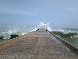
Villukuri was once used as an Army Training Camp in the Travancore Kingdom. "Villu" meaning "arrow" while "Kuri" meaning "aiming it". Villukuri was the place where Marthandavarma stored weapons for the Battle of Colachel.
Villukuri Fort was used for training soldiers. After a defeat by the Dutch, captain Dilenoy trained the Travancore army in this fort with specific training on the use of cannons, guns, etc. The fort fell into ruins due to lack of protective measures by the government.
| Village Name | Special Notes | |
|---|---|---|
| Villukuri Junction | A famous st. Sebastian kurusady is located | |
| Villukury RC Street & Simon Nagar | A small village, Known for Fish market and evening market. St. Alosious church is the Sub parish of St. Sebastian church, Madathattuvilai | |
| Thiruvidaikode | Famous for the Lord Siva Temple called Chadaiyappar temple. | |
| Madathattuvilai | Madam stands for Houses, known for the St.Sebastian Church and the Kurusadi | |
| Kuthiraipanthivilai | Stands for Horse resting area. | |
| Karavilai, | A small village in the Villukuri panchayat, known for its 300 years ancient Sri Bathrakali temple and once in 12 years, the temple celebrates the festival in a grand manner. Villukuri(saralvilai) has a famous Sudalai Madan Swami temple called The Mother Temple for all other Sudalai Madan Swami temples situated around Saralvilai. In Villukuri, there is a Siva Temple called the "Chadaiyappar temple". | |
| Kulumaikadu | A small village in villukuri panjayath. Famous temple's Sri sakthi vinayagar temple, Sri Bramasakthi Amman temple, sriman Narayanaswami Temple. | |
| Melapallam | ||
| Keelapallam | ||
| Villukuri(saralvilai) | A famous Sudalai Madan Swami temple called The Mother Temple for all other Sudalai Madan Swami temples situated around Saralvilai, also has famous Siva Temple called the Chadaiyappar temple. On Sivalaya Ottam is an additional temple. Kumara Kovil and the great Murugan temple are also nearby. |
Vilikuri hosts many schools:
Other facilities include:

Kanniyakumari district is one of the 38 districts of Tamil Nadu state and the southernmost district in mainland India. It stands second in terms of population density among the districts of Tamil Nadu. It is also the richest district in Tamil Nadu in terms of per capita income, and also tops the state in Human Development Index (HDI), literacy, and education. The district's headquarters is Nagercoil.
Alandur is a zone of Chennai corporation, and an urban node in Chennai district in Guindy division in the state of Tamil Nadu, India. It is Surrounded by Guindy in the North and East, Adambakkam in the South, Pazhavanthangal in the South-West and St Thomas Mount in the North-West. As of 2011, Alandur had a population of 164,430. The town agglomeration of Alandur will have an estimated population of 300,000 by 2030. Alandur neighbours the St. Thomas Mount Cantontment, the Officers Training Academy of the Indian army and the nearby towns of Guindy and Adambakkam. M. G. Ramachandran, a former chief minister of Tamil Nadu started his political career by winning his first legislative election from Alandur in 1967. Alandur also holds famous landmarks of Chennai namely Nehru Statue and Kathipara Junction.
Alangulam is a village in Vembakkottai block, Vembakottai taluk, Virudhunagar district in the state of Tamil Nadu in India. The state-government-run cement and asbestos factory is located here. The area is rich in limestone and asbestos. A nearby school addresses the needs of local students. This area contains Three primary government schools and One Higher secondary school. The private schools are Tancem Educational Trust Matric Hr sec School run by Tamil Nadu Cements and Maheswari Nursery Primary school.
Kannamangalam, previously referred as Mangalam is a panchayat town in Tiruvanamalai district in the Indian state of Tamil Nadu. It is located around 21 km from Vellore. Places with the suffix "mangalam" were believed to have been given as charity by the Kings of a particular reign, "Kannamangalam" was thus named by the same criteria. The Naganathi River, which passes through locality serve the water needs of the town during seasonal periods. Mudaliars and Muslims form the majority of the population in Kannamangalam town. Where as, Vanniyars are abundant in neighbouring villages.
Kilpennathur is a Panchayat Town in Tiruvanamalai district in the Indian state of Tamil Nadu. Kilpennathur is one of the taluks of Tiruvannamalai district and an assembly constituency of Tamil Nadu. The MLA of Kilpennathur assembly constituency is DMK party Mr. K. Pichandi. Vettavalam is the most populous town panchayat in this taluk. Kilpennathur is located a 12.25 degrees latitude and 79.224 degrees longitude. Nearest towns are Avalurpet, Vettavalam, Gingee and Tiruvannamalai, and Chennai is about 177 km away.
Colachel is a coastal town in the far south of India, located within the administrative jurisdiction of Kanyakumari District. It is a natural harbor on the Malabar coast, located 20 km north-west of Kanyakumari, the southernmost tip of India. As of 2011 the municipality had a population of 23,227 and a metropolitan population of 47,007.
Kottaram is a village located in Kanyakumari district in the Indian state of Tamil Nadu. Kottaram the word origin from Malayalam/Tamil meaning Palace. So Kottaram means not only a village but also a Palace because 18th & the beginning of the 19th century Kottaram village was ruled by Travancore Maharajas and they have constructed Guest Houses for them. In 1947 August 15 India got independence from British and Sri Vallabhai Pattel initiated to divided India as States and the states divided into Districts according to the regional language and the present Kottaram village became part of Tamil Nadu by 1 November 1956.
Madhavaram is a neighbourhood of Chennai, Tamil Nadu, India. Located in the northern part of Chennai, it is also a taluk in Chennai District and a zone in Greater Chennai Corporation. It is located in between Perambur and Kodungaiyur. As of 2011, the neighbourhood had a population of 119,105. The Chennai district was expanded on 16 August 2018 by transferring Madhavaram taluk from Tiruvallur district to Chennai district.
Manamadurai is a Municipality Town in Sivaganga district in the Indian state of Tamil Nadu. Manamadurai falls under Manamadurai Legislative assembly.
Nilakkottai is a town in the Dindigul district of the Indian state of Tamil Nadu. The town was established in 1958, as 1st Grade Town Panchayat. In 1970, it was changed to Selection Grade. The Town Panchayat has been under the municipal act since 1996. In 2004, it was called Special Village Panchayat, and in 2006, Selection Grade Town Panchayat.
Podaturpet is a Town under Pallipattu(Pallipet) Taluk in Thiruvallur district in the Indian state of Tamil Nadu.
Tiruvaikuntam, also referred to as Srivaikuntam is a panchayat town in Thoothukudi district in the Indian state of Tamil Nadu. It is located on the banks of the river Thamirabarani.

Suchindram is a panchayat town in Kanyakumari district in the Indian state of Tamil Nadu with Indian postal code as 629704. It is an important pilgrim centre and the site of the famous Thanumalayan Temple. There is an Anjaneya,, statue which stands at 22 feet and is carved of a single granite block.
Thorapadi is a part of Vellore Corporation. It is a prominent area in the city of Vellore.
Thiruvithamcode, is a small panchayat town located in the Kanyakumari district of the Indian state of Tamil Nadu. Thiruvithamcode is about 20 km from Nagercoil and 2 km from Thuckalay.
Uthukottai is a town in Suburbs of Chennai, one of the taluk headquarters in Thiruvallur District Tamil Nadu, also one of the border towns of Tamilnadu - Andhra Pradesh, located on the banks of the Arani river. This town is the central hub for many nearby towns and villages for their needs of education, markets, shops, businesses, banks, travel, transport and entertainment(Movie Theatres, badminton courts, cricket grounds, Gyms). The town features a channel which helps to direct water from the Krishna river for local irrigation.
Nerkundram or Nerkunram is a census town located in Chennai City, Chennai district in the Indian state of Tamil Nadu. It falls under Maduravoyal constituency in Tiruvallur district in the Indian state of Tamil Nadu. It consists of a portion of Ambattur taluk and part of Chennai Corporation. It falls under Sriperumbudur.
Vallavilai is a fishing village in Kollankodu panchayat, Kanyakumari district, Tamil Nadu, India.

Madathattuvilai is a village under Villukuri Panchayat in Kanyakumari district, the southernmost district in the state of Tamil Nadu in India. 300+ residents of Madathattuvilai have donated their eyes in last one decade and making it a trailblazer among cities and towns across the country.
Muttom road Eraniel is a place near Eraniel in Kanyakumari district in the state of Tamil Nadu, India.