Thingalnagar

Last updated

Thingalnagar
Monday Market
Nickname(s): 
Thingal Santhai
India Tamil Nadu location map.svg
Red pog.svg
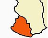
Thingalnagar
Location in Tamil Nadu, India
India location map.svg
Red pog.svg
Thingalnagar
Thingalnagar (India)
Coordinates: Coordinates: 8°11′47″N77°17′59″E / 8.19639°N 77.29972°E / 8.19639; 77.29972
CountryFlag of India.svg  India
State Tamil Nadu
District Kanniyakumari
Population
 (2001)
  Total12,554
Languages
  Official Tamil
Time zone UTC+5:30 (IST)

Thingalnagar is the town panchayat, located in Kanniyakumari district in the Indian state of Tamil Nadu.

Contents

The origin of the name "Thingalnagar" ("Monday Market" in English) is that every Monday, people from several nearby villages, wholesalers, and farmers for trading gather at the market. Markets can be found in Thingalnagar selling fresh marine fish, vegetables, and pets.

Demographics

As of the 2001 Census of India, [1] Thingalnagar has a population of 12,554. Males constitute 49% of the population, and females 51%. Thingalnagar has an average literacy rate of 78%, higher than the national average of 59.5%; male literacy is 81%, and female literacy is 76%. In Thingalnagar, 10% of the population is under 6 years of age.

Education

Related Research Articles

Eraniel Town in Tamil Nadu, India

Eraniel is a panchayat town in Kanyakumari district in the state of Tamil Nadu, India. It is of major commercial and political importance in the history of South India, as it was the seasonal capital of the affluent Venad and later Travancore kingdoms until the seventeenth century, when Padmanabhapuram and Thiruvananthapuram rose to prominence. Currently it is known for its archaeological importance for the ruins of the dilapidated Eraniel Palace.

Perundurai is a Special Grade Town Panchayat in Erode district in the Indian state of Tamil Nadu. Perundurai is the only special grade town panchayat among 42 in the district. Perundurai has developed as the industrial center with SIPCOT Industrial Estate and SEZ Complex. It is the Asia's Second largest SIPCOT.

Alipurduar City in West Bengal, India

Alipurduar is a city and a municipality in the Indian state of West Bengal. It is the headquarters of the Alipurduar district. Situated on the east bank of Kaljani River on the foothills of the Himalayas, the city is a gateway to Bhutan and northeastern states of India. Alipurduar was a sub-divisional town of Jalpaiguri district. On 25 June 2014, Smt. Mamata Banerjee, the Hon’ble Chief Minister, GoWB, declared Alipurduar as the 20th district of West Bengal.

Kanyakumari district District of Tamil Nadu in India

Kanyakumari district is one of the 38 districts in Tamil Nadu state and the southernmost district in mainland India. It stands second in terms of population density among the districts of Tamil Nadu. It is also the richest district in Tamil Nadu in terms of per capita income, and also tops the state in Human Development Index (HDI), literacy, and education. The district's headquarters is Nagercoil.

Ayakudi is a panchayat town in Dindigul district in the state of Tamil Nadu, India. Ayakudi is thought to be the place where the kings of Ay Kingdom originated. The city is known for guava. It is filled with nature in the slopes of Kodaikanal.

Bilariaganj is a town and a nagar panchayat in Azamgarh district in the state of Uttar Pradesh, India.

Chhipabarod is a census town in Baran district in the state of Rajasthan, India.

Kalanwali is a city and a municipal committee in Sirsa district in the Indian state of Haryana. Being very near the Punjab border, most of the people in this area have Punjabi as their mother tongue.

Kilpennathur is a Panchayat Town in Tiruvanamalai district in the Indian state of Tamil Nadu. Kilpennathur is one of the taluks of Tiruvannamalai district and an assembly constituency of Tamil Nadu. The MLA of Kilpennathur assembly constituency is DMK party Mr. K. Pichandi. Vettavalam is the most populous town panchayat in this taluk. Kilpennathur is located a 12.25 degrees latitude and 79.224 degrees longitude. Nearest towns are Avalurpet, Vettavalam, Gingee and Tiruvannamalai, and Chennai is about 177 km away.

Mallasamudram Town in Tamil Nadu, India

Mallasamudram is a small town in Thiruchengode taluk, Namakkal district in the Indian state of Tamil Nadu. It is the headquarter of the Mallasamudram block. Mallasamudram is also known as "Mallai village", "Mallai".

Neyyoor is a panchayat town in Kanniyakumari district in the Indian state of Tamil Nadu.

Nilakkottai is a town in the Dindigul district of the Indian state of Tamil Nadu. The town was established in 1958, as 1st Grade Town Panchayat. In 1970, it was changed to Selection Grade. The Town Panchayat has been under the municipal act since 1996. In 2004, it was called Special Village Panchayat, and in 2006, Selection Grade Town Panchayat.

Pirawa is a city and a municipality in Jhalawar district in the India.

Badi semariya is a town and a nagar panchayat and Legislative Assembly Area in Rewa district in the Indian state of Madhya Pradesh.

Tharamangalam Town in Tamil Nadu, India

Tharamangalam is a Municipality in Salem district in the Indian state of Tamil Nadu.

Thoubal Town in Manipur, India

Thoubal is a town, a municipal council with 18 municipal wards and district Headquarters in Thoubal district in the Indian state of Manipur. The name 'Thoubal' comes from 'Athouba' meaning brave people symbolising the courageous people of the district. It is one of the larger towns of Manipur. It is idyllic and has many lakes and rivers, paddy fields, and gardens. It is also the window to South-East Asia as the Trans-Asian highway (AH1) passes through it. It is well connected with Imphal, Kakching, Moreh, and Yairipok.

Uthukottai is a town in Suburbs of Chennai, one of the taluk headquarters in Thiruvallur District Tamil Nadu, also one of the border towns of Tamilnadu - Andhra Pradesh, located on the banks of the Arani river. This town is the central hub for many nearby towns and villages for their needs of education, markets, shops, businesses, banks, travel, transport and entertainment(Movie Theatres, badminton courts, cricket grounds, Gyms). The town features a channel which helps to direct water from the Krishna river for local irrigation.

Julana is a municipal committee town in the Jind district in the Haryana state of India. It is positioned in the Interior of Haryana and is usually known as the Heart of Haryana. It is the administrative headquarters of Julana Tehsil, located in the middle of Rohtak and Jind on NH 71.

Tirupathur taluk is a taluk in Tirupathur district of the Indian state of Tamil Nadu. The headquarters of the taluk is the town of Tirupathur. It is known as the "Sandalwood Town" due to the abundant availability of sandalwood trees in the surrounding hills. On August 15, 2019, honourable Chief Minister of Tamil Nadu, Edapaadi K. Palanisami announced Tirupathur district, as a new district of Tamil Nadu.

Muttom road Eraniel is a place near Eraniel in Kanyakumari district in the state of Tamil Nadu, India.

References

  1. "Census of India 2001: Data from the 2001 Census, including cities, villages and towns (Provisional)". Census Commission of India. Archived from the original on 16 June 2004. Retrieved 1 November 2008.