
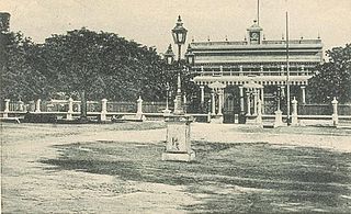
Thanjavur, also known as Thanjai, previously known as Tanjore, is a city in the Indian state of Tamil Nadu. It is the 11th biggest city in Tamil Nadu. Thanjavur is an important center of southern Indian religion, art, and architecture. Most of the Great Living Chola Temples, which are UNESCO World Heritage Monuments, are located in and around Thanjavur. The foremost among these, the Brihadeeswara Temple, built by the Chola emperor Rajaraja I, is located in the centre of the city. This temple has one of the largest bull statue in India carved out of a single granite rock called Nandi. Thanjavur is also home to Tanjore painting, a painting style unique to the region. Thanjavur is the headquarters of the Thanjavur District. The city is an important agricultural centre located in the Kaveri Delta and is known as the Rice bowl of Tamil Nadu. Thanjavur is administered by a municipal corporation covering an area of 36.31 km2 (14.02 sq mi) and had a population of 222,943. Roadways are the major means of transportation, while the city also has rail connectivity. The nearest airport is Tiruchirapalli International Airport, located 59.6 km (37.0 mi) away from the city. The nearest seaport is Karaikal, which is 94 km (58 mi) away from Thanjavur. The city first rose to prominence during the reign of the Cholas when it served as the capital of the empire. After the fall of the Cholas, the city was ruled by various dynasties such as the Mutharaiyar dynasty, the Pandyas, the Vijayanagar Empire, the Madurai Nayaks, the Thanjavur Nayaks, the Thanjavur Marathas and the British Empire. It has been a part of independent India since 1947.
Karaikal is a town of the Indian Union Territory of Puducherry. Karaikal was sold to the French by the Rajah of Thanjavur and became a French Colony in 1739. The French held control, with occasional interruptions from the British, until 1954, when it was de facto incorporated into the Republic of India, along with Mahé, Yanaon, and Pondichéry.

Thiruvaiyaru is a panchayat town in Thanjavur District in the Indian state of Tamil Nadu.

Kallanai is an ancient dam built by Karikala of Chola dynasty in 150 CE. It is built across the Kaveri river flowing from Tiruchirapalli District to Thanjavur district, Tamil Nadu, India. The dam is located in Thanjavur district, 15 km from Tiruchirapalli and 45 km from Thanjavur. It is the fourth oldest water-diversion or water-regulator structure in the world and the oldest in India that is still in use. Because of its spectacular architecture, it is one of the prime tourist spots in Tamil Nadu.

Tiruchirappalli District is one of the 38 districts, located along the Kaveri River, in Tamil Nadu, India. The headquarters of the district is the city of Tiruchirappalli.
Melathiruppanthuruthi is a panchayat town in Thanjavur district in the Indian state of Tamil Nadu.South India's Cleanest town panchayat and best in Solid waste management in south zone awarded by central government of India 2019-2020.
Thirukattupalli is a panchayat town near Thiruvaiyaru in Thanjavur district in the Indian state of Tamil Nadu. The economy of this town is majorly based on the agricultural lands of the surrounding villages. Its nearby major cities include Thanjavur and Trichy. Modes of transportation to these cities include regular daily bus services and Budalur Railway Station. Sir P. S. Sivaswami Iyer Higher Secondary School located at the heart of this town serves as the alma-mater for nearly all locals.

The Vennar River or Vennaaru is a river and distributary of the Kaveri River in the Kaveri delta. It flows through the Thanjavur, Tiruvarur, and Nagapattinam districts of Tamil Nadu, India.

Thanjavur district is one of the 38 districts of the state of Tamil Nadu, in southeastern India. Its headquarters is Thanjavur (Tanjore). The district is located in the delta of the Cauvery River and is mostly agrarian.

Thiruvarur district is one of the 38 districts in the Tamil Nadu state of India. As of 2011, the district had a population of 1,264,277 with a sex-ratio of 1,017 females for every 1,000 males.
Thennamanadu is a village panchayat in Orattanadu Block of Thanjavur district in Tamil Nadu, South India. It is located between the cities of Thanjavur and Pattukkottai, 20 km (12 mi) from Thanjavur, 2 km (1.2 mi) from Orathanadu and 339 km (211 mi) from the state capital Chennai.
Adirampattinam is a newly established Municipality in the Pattukottai taluk of the Thanjavur district in the Indian state of Tamil Nadu. It is also short known by Adirai. It is the largest coastal town in the district and fourth largest town in the Thanjavur district.

Aiyarappar is a Hindu temple dedicated to Shiva located in the village of Tiruvaiyaru, Tamil Nadu, India. Shiva is worshiped as Aiyarappar, and is represented by the lingam and his consort Parvati is depicted as AramValarthaNaayagi. The presiding deity is revered in the 7th century Tamil Saiva canonical work, the Tevaram, written by Tamil poet saints known as the nayanars and classified as Paadal Petra Sthalam.
Kumbakonam block is a community development block in the Kumbakonam taluk of Thanjavur District, Tamil Nadu, India. There are a total of 47 villages in this block. The block is surrounded by the Thirumanur and T.Palur blocks of Ariyalur District to the north, Thiruvidaimarudur and Thiruppanandal blocks of Thanjavur District to the east and Tiruvarur block of Tiruvarur District to the south and Papanasam block of Thanjavur district to the west. It is one of the six blocks of Thanjavur district watered by the Kaveri River.
The Vettar River or Vettaaru is a river in the Kaveri delta that flows through the Thanjavur, Tiruvarur, and Nagapattinam districts of the Indian state of Tamil Nadu.
Mullaiyar is a river flowing in the Tiruvarur district of the Indian state of Tamil Nadu. It is a tributary of the Kaveri river, and flows into the Bay of Bengal.

Tiruchirappalli railway division(Tamil:[திருச்சிராப்பள்ளிரயில்கோட்டம்]) is one of the six railway divisions of Southern Railway zone (SR) of India. It has its administrative headquarters located at Tiruchirappalli. It serves most of the districts of delta region and Central Tamil Nadu.
Vishnampettai is a large village in Budalur block, Thiruvaiyaru taluk of Thanjavur district, Tamil Nadu. This village is located in the banks of Kaveri River, Kollidam River and Kudamurutti River.

Mayiladuthurai district is one of the 38 districts of the Indian state of Tamil Nadu. The district was carved out of Nagapattinam district in 2020. Its headquarters are located at Mayiladuthurai.

The Vellar River or South Vellar River is a non-perennial river in the Indian state of Tamil Nadu that flows southeast into the Palk Strait, part of the Bay of Bengal.

