Sakleshpur, also known as Sakleshpura or Sakaleshapura, is a hill station town and headquarters of Sakleshpur taluk and one of the two Sub-divisional headquarters in Hassan district in the Indian state of Karnataka.
The Western Ghats mountains extend along the western edge of the taluk, separating Sakleshpur from Dakshina Kannada district. The rest of the district lies on the Deccan Plateau.[6] The Hemavati River, a tributary of the Kaveri, drains the eastern portion of the town, originating in Chikkamagaluru district and flowing through Sakleshpur town.[7]
Two rivers flow in western part of Sakleshpura taluk and drain through the Ghats.[8] The Kempuhole River originates near Manjarabad Fort and flows westward to join the Netravati River, which empties into the Arabian Sea at Mangalore. The Kumaradhara River, another tributary of the Netravati, drains the southwestern portion of the taluk.[8] These rivers form passes through the Ghats. The Bangalore-Mangalore Highway follows the Kempuhole River,[9] as does the rail line linking Sakleshpur to Mangalore.[10]Bisle Ghat Road follows the Kumaradhara, linking the southwestern portion of the taluk to Kulkunda and Subramanya in Dakshina Kannada.[11]
Sakleshpur is located in the Western Ghats, a mountain range that stretches from Kerala to Gujarat. The southern range around Sakleshpur, which includes the Bisle Reserve Forest, is listed as one of the 18 bio-diversity hotspots in the world.[12][13] The sub-tropical climate and heavy rains during the wet season create an environment where several unique plant and animal species flourish.[12]
Local flora of Sakleshpur include the reddish-orange pagoda flower (Clerodendrum paniculatum), locally known as raktha pushpa (blood flower).[14]
Sakleshpur has Aw climate, according to the Koppen-Geiger classification.[15] In 2022 Hethur hobli in Sakleshpura taluk received the maximum downpour of 4,305 millimetres (169.5in).[17] As per the records, the highest rainfall of 33.96 inches (862.5 mm) in June alone was recorded in 1896.[18]
Demographics
Show zoomed out
Show zoomed mid
Show zoomed in
As of 2011[update] India census,[19] Sakleshpur had a population of 23,352[20] of which 11,558 are males while 11,794 are females. Sakleshpur has an average literacy rate of 88.47%: male literacy is 92.72%, and female literacy is 84.31%. In Sakleshpur, 11% of the population is under 6 years of age.
Economy
The town lies in the Malnad region on the hills of the biodiversity hotspot, the Western Ghats. It has a tropical in west and temperate climate in eastern part surrounded with lofty green hills full of coffee, cardamom, pepper and areca plantations.[2] These crops which contribute mainly to the economy of the taluk are grown in the surrounding villages and the entire taluk are brought to Sakleshpur city for sale. The town lies on the National Highway 75 (NH 75) which connects the port city of Mangalore (128km),[21] with the capital city Bangalore (224km)[22] of Karnataka state. The nearest airport is Mangalore International Airport, situated at a distance of 129km (80mi).[23]
Notable locations
Manjarabad Fort
The Manjarabad Fort was constructed by Tipu Sultan.[24] It is located on the outskirts of Sakleshpur on NH 75.[25] It has a 8-pointed star-shaped fort on a hillock overlooking the road to Mangalore.[26] There is a hollow entrance in the center, which is said to be the entrance of a tunnel leading to Srirangapattana.[27] There is a mural with the fort's map at the entrance which is in excellent condition. The fort is maintained by the Department of Archeology.[14]
Gallery
Positioning of Hassan district in Karnataka
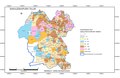
Hobli Map of Hassan district
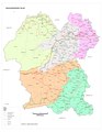
Map of Sakleshpur Taluk as per 2001 Census
Map of Sakleshpur Taluk as per 2011 Census
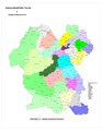
Sakleshpur Taluk - Hobli and Village Map
Sakleshpur Taluk - Grama Panchayat and Village Map
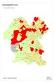
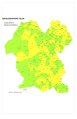
Sakleshpur Taluk Map about Fluoride content in DWS
This page is based on this Wikipedia article Text is available under the CC BY-SA 4.0 license; additional terms may apply. Images, videos and audio are available under their respective licenses.