
Chendamangalam is a small town and a panchayat in Paravur Taluk, Ernakulam district in the state of Kerala, India.
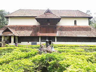
Nedumangad is a town and municipality in Thiruvananthapuram metropolitan area of Thiruvananthapuram district in the Indian state of Kerala, and is the headquarters of Nedumangad (tehsil) and Nedumangad Revenue Division(RDO). It is a suburb of the extended metropolitan region of Thiruvananthapuram city. It is located around 16 km to the north-east of Thiruvananthapuram city on the Thiruvananthapuram — Shencottah SH2. It is an important commercial center in the district. It is a growing commercial and educational hub and all important government institutions are situated in the town. Nedumangadu Market is important in South Kerala.

Taliparamba is a Municipality, Taluk and one of the Revenue division in North Malabar region of Kerala. The Municipal town spreads over an area of 25.04 square kilometres (9.67 sq mi) and is inhabited by 44,247 people.
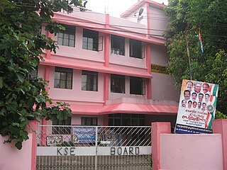
Perumbavoor is a historic place located at Bank of Periyar in Ernakulam District in the Indian state of Kerala. It lies in the north-eastern tip of the Greater Cochin area and is also the headquarters of Kunnathunad Taluk. Perumbavoor is famed in the state for wood industries and small-scale industries. Ernakulam lies 30 km southwest of Perumbavoor. The town lies between Angamaly and Muvattupuzha on the Main Central Road (MC), which connects Thiruvananthapuram to Angamaly through the old Travancore part of Kerala. Perumbavoor lies in the banks of rivers Periyar and Muvattupuzha.
Puthenvelikkara is a village in the Paravur Taluk Ernakulam district of Kerala, India. The Chalakkudy River merges with the Periyar River at Elenthikara in the village of Puthenvelikkara. Puthenvelikkara is on the banks of the river Periyar, Chalakudy and Kottapuram lagoon. It is a centre of agricultural production in the region with its many rice paddy fields.

North Paravur, formerly known as Parur, is a municipality in Ernakulam district in the Indian state of Kerala. It is a northern suburb of the city of Kochi and is situated around 20 km from the city centre.It is also the first place in India to use electronic voting machine during by-elections in 1982.

Ernakulam refers to the central, mainland portion of the city of Kochi in central Kerala, India and has lent its name to the Ernakulam district. The Kerala High Court, the office of the Kochi Municipal Corporation and the Cochin Stock Exchange are situated here in Ernakulam. The Ernakulam Junction is a major railway station of the Indian Railways. Initially, Ernakulam was the headquarters of the Ernakulam District but was later shifted to Kakkanad. Ernakulam was once the capital of the Kingdom of Cochin. It is located 220 kilometres (137 mi) north-west of the state capital Thiruvananthapuram. The city has served as an incubator for many Malayali entrepreneurs and is a major financial and commercial hub of Kerala.

Eloor is a suburb of Kochi and a municipality in Paravur Taluk, Ernakulam District in the Indian state of Kerala, India. It is an industrial area situated around 13 kilometres north of the city centre. It is an island of 14.21 km2 formed between two distributaries of river Periyar and is the largest industrial belt in Kerala.The neighbouring places of Eloor are Kalamassery industrial hub, Aluva, Cheranalloor and Paravur.

Kadungalloor is a census town, just 1km from Aluva Town, It is in Paravur Taluk, Ernakulam district in the Indian state of Kerala. The industrial estate of Muppathadam and Edayar is situated in this panchayat. Pottuvellari is widely cultivated in this panchayat. Panchayat consists of notable peoples in cultural and local arts. Famous personalities include actor Sathar,writer Sethu and award-winning Malayalam novelist Gracy. Recently Kadungallor panchayath, previously in Paravur Taluk joined Aluva Taluk. Muppathadam is the main Commercial Center of Kadungalloor.

Kottuvally is a census town in Paravoor.It is also a village in Paravur Taluk, Ernakulam district in the Indian state of Kerala. The village is situated in the south of the taluk. The nearest town is North Paravur, 4 km away. The Kottuvally panchayath is spread out on both sides of NH-66 road.

Ezhikkara is a panchayat in Paravur Taluk of Ernakulam District, Kerala. The North Paravur, Chathanad road (9 km) passes through this village. Ezhikkara is situated close to Ernakulam. Ezhikkara is famous for its pokkali fields and prawn farms.

Paravur Taluk is a taluk of Ernakulam District in the Indian State of Kerala. North Paravur is the capital of the taluk. Paravur Taluk lies in the north western part of Ernakulam district bordering Thrissur district. The surrounding taluks are Kochi to the west consisting of Vypin Island, Kodungallur to the north, Chalakudy to the north consisting of Mala, Aluva to the east consisting of Angamaly, Nedumbassery and Aluva, Kanayanur to the south consisting of Cochin City. Paravur is a part of Kochi urban agglomeration area. The western parts of taluk are coastal areas with cultivations like prawn and pokkali rice. The eastern parts are fertile lands. The heavy industries of Kochi is located in Udyogmandal area of the taluk.

Vadakkekara is a census town, panchayat in Paravur Taluk, Ernakulam District, Kerala state in India. Paravur town is situated 5 km from this village. The main centre in this village is Moothakunnam. Vadakkekara is one of the early formed panchayat in the state. The cultural and historical place in Ernakulam Dristrict, combines the parts of the early Muzaris. Maliankara is famous for being the landing place of St. Thomas.
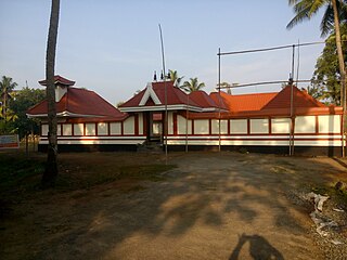
Kunnukara is a census town and panchayat in Paravur Taluk of Ernakulam district, Kerala, India. The village is situated on the Airport road connecting North Paravur (NH66) and Nedumbassery (NH544). North Paravur is the nearest town, 7 km from this village. Aluva (10 km) and Angamaly (12 km) are also near to Kunnukara. Its administrative headquarters is in Kunnukara Town itself. The Mini Civil Station has four hospitals, all the Govt. offices, a Khadi Unit Supermarkets etc.

Panayikulam is a small village which falls in the Alangad Grama Panchayat, Paravur Taluk, Kerala, India. It is just near to Aluva town. A nice place to live in, easily accessible to Aluva Railway Station at 7 km, Nedumbassery International Airport 10 km and the Kochi City at 15 km. It is a preferred residential locality due to its proximity to the industrial areas, viz Binanipuram, Eloor and Kalamassery, where major factories like FACT, HMT, HIL, TCC, Binani,CMRL etc., are situated. Can commute on daily basis to the InfoPark, Kochi which is almost 12 km away. The place is providing its residents with pure water with no salinity in it and plain beautiful land very close to the Periyar River.It is the birthplace of Famous Film director/Actor Althaf Salim
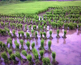
Karumallur is a village in Paravur Taluk, Ernakulam district in the Indian state of Kerala. Karumalloor is a panchayat in Ernakulam District. The village consists of large tracts of paddy fields. Karumallur is bounded by distributaries of the river Periyar. The panchayat is mainly a rice-based agrarian economy.

Aroli is a village of Pappinisseri Panchayat in Kannur district in the Indian state of Kerala.
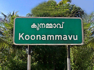
Koonammavu is a northern suburb of Kochi city which is associated in the Kochi metropolitan area. Koonammavu (Valluvally) is a census town in Kottuvally Panchayat,North Paravur Taluk, Ernakulam District, Kerala, India and lies between Edappally and North Paravur adjacent to Varappuzha.
Parayakadu, Ernakulam is also known as Parayad or Parayakad within the Chittatukara Village Panchayat, North Paravur Paravur Taluk, Ernakulam district, Kerala, India.


