Meenangadi

Last updated

Meenangadi
Town
Wayanad-meenngadi map-en by stalin.svg
India Kerala location map.svg
Red pog.svg
Meenangadi
India location map.svg
Red pog.svg
Meenangadi
Coordinates: 11°39′39″N76°09′19″E / 11.660779°N 76.155185°E / 11.660779; 76.155185
CountryFlag of India.svg India
StateKerala
District Wayanad
Block Sulthan Bathery
First Settlement Neolithic Age [1] [2]
Named after Matsya Avathara Temple and Fish Market
Area
  Total
53.52 [3]  km2 (13,225.08 acres)
Elevation
773.00 m (2,536.09 ft)
Population
 (2011) [4]
  Total
33,450
  Estimate 
(2016 [5] )
34,601
  Density630/km2 (1,600/sq mi)
Languages
  Official Malayalam
Others:English, Kannada, Tamil, Hindi
  Summer (DST) UTC+5:30 (IST)
PIN
673 591
Telephone code91 (0)4936

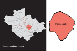
Meenangadi is an old town situated on the highway NH 766 between Kalpetta and Sulthan Bathery in Wayanad District, [6] in Kerala, India. This place is one among the Provinces where the existence of Dolmens provide an historical evidence of earlier civilisation. [7] [8] Coffee bean, Black pepper, Ginger, Rice and Areca are the major crops cultivated in this area. [9] Meenangadi is famous for its Fish Market and Cattle Market. [10] The nearest railway station is at Kozhikode at 87 km and airport is Kannur International Airport [11] with 94 km [12] from Meenangadi. Meenangadi is surrounded by, Ambalavayal Panchayat, Kalpetta Taluk towards west, Gudalur Taluk towards East, Mananthavady Taluk towards west. [13] [14] Kalpetta, Sultan Bathery, Kozhikode are the nearby Cities and towns to Meenangadi.
Kerala's first carbon neutrality project launched in Meenangadi in June 2016. [15] Upon achieving the goals of the project, Meenangadi will be the first village in India to go completely carbon neutral. [16] Meenangadi has a population of 33450 According to 2011 Census with two Villages Purakkadi and (Part)Krishnagiri. [4] [17]

Contents

The village is home to St. Peter Orthodox Valiyapally, a major parish affiliated with the Malankara Orthodox Syrian Church. [18]

Educational institutions

Climate

Climate data for Meenangadi, Kerala
MonthJanFebMarAprMayJunJulAugSepOctNovDecYear
Mean daily maximum °C (°F)27.2
(81.0)
29
(84)
30.7
(87.3)
30.6
(87.1)
29.6
(85.3)
26.1
(79.0)
24.7
(76.5)
25.3
(77.5)
26.2
(79.2)
26.8
(80.2)
26.5
(79.7)
26.5
(79.7)
27.4
(81.4)
Mean daily minimum °C (°F)16.6
(61.9)
17.8
(64.0)
19.5
(67.1)
20.7
(69.3)
20.8
(69.4)
19.8
(67.6)
19.4
(66.9)
19.4
(66.9)
19.2
(66.6)
19.4
(66.9)
18.5
(65.3)
16.9
(62.4)
19.0
(66.2)
Average precipitation mm (inches)4
(0.2)
9
(0.4)
17
(0.7)
95
(3.7)
185
(7.3)
513
(20.2)
1,011
(39.8)
543
(21.4)
235
(9.3)
226
(8.9)
84
(3.3)
22
(0.9)
2,944
(116.1)
Source: Climate-Data.org [23]

References

  1. Benhur, Abraham (2012). Megalithic Monuments of South India. pathofdolmens.
  2. Menon, T. Madhava; Linguistics, International School of Dravidian (2000). A handbook of Kerala. International School of Dravidian Linguistics. ISBN   9788185692272.
  3. Keralam, Digital. "Meenangadi Grama Panchayath Meenangadi Wayanad Kerala India | Digital Keralam". Digital Keralam.
  4. 1 2 "Census of India 2011 - Kerala district census handbook - Wayanad" (PDF). Archived from the original (PDF) on 17 July 2016.
  5. "Creating a carbon neutral Meenangadi Grama Panchayat" (PDF). Archived from the original (PDF) on 16 January 2021.
  6. "Official website of Wayanad district". Archived from the original on 21 May 2018. Retrieved 14 March 2015.
  7. "The Path of the Dolmens". pathofdolmens.org.
  8. Manoj, E. m (30 December 2012). "Megalithic rock-cut tomb found in Wayanad". The Hindu.
  9. "Official Web Site of Wayanad District". wayanad.nic.in. Archived from the original on 10 July 2007.
  10. Department, Kerala (India) Animal Husbandry (1974). Report on Quinquennial Livestock Census, 1966: 1966:1. Department of Animal Husbandry, Livestock Census.
  11. "Home". www.kannurairport.in. Archived from the original on 2 August 2018. Retrieved 24 January 2017.
  12. "Google Maps". Google Maps.
  13. "Meenangadi have high connectivity of roads towards Calicut, Mysore and Bangalore. Nearest tourist centers are edakkal caves( ~ 8 Km) and karapuzha dam (~6 Km)". www.keralatourism.org.
  14. "Meenara, Manikkal Panchayat, Thiruvananthapuram District, Kerala, India". Kerala Tourism.
  15. "Kerala's first carbon neutrality project launched in Wayanad". 5 June 2016 via The Economic Times - The Times of India.
  16. Kerala Achieved What the World Is Struggling With – Becoming Carbon Neutral!, 5 June 2017
  17. Staff Reporter (4 September 2013). "Meenangadi panchayat plans project for tribals". The Hindu.
  18. "St. Peter Orthodox Church - Meenangadi". directory.mosc.in. MOSC Publications. Retrieved 17 June 2024.
  19. "Official Web Site of Wayanad District". wayanad.nic.in. Archived from the original on 23 January 2009.
  20. "Model College, Meenagadi". www.ihrd.ac.in.
  21. "Vivekanandavidyamandiram". Archived from the original on 18 December 2014. Retrieved 30 March 2020.
  22. "Anns English Medium School :: Home | Meenengadi | Wayanad | Kerala | India". Archived from the original on 2 April 2015. Retrieved 30 March 2020.
  23. "CLIMATE: MEENANGADI", Climate-Data.org. Web: .