Perinthalmanna

Last updated

Perinthalmanna
Perintalmanna
Perinthalmanna.jpg
Night view of Perinthalmanna Municipal town
India Kerala location map.svg
Red pog.svg
Perinthalmanna
Location in Kerala, India
India location map.svg
Red pog.svg
Perinthalmanna
Perinthalmanna (India)
Coordinates: 10°58′36″N76°13′37″E / 10.9765415°N 76.2269231°E / 10.9765415; 76.2269231
CountryFlag of India.svg India
State Kerala
District Malappuram
Taluk Perinthalmanna
Revenue villagesPerintalmanna
Pathaikkara
Government
  TypeSecond Grade Municipality
  BodyPerinthalmanna Municipality
  ChairmanP. Shaji (CPI-M)
  Vice ChairpersonNaseera. A
  M.L.A Najeeb Kanthapuram (UDF)
Area
[1]
  Total
34.41 km2 (13.29 sq mi)
Population
 (2011) [1]
  Total
49,723
  Density1,445/km2 (3,743/sq mi)
Languages
  Official Malayalam, English
Time zone UTC+5:30 (IST)
PIN
679322
Telephone code04933
Vehicle registration KL-53
State Assembly Constituency Perinthalmanna
Lok Sabha Constituency Malappuram
Website perinthalmannamunicipality.lsgkerala.gov.in

Perinthalmanna is a town and municipality in Malappuram district, Kerala, India. It serves as the administrative centre for the Perinthalmanna taluk, as well as a revenue division, a community development block, and a police sub-division bearing the same name. [2] It was formerly the headquarters of the Kingdom of Valluvanad. The town is located 23 kilometres (14 mi) southwest of Malappuram at the centre of the KozhikodePalakkad National Highway 966. [3]

Contents

History

Map of Valluvanad Taluk in Malabar District (1909) Geography of Malabar1.jpg
Map of Valluvanad Taluk in Malabar District (1909)

During the last decades of the eighteenth century, the region came under the control of the vast Kingdom of Mysore, and was the headquarters of the Kingdom of Valluvanad. Perinthalmanna, along with the towns of Malappuram, Manjeri, and Tirurangadi, was one of the main centres of the Malabar Rebellion of 1921. [4] Now it is one of the important commercial centre in Malappuram district.

Perinthalmanna became a Grama Panchayat in 1933 under the Malabar District board. The town was later upgraded to a municipality on 10 February 1990. [5] As of the 2011 India census, Perinthalmanna had a population of 49,723 spread over an area of 34 km2 (13 sq mi). [1] [6] Perinthalmanna serves as the headquarters of one of the two revenue divisions in Malappuram district, having jurisdiction over Perinthalmanna, Eranad, and Nilambur taluks. Perinthalmanna is also as the headquarters of Perinthalmanna Block Panchayat and Revenue Divisional Office and Sub Divisional Police Office. [7] [8] [9]

Geography

Kodikuthimala hill station, east of Perinthalmanna Kodikuthimala, Malappuram.jpg
Kodikuthimala hill station, east of Perinthalmanna

The Thuthapuzha, a tributary of the Bharathappuzha (Ponnani River), which is also the longest river of Kerala, flows through Thootha, a village located about 10 km from Perinthalmanna. [10] The Western Ghats mountain range begins east of Perinthalmanna. [10] Kodikuthimala hillstation is located in the Thazhekode village of Perinthalmanna Taluk, which also shares its boundary with the municipality of Perinthalmanna. [10] Melattur village of Perinthalmanna Taluk is a part of Nilgiri Biosphere Reserve. [10]

Angadipuram Laterite is a notified National Geo-heritage Monument located about two kilometres (1.2 mi) west of the Perinthalmanna town centre. [11] [12] [13]

Gulmohar flowering trees are widely seen in the Perinthalmanna area. [14]

Demographics

Religion in Perinthalmanna municipality (2011) [15]
  1. Islam (58.5%)
  2. Hinduism (38.4%)
  3. Christianity (2.97%)
  4. Other (0.11%)

Civic administration

The town is administered by the Perinthalmanna Municipality, headed by a chairperson. For administrative purposes, the municipality is divided into 37 wards, [16] from each of which members of the municipal council are elected for five years. 
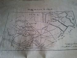
As of 2011 India census, Perinthalmanna Municipal Region had a population of 49,723 spreading an area of 34 sq.km. Following the 2025 ward delimitation, Perinthalmanna Municipality now comprises 37 wards, increased from 34. [17] These wards are: [18]

Members of the Perinthalmanna Municipal Council (2025) [19] [20]
Ward. NoWardWard name (ML)Councillor [21] [22] PartyAllianceWard Geo Map [23]
1Cheerattamannaചീരട്ടമണ്ണAttuparambil SharathCPI(M)   LDF [24]
2Manathumangalamമാനത്തുമംഗലംAleena MariyamINC   UDF [24]
3Kakkoothകക്കൂത്ത്Rajeena SaleemIUML  UDF [23]
4Mundathappadiമുണ്ടത്തപ്പടിPacheeri Husaina NasarInd.  UDF-backed
5Valiyangadiവലിയങ്ങാടിMohammed Mansoor NechiyilInd.  LDF-backed
6KulirmalaകുളിർമലNalakath Mohammed BasheerIUML  UDF
7Chembankunnuചെമ്പൻകുന്ന്Ajil KumarCPI(M)  LDF
8Kunnumpuramകുന്നുംപുറംSameena JafferIUML  UDF
9Aalakunnuആലക്കുന്ന്Unais KakkoothIUML  UDF
10Ponniyakurussiപൊന്നിയക്കുറിശ്ശിCheriyil Saleena MIUML  UDF
11Idukkumukhamഇടുക്കുമുഖംRashik K. M.Ind.  UDF-backed
12Manazhi Standമനഴി സ്റ്റാന്റ്Fazal MohammedINC  UDF
13Panchamaപഞ്ചമDineshINC  UDF
14Kuttipparaകുട്ടിപ്പാറPacheeri SubairInd.  UDF-backed
15KovilakampadiകൊവിലകംപടിSurayya FarooqIUML  UDF
16Pathaikkara U.P. Schoolപാതായിക്കര യുപി സ്കൂൾPreethaCPI(M)  LDF
17Manappadiമനപ്പടിSreenivasanCPI(M)  LDF
18P.T.M. Collegeപി.ടി.എം കോളേജ്Sherlija C. P.CPI(M)  LDF
19Thanneerpanthalതണ്ണീർപന്തൽArunIUML  UDF
20Olinkaraഒലിങ്കരAskar KarimpanakkalInd.   UDF Backed
21Aanathaanamആനത്താനംAmbili ManojCPI(M)  LDF
22Kizhakkekaraകിഴക്കേകരVandanaCPI(M)  LDF
23Thekkekaraതെക്കേക്കരThottasseri KhadeejaIUML  UDF
24Padinjarekkaraപടിഞ്ഞാറേക്കരSunil Kumar M. P.CPI(M)  LDF
25Valayammoochiവളയമ്മൂച്ചിSumayyaInd.  UDF-backed
26Aasharikkaraആശാരിക്കരKalathil MusthafaInd.   UDF Backed
27Marukaraparambaമറുകരപറമ്പ്Mohammed Shakeer T.CPI(M)  LDF
28Kunnappally Southകുന്നപ്പള്ളി സൗത്ത്Jumana Saleem PathathCPI(M)  LDF
29Kollakodeകൊല്ലക്കോട്Mohammed Fazil KakranIUML  UDF
30Vattaparaവട്ടപ്പാറPacheeri Naseema FirozIUML  UDF
31Thekkinkodeതെക്കിങ്കോട്Jishnu NarayananCPI(M)  LDF
32Kavungaparambaകാവുങ്ങപറമ്പ്Surayyabanu (Muthu)Ind.  LDF-backed
33J.N. Road Centralജെ.എൻ. റോഡ് സെൻട്രൽPathath Smrithi RajeshCPI(M)  LDF
34Thottakkaraതോട്ടക്കരNishaINC  UDF
35Puthoorപുത്തൂർV. RahulCPI(M)  LDF
36Muttungalമുട്ടുങ്കൽBindu ManikandanCPI(M)  LDF
37Lemon Valleyനാരങ്ങ കുണ്ട്SabithaINC  UDF

Legend:

   Communist Party of India (Marxist)
   Indian National Congress
   Indian Union Muslim League
   Independent
   United Democratic Front (Kerala)
   Left Democratic Front (Kerala)
  Others

Note:

Perinthalmanna Municipality election, 2025

References: [25] [26] [27]

S.No.Party nameParty symbolNumber of councillors
01 UDF UDF logo.png 15
02 LDF Left Democratic Front (Kerala) Logo.svg 14
03Independents No flag.svg 8

In the 2025 Perinthalmanna municipal election, the UDF won 21 of 37 wards, ending LDF’s control since 1995. Within UDF, 10 Muslim League, 5 Muslim League independents, 5 Congress, and 1 Congress rebel were elected. For LDF, 14 CPM and 2 Left independents won. [21]


Perinthalmanna Municipality election 2020

S.No. [28] Party nameParty symbolNumber of councillors
01 LDF Left Democratic Front (Kerala) Logo.svg 17
02 UDF UDF logo.png 09
03Independents No flag.svg 08

Law and order

The municipality comes under the jurisdiction of the Perinthalmanna Police Station, which was formed on 1 September 1988. [29] The station has the jurisdiction over the revenue villages of Perinthalmanna, Pathaikara, Angadipuram, Elamkulam, Aliparamba, Anamangad, Arakkuparamba, Thazhekode, and parts of Pulamantol and Valambur. [29] Perinthalmanna Municipality, Thazhekkode Grama Panchayat, Alipparamba Grama Panchayat, Elamkulam Grama Panchayat, and Angadippuram Grama Panchayat are included in the Perinthalmanna Police Station limit. [29]

The border police stations are headquartered at Kolathur, Mankada, Melattur, Koppam, Nattukal and Cherpulassery. [29]

Perinthalmanna town is also the headquarters for one of the six subdivisions of Malappuram District Police. [30] The office of the Deputy Superintendent of Police, Perinthalmanna, is situated in the town, and the police stations at Perinthalmanna, Kolathur, Mankada, Melattur, Pandikkad, and Karuvarakundu, as well as the Perinthalmanna Traffic Enforcement Unit, fall under the jurisdiction of the Perinthalmanna Subdivision. [30]

Courts

The court complex at Perinthalmanna has the following courts: [31]

Elected representatives

Perinthalmanna assembly constituency consists Perinthalmanna Municipality and surrounding panchayats of Melattur, Vettathoor, Thazhekkode, Aliparamba, Elamkulam and Pulamanthole. It is part of the Malappuram Lok Sabha constituency. The current MLA, Najeeb Kanthapuram, and MP, Abdussamad Samadani, are from the Indian Union Muslim League (IUML), respectively. [32]

MLA of Perinthalmanna
Najeeb Kanthapuram MLA.jpg
Incumbent
Najeeb Kanthapuram (IUML)
since 2021
Member of Kerala Legislative Assembly
Precursor Manjalamkuzhi Ali
First holder P. Govindan Nambiar
Member of Parliament
(Lok Sabha)
Mp abdussamad samadani.jpg
since 2021
AbbreviationMP
Member of Parliament of India (Loksabha)

Health care

Perinthalmanna is widely regarded as a major health care hub in Kerala, often referred to as the “hospital city” of Malabar due to the high concentration of multi-speciality hospitals, super-speciality centres, and clinics located in and around the town. Patients from across Malappuram district and neighbouring regions such as Palakkad, Thrissur, and Kozhikode frequently seek medical treatment here. [33]

Notable people

Perinthalmanna Block

Perinthalmanna Block Panchayat is the rural local body responsible for the block-level administration of the following Gram panchayats: [2]

Perinthalmanna Block Panchayat is divided into 17 divisions, with each member elected from a division. The divisions are as follows: [34]

Ward no.NameWard no.Name
1Nenmini10Kunnakkavu
2Chemmaniyode11Elamkulam
3Melattur12Pulamanthole
4Karyavattoom13Kuruvambalam
5Vettathoor14Pariyapuram
6Arakkuparamba15Thirurkkad
7Thazhekkode16Angadippuram
8Aliparamba17Pattikkad
9Anamangadu

See also

References

  1. 1 2 3 4 5 6 "Malappuram census handbook" (PDF). censusindia.gov.in.
  2. 1 2 "Perinthalmanna Block". lsgkerala.gov.in.
  3. S. Anil Radhakrishnan (24 March 2018). "New Roads, New Vistas". The Hindu.
  4. Sreedhara Menon, A. (2007). A Survey of Kerala History (2007 ed.). Kottayam: DC Books. ISBN   9788126415786.
  5. "Perinthalmanna - About city". Kudumbasree. Retrieved 11 December 2020.
  6. "Kudumbashree | About ULBs - Perinthalmanna Municipality". www.kudumbashree.org. Retrieved 5 May 2023.
  7. "Revenue Divisional Office, Perinthalmanna | Welcome to Malappuram | India" . Retrieved 5 May 2023.
  8. "Official Website of Malappuram - Perinthalmanna Sub Division". malappuram.keralapolice.gov.in. Retrieved 5 May 2023.
  9. "Block Panchayaths | CRD". rdd.lsgkerala.gov.in. Retrieved 5 May 2023.
  10. 1 2 3 4 Directorate of Census Operations, Kerala. District Census Handbook, Malappuram (PDF). Thiruvananthapuram: Directorate of Census Operations, Kerala.
  11. "National Geological Monument, from Geological Survey of India website". Archived from the original on 12 July 2017. Retrieved 23 May 2017.
  12. Geo-Heritage Sites, Minister of Mines Press release, 09-March-2016
  13. national geo-heritage of India Archived 11 January 2017 at the Wayback Machine , INTACH
  14. Our Currespondent (21 May 2020). "Gulmohar flowers give a different hue to Melattur railway station". Onmanorama. Manorama Online. Retrieved 30 April 2021.
  15. 1 2 "Religion – Kerala, Districts and Sub-districts". Census of India 2011. Office of the Registrar General.
  16. "Perinthalmanna municipality". lsgkerala. Retrieved 30 November 2020.
  17. Ward list of Perinthalmanna- State Election Commission, Kerala
  18. "Wards of Perinthalmanna". sec.kerala.gov.in.
  19. "Local Body Elections 2025 - TREND by State Election Commission Kerala". trend.sec.kerala.gov.in. Retrieved 13 December 2025.
  20. 1 2 "Perinthalmanna Municipal Election Results 2025". Mathrubhumi English. Retrieved 13 December 2025.
  21. "Local Body Elections 2025 - TREND by State Election Commission Kerala". trend.sec.kerala.gov.in. Retrieved 13 December 2025.
  22. 1 2 "Perinthalmanna Localbody". wardmap.ksmart.live. Retrieved 13 December 2025.
  23. 1 2 "Perinthalmanna Localbody". wardmap.ksmart.live. Retrieved 13 December 2025.
  24. "Local Body Elections 2025 - TREND by State Election Commission Kerala". trend.sec.kerala.gov.in. Retrieved 13 December 2025.
  25. "Local Body Elections 2025 - TREND by State Election Commission Kerala". trend.sec.kerala.gov.in. Retrieved 13 December 2025.
  26. "Kerala local body elections: Historic win for UDF in Perinthalmanna after 30 years". @mathrubhumi. 13 December 2025. Retrieved 13 December 2025.
  27. "LOCAL BODY ELECTIONS KERALA - TREND 2020". Archived from the original on 16 December 2020. Retrieved 16 December 2020.
  28. 1 2 3 4 "Perinthalmanna PS". Kerala police. Retrieved 30 November 2020.
  29. 1 2 "Perinthalmanna Subdivision". Kerala police.
  30. "History | DISTRICT COURT MANJERI | India". malappuram.dcourts.gov.in. Archived from the original on 19 April 2025. Retrieved 3 September 2025.
  31. "Members - Kerala Legislature". www.niyamasabha.org. Retrieved 20 December 2023.
  32. "Malappuram-Public Hospitals – sha". sha.kerala.gov.in. Retrieved 3 September 2025.
  33. "Perinthalmanna Block Panchayat | Local Self Government Department". lsgkerala.gov.in. Retrieved 21 December 2023.