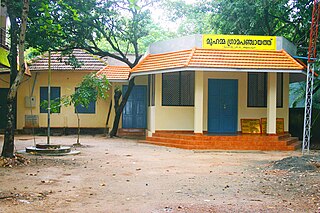
Perakam | |
---|---|
city | |
Coordinates: 10°36′13″N76°00′27″E / 10.6037400°N 76.007440°E Coordinates: 10°36′13″N76°00′27″E / 10.6037400°N 76.007440°E | |
Country | |
State | Kerala |
District | Thrissur |
Population (2001) | |
• Total | 10,356 |
Languages | |
• Official | Malayalam, English |
Time zone | IST (UTC+5:30) |
Perakam is a census town in Thrissur district in the Indian state of Kerala.
A census town is a type of town that satisfies certain characteristics, depending on the country in which it is located.
Thrissur is a revenue district of Kerala situated in the central part of that state. Spanning an area of about 3,032 km2, Thrissur district is home to over 10% of Kerala’s population.
India, also known as the Republic of India, is a country in South Asia. It is the seventh largest country by area and with more than 1.3 billion people, it is the second most populous country as well as the most populous democracy in the world. Bounded by the Indian Ocean on the south, the Arabian Sea on the southwest, and the Bay of Bengal on the southeast, it shares land borders with Pakistan to the west; China, Nepal, and Bhutan to the northeast; and Bangladesh and Myanmar to the east. In the Indian Ocean, India is in the vicinity of Sri Lanka and the Maldives, while its Andaman and Nicobar Islands share a maritime border with Thailand and Indonesia.
As of 2001 [update] India census, [1] Perakam had a population of 10,356. Males constitute 47% of the population and females 53%. Perakam has an average literacy rate of 84%, higher than the national average of 59.5%: male literacy is 85%, and female literacy is 84%. In Perakam, 11% of the population is under 6 years of age.
Muzhappilangad is a small coastal village near Thalassery in Kannur district in the Indian state of Kerala.
Paharpur is a census town in Gaya district in the Indian state of Bihar.
Chanpatia is a town and a notified area in Paschim Champaran district in the state of Bihar, India.
Devsar is a census town in Navsari district in the state of Gujarat, India.
Dhana is a census town in Sagar district in the state of Madhya Pradesh, India.
Template:Infobox settlemen
Gangaghat is a city and a municipal board in Unnao district in the state of Uttar Pradesh, India.
Jabalpur Cantonment is a cantonment town in Jabalpur District in the Indian state of Madhya Pradesh.
Kanjikkuzhi is a census town in Kottayam district in the Indian state of Kerala. It is a suburb of Kottayam City. It lies on the Kottayam - Kumily state highway.
Kappiyarai is a panchayat town in Kanniyakumari district in the Indian state of Tamil Nadu.
Krishnasamudram is a census town in Tiruchirappalli district in the Indian state of Tamil Nadu.
Lauthaha is a city and a notified area in Purvi Champaran district in the Indian state of Bihar.
Nadathara is a residential area situated in the City of Thrissur in Kerala state of India. Nadathara is Ward 22 of Thrissur Municipal Corporation. As of 2001 India census, Nadathara had a population of 12,593. Males constitute 49% of the population and females 51%. Nadathara has an average literacy rate of 84%, higher than the national average of 59.5%: male literacy is 86%, and female literacy is 82%.
Peralam is a panchayat town in Thiruvarur district in the Indian state of Tamil Nadu.
Raghunathpur is a census town in Buxar District in the Indian state of Bihar.
Rengali Dam Projectship is a census town in Anugul district in the Indian state of Odisha.
Uttar Raypur is a census town under Budge Budge police station of Budge Budge I CD Block in Alipore Sadar subdivision of South 24 Parganas district in the Indian State of West Bengal. It is a part of Kolkata Urban Agglomeration.
Vanasthali is a census town in Tonk district in the Indian state of Rajasthan.
Vengathur is a census town in Thiruvallur district in the Indian state of Tamil Nadu.
Piro is a town and a notified area in Bhojpur District, in the Indian state of Bihar.
This article related to a location in Thrissur district, Kerala, India is a stub. You can help Wikipedia by expanding it. |