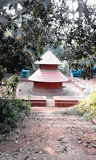
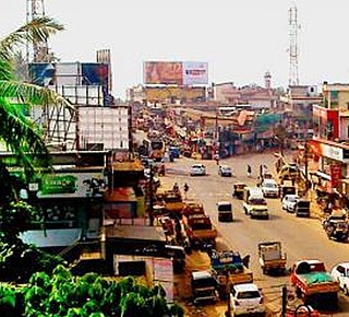
Nedumangad is a town and municipality in Thiruvananthapuram metropolitan area of Thiruvananthapuram district in the Indian state of Kerala, and is the headquarters of Nedumangad tehsil and Nedumangad Revenue Division (RDO). It is a suburb of the extended metropolitan region of Thiruvananthapuram city. It is located around 16 km to the north-east of Thiruvananthapuram city on the Thiruvananthapuram – Shenkottah (State Highway 2). It is an important commercial center in the district. It is a growing commercial and educational hub and all important government institutions are situated in the town. Nedumangadu Market is important in South Kerala.

Idimuzhikkal or Chelembra is a town in Malappuram district, Kerala, India. Chelembra is the Panchayath and Idimuzhikal is the capital of this Panchayath. Chelembra grama panchayat in the district.
Chathamangalam is a village in Kozhikode district of Kerala state, India.
Kayanna is a village in Kozhikode district in the state of Kerala, India.

Maniyur Grama Panchayat is located in Vadakara Taluk, in the Kozhikode district in the state of Kerala, India. It covers an area of 31.03 km2.
Velom Grama Panchayath is a village in Kozhikode district in the state of Kerala, India.
Abdu Rahiman Nagar is a census town in Malappuram district in the state of Kerala, India. It is also the name of a Grama Panchayat.
Alamcode , also Alamkod, is a village in Malappuram district in the state of Kerala, India.
Elankur is a village in Trikkalangode Grama Panchayat in Malappuram district in the state of Kerala, India near Manjeri. Most of the people in this village are farmers involved in rice cultivation.

Marakkara is a grama panchayath in Kuttippuram Block Panchayat, Tirur Taluk, Malappuram district in the state of Kerala, India.

Parappur is a village and townland two kilometers north of Kottakkal in Malappuram district in the state of Kerala, India.

Pulpatta or Pulpetta is a village in Eranad Taluk, Malappuram district in the state of Kerala, India. It is located 7 km away from Manjeri.

Purathur is a beautiful sandy coastal village and a Grama Panchayat in Tirur Taluk, Malappuram district in the state of Kerala, India. Bharathappuzha river and Tirur River merges together in Purathur and join with the Arabian Sea at Padinjarekara Azhimukham, which is also the southernmost tip of Purathur Gram panchayat. Opposite to Padinjarekara Azhimukham is Ponnani port. The village is located at the southernmost tip of Tirur Taluk and is bordered by historically important Ponnani port in Ponnani Municipality of Ponnani taluk to south.
Thennala is a Grama panchayat in Malappuram district in the Indian state of Kerala. Thennala is known for its cultured population and localities. National Highway (NH-17) passes through the pookkipparamb. Parapanangadi is the nearest railway station (12 km) and Calicut International airport is the nearest airport (23 km).

Trikkalangode is a large Grama Panchayath located in Ernad (Manjeri) Taluk of Malappuram district in Kerala state with total 10415 families residing. The Trikkalangode Grama Panchayath has population of 52090 of which 25140 are males while 26950 are females as per Population Census 2011. In Trikkalangode village population of children with age 0-6 is 7266. Average Sex Ratio of Trikkalangode is 1046 which is lower than Kerala state average of 1084. Child Sex Ratio for the Trikkalangode as per census is 927, lower than Kerala average of 964.

Mudikkode is a small village located in the Malappuram district in the state of Kerala. It is situated in Anakkayam Panchayath. Mudikkode is 17 km from the district headquarters of Malappuram. Nearby cities are Manjeri (10 km) and Pandikkad (6 km). The Kadalundi river is a presence in the village. Agriculture is a major source of income. Mudikkode is unique in Kerala for its diverse mix of religions; 95 percent of Mudikkode residents are Muslims and the remaining 5 percent are Hindus.
Cherukavu is a census town in Malappuram district in the state of Kerala, India.

Kalathingal is a village in Kuzhimanna, Malappuram district in the Indian state of Kerala.This is a Place where three Grama Panchayats sharing their boarder lines( Areacode, Kuzhimanna and Kavanur Grama Panchayats). This area is also known as Black Commandos Kalathingal which is a Youth Club which Performing there.
Cherucode is a place located in India, Kerala State, Malappuram district, in the Province of Porur Panchayath.
Athavanad is a village and Grama Panchayat in the Malappuram district, the Indian state of Kerala.