Kozhikode is the largest city in the erstwhile Malabar District and acted as its headquarters during British Raj.[10] In antiquity and the medieval period, Kozhikode was dubbed the City of Spices for its role as the major trading point for Indian spices.[11] It was the capital of an independent kingdom ruled by the Samoothiris (Zamorins), which was also the largest kingdom in Kerala prior to the expansion of Travancore in the mid-18th century CE.[10] The port at Kozhikode acted as the gateway to medieval South Indian coast for the Chinese, the Arabs, the Portuguese, the Dutch and finally the British.[10]
Kozhikode district is bordered by the districts of Kannur and Mahé (Puducherry) to the north, Wayanad to the east, and Malappuram to the south. The Arabian Sea lies to the west and the Western Ghats mountain range stretches towards the east. Vavul Mala, a 2,339 m high peak situated on the trijunction of Kozhikode, Malappuram, and Wayanad districts, is the highest point of elevation in the district. It lies between latitudes 11° 08'N and 11° 50'N and longitudes 75° 30'E and 76° 8'E. The Thamarassery Churam connects the city of Kozhikode with the plateau of Wayanad.[10]
The district is divided into four taluks: Kozhikode, Vatakara, Koyilandy and Thamarassery. By the 2011 census there are 12 block panchayats: Balusseri, Chelannur, Koduvally, Kozhikode, Kunnamangalam, Kunnummal, Melady, Panthalayani, Perambra, Thodannur, Thuneri and Vatakara.[12] The Multidimensional Poverty Index report prepared by NITI Aayog based on the National Family Health Survey 2015–16 declared Kozhikode as the third-least poor district in India, only after to Kottayam and Ernakulam, with a negligible multidimensional poverty rate of 0.26%.[13]
Etymology
The exact origin of the name Kozhikode is uncertain. According to many sources, the name Kozhikode is derived from Koyil-kota (fort), meaning fortified palace.[14]Koil or Koyil or Kovil is the Malayalam/Tamil term for a Hindu temple, referring to the Tali Shiva Temple.[15] Both the terms kōyil and kōvil are used interchangeably. The name also got corrupted into Kolikod, or its Arab version Qāliqūṭ and later its anglicised version Calicut.[16] The Arab merchants called it Qāliqūṭ (IPA: qˠaːliqˠːuːtˤ).[17] Chinese merchants called it Kūlifo. Tamils called it as Kallikottai.[18]
The city is officially named Kozhikode in Malayalam, and in English, it is known by its anglicised version, Calicut.[19] The word calico, a fine variety of hand-woven cotton cloth that was exported from the port of Kozhikode, is thought to have been derived from Calicut.[20] The term for tricolour cats called calico cats, is as well derived from the fabric name.[21][22]
At that time, Kozhikode district had two Revenue Divisions: Kozhikode Revenue Division and Malappuram Revenue Division.[23] Kozhikode Revenue Division had four Taluks: Vatakara, Koyilandy, Kozhikode, and South Wayanad.[23] Malappuram Division had two Taluks: Eranad and Tirur.[23]
According to the 2011 census, Hindus constitute the majority of the population, followed by Muslims and Christians. The proportion in the 2011 census was 56.21% Hindus; 39.24% Muslims and 4.26% Christians.[31]
There is a small presence of Jains (601), Sikhs (297), and Buddhists (235).[32]
Climate
The district has a generally humid climate with a very hot season extending from March to May. The rainy season is during the South West Monsoon, which sets in the first week of June and extends up to September. The North East Monsoon extends from the second half of October through November. The average annual rainfall is 3,266 millimetres or 129 inches. The best weather is found in towards the end of the year, in December and January – the skies are clear, and the air is crisp. The highest temperature recorded was 39.4°C or 102.9°F in March 1975. The lowest was 14°C or 57.2°F recorded on 26 December 1975.
The headquarters of the district administration is Kozhikode Civil Station in West Hill. The district administration is headed by the District collector. He is assisted by deputy collectors with responsibility for general matters, land acquisition, revenue recovery, land reforms, and elections.[34]
There are seven municipal towns in the district, in addition to the Kozhikode Municipal Corporation, which was established in 1962 as the second municipal corporation in Kerala after Trivandrum.[35] The district's municipal towns are:[7]
Kozhikode is one of the largest economic hubs in Kerala. Being home to about 8% of the state's population, the district contributes more than 12% to the state's income. Nedungadi Bank, the first and oldest bank in the modern state of Kerala, was established by Appu Nedungadi at Kozhikode in the year 1899.[40] Cyberpark at Kozhikode is one of IT hubs in Kerala. The economy of Kozhikode significantly depends upon its Service sector.
Culture
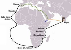
An old map of India in 1804. Note that only Thalassery, Kozhikode, and Kochi, are marked as cities within the present-day state of Kerala
Malayalam language
In the field of Malayalam language and literature, Kozhikode district has made many significant contributions. During the 17th century, His Highness Sri Samoothiri Manavedan Maharaja authored the famous Krishnattam, a Manipravalam text describing the childhood of Lord Krishna in eight volumes. The district is famous for folk songs or ballads known as Vadakkan Pattukal. The most popular songs celebrate the exploits of Thacholi Othenan and Unniyarcha. An intellectual debate for Vedic scholars, where winners receive the title of Pattathanam, takes place at Thali temple during the month of Thulam. Kozhikode also has a strong associations with ghazals and football.
Malayalam literature
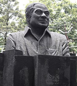
A bust of S. K. Pottekkatt facing S.M. Street in Kozhikode
Many prominent writers of Malayalam literature hail from Kozhikode district. Among them are S. K. Pottekkatt, Thikkodiyan, Punathil Kunjabdulla, U. A. Khader, Akbar Kakkattil, N. N. Kakkad, P. Valsala and M. N. Karassery. S. K. Pottekkatt was perhaps the most celebrated writer from Kozhikode whose award-winning work Oru Theruvinte Katha is set in S. M. Street. Several leading Malayalam publishing houses are based in the city, including Poorna, Mathrubhumi, Mulberry, Lipi and Olive. Several libraries are located in and around the city. The Kozhikode Public Library and Research Centre at Mananchira was constructed in 1996.[41] In 2023, Kozhikode became India's first UNESCO City of Literature.[42]
Music
In addition to the Malabar Mahotsavam, the annual cultural fest of Kozhikode,[43] every year since 1981 the Tyagaraja Aradhana Trust has been conducting a five-day music festival in honour of Tyagaraja. The festival is complete with the Uncchavritti, rendering of Divyanama kritis, Pancharatna Kritis, concerts by professional artistes and students of music from morning to late in the evening.[44]
Kozhikode has a tradition of Ghazal and Hindustani music appreciation. There are many Malayalam Ghazals. The late film director and play back singer M. S. Baburaj, from Kozhikode was influenced by Ghazal and Hindustani.[45]
There are DJ parties and events that are held in hotels and malls and pubs and IT parks in Calicut. Ragam and Thatva fest in NITC and different fests in IIM gets participation of international bands.[46][47]
Kozhikode offers a variety of South Indian, North Indian, European, Chinese, Arab, Gujarati and Jain food. The culinary culture of the city has been moulded by Portuguese, Dutch, French, British, Arab and other Indian influence. It offers both veg and non-veg dishes in great variety. The mall culture in the city has gained momentum and fast foods are very popular. The new generation is more inclined to Chinese, Arab and American food culture and a new trend of vegetarianism is getting popular because of health concerns. The city is also famous for Haluva called as Sweet Meat by Europeans due to the texture of the sweet. Kozhikode has a main road in the town named S. M. Street (Mittayi Theruvu). It derived this name from the numerous Halwa stores which used to dot the street. The history of this Street dates back to time of the Zamorin of Calicut, when the ruler invited Gujarati sweetmeat makers to set up shop in the city and accommodated their shops just outside the palace walls.[48] Another speciality is banana chips, which are made crisp and wafer-thin. Other popular dishes include seafood preparations (prawns, mussels, mackerel) . Vegetarian fare includes the sadya.
Kozhikode, the largest city in the Malabar region, also has a vital role in the entertainment segment. The city's first theatre, Calicut Crown, was opened as early as 1925. The city has more than 10 theatres and two multiplexes, the PVS Film City (the first multiplex in Malabar region) and Crown Theatre.[49]
Kozhikode is known as the second Mecca of football (after Kolkata).[50] The other most popular games in Kozhikode are cricket,[51] football, basketball, badminton and volleyball. The EMS Stadium hosted many international football matches of major football teams in the past. The city is home to many international footballers. One of the famous was Olympian Abdurahman who played for the nation in many international games including Melbourne Olympic games. K.P. Sethu Madhavan, Premnath Phillips, Muhamad Najeeb, M Prasannan, Sudheer etc. are some international footballers from Kozhikode. The seven-a-side form of football is also very famous in the city. P. T. Usha, is a famous athlete who is regarded as one of the greatest athletes India has ever produced and is often called the "queen of Indian track and field". She is nicknamed Payyoli Express. Currently she runs the Usha School of Athletics at Koyilandy in Kerala. T. Abdul Rahman, popularly known as Olympian Rahman, was an Indian Olympian footballer from Kozhikode. Rahman was a member of the Indian team that reached the semi-final in 1956 Melbourne Olympics. Other sports personalities include Jimmy George, Tom Joseph (Indian volleyball player and was captain of Indian volleyball team) and Premnath Phillips. Jaseel P. Ismail, V. Diju, Aparna Balan & Arun Vishnu are international badminton players from the city. The Sports & Education Promotion Trust (SEPT) was established to promote sports development in India with focus on football. Started in 2004 and based in Kozhikode, the trust has set up 52 centres called "football nurseries" spread across thirteen districts in Kerala.[52] Since 2010, Calicut Mini Marathon runs have been organised by IIM Kozhikode and witness participation of around 7000 people every year.
Radio
The Kozhikode radio station of All India Radio has two transmitters: Kozhikode AM (100 kilowatt) and Kozhikode FM [Vividh Bharathi] (10 kilowatt). Private FM radio stations: Radio Mango 91.9 operated by Malayala Manorama Co. Ltd. and Red FM 93.5 of the SUN Network. AIR FM radio station: Kozhikode – 103.6MHz; AIR MW radio station: Kozhikode – 684kHz.
Television
The headquarters and studio of MediaOne TV at Velliparamba, Kozhikode
A television transmitter has been functioning in Kozhikode since 3 July 1984, relaying programmes from Delhi and ThiruvananthapuramDoordarshan. Doordarshan has its broadcasting centre in Kozhikode located at Medical College. The Malayalam channels based on Kozhikode are the Shalom Television, Darshana TV and Media One TV. All major channels in Malayalam viz. Manorama News, Asianet, Surya TV, Kairali TV, Amrita TV, Jeevan TV, Indiavision and Jaihind have their studios and news bureaus in the city. Satellite television services are available through DD Direct+, Dish TV, Sun Direct DTH and Tata Sky. Asianet Cable Vision popularly known as ACV telecasts daily city news. Spidernet is another local channel. Other local operators include KCL and Citinet.
The Calicut Press Club came into existence in 1970. It is the nerve centre of all media activities, both print and electronic. Began with around 70 members in the roll, this Press Club, over the years, became a prestigious and alert media centre in the state with a present membership of over 280.[53]
Kozhikode is served by Calicut International Airport(IATA: CCJ, ICAO: VOCL) located at Karipur in Malappuram District, about 28 kilometres (17 miles) from Kozhikode city. The airport started operation in April 1988. It has two terminals, one for domestic flights and second for international flights.[54]
Road
Kozhikode is well connected by road. NH 66 and NH 766 connects Calicut to rest of India.[55][56] It has bus services to all parts of Kerala, Karnataka, Tamil Nadu and to important cities like Hyderabad and Mumbai.[citation needed]. New national highway is planned from Calicut to Bangalore.[57]
12Annual Vital Statistics Report – 2018(PDF). Thiruvananthapuram: Department of Economics and Statistics, Government of Kerala. 2020. p.55. Archived from the original(PDF) on 2 November 2021. Retrieved 29 October 2020.
↑District Administration, Kozhikode. "Revenue divisions in Kozhikode district". National Informatics Centre, Ministry of Electronics and Information Technology, Government of India. Retrieved 22 June 2022.
1234District Administration, Kozhikode. "Revenue Villages in Kozhikode". kozhikode.nic.in. National Informatics Centre, Ministry of Electronics and Information Technology, Government of India. Retrieved 17 August 2020.
↑"Games in Kerala". Information and Public relations office of Kerala. Archived from the original on 28 April 2006. Retrieved 12 June 2006. Football and Cricket – the Most Popular Games
M. K. Devassy (1965), 1961 Census Handbook- Kozhikode District(PDF), Directorate of Census Operations, Kerala and The Union Territory of Laccadive, Minicoy, and Amindivi Islands
This page is based on this Wikipedia article Text is available under the CC BY-SA 4.0 license; additional terms may apply. Images, videos and audio are available under their respective licenses.