Maniyoor

Last updated

Maniyoor
India Kerala location map.svg
Red pog.svg
Maniyoor
Location in Kerala, India
India location map.svg
Red pog.svg
Maniyoor
Maniyoor (India)
Coordinates: 11°57′0″N75°27′0″E / 11.95000°N 75.45000°E / 11.95000; 75.45000 Coordinates: 11°57′0″N75°27′0″E / 11.95000°N 75.45000°E / 11.95000; 75.45000
CountryFlag of India.svg  India
State Kerala
District Kannur
Government
  Type Panchayati raj (India)
  BodyKuttiattoor Grama Panchayat
Area
  Total14.02 km2 (5.41 sq mi)
Population
 (2011)
  Total12,681
  Density900/km2 (2,300/sq mi)
Languages
  Official Malayalam, English
Time zone UTC+5:30 (IST)
PIN
670592
ISO 3166 code IN-KL

Maniyoor is a census town in Kannur district in the Indian state of Kerala. [1]

Contents

Demographics

As of 2011 India census, Maniyoor had a population of 12,681 of which 5,902 are males and 6,779 are females. Maniyoor census town spreads over an area of 14.02 km2 with 2,594 families residing in it. The sex ratio of Maniyoor was 1,149 higher than state average of 1,084. In Maniyoor, population of children under 6 years was 12.6%. Maniyoor had overall literacy of 93.9%, higher than national average of 59% and lower than state average of 94%. [2]

Religion

As of 2011 Indian census, Maniyoor census town had total population of 12,681 which constitute 61.2% Hindus, 38.5% Muslims and 0.3% others. [3]

Transportation

The national highway passes through the town of Valapattanam. Goa and Mumbai can be accessed on the northern side and Cochin and Thiruvananthapuram can be accessed on the southern side. The road to the east of Iritty connects to Mysore and Bangalore. The nearest railway station is Kannur on the Mangalore-Palakkad line.

Trains are available to almost all parts of India subject to advance booking over the internet. There are airports at Mattanur, Mangalore and Calicut. All of them are international airports but direct flights are available only to Middle Eastern countries.

Related Research Articles

Cheruthazham Census Town in Kerala, India

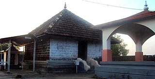
Cheruthazham is a census town in Kannur district in the state of Kerala, India. It is the location of the famous Hanumarambalam, dedicated to Sri Rama and Hanuman.Cherutazham is also the birthplace of Kalamandalam Krishnan Nair who gave a new dimension to the art of Kathakali. There are many artists in Cherutazham who are experts in the traditional musical items like "panchavadyam", "taayambaka", "chenda melam" etc. The new generation of Cherutazham is also getting trained in these art forms.

Anjarakkandy village in Kerala, India

Anjarakandy is a gram panchayat in Kannur district of Kerala, India. Anjrakandy river is flowing through Anjarakandy.

Alakode, Kannur district Town in Kerala, India

Alakode is a town in Kannur district in the Indian state of Kerala. It is located 46 km towards North of District headquarters Kannur. Alakode is located on Taliparamba-Manakadavu-Coorg Road. Alakode was one of the major centers of Malabar Migration.All sorts of misery in the hilly areas is still a major problem here

Aralam Village in Kerala, India

Aralam is a village and Grama Panchayat in Kannur district in the Indian state of Kerala.

Ayyankunnu village in Kerala, India

Ayyankunnu is a village in Kannur district in the Indian state of Kerala.The name ayyankunnu came from the five hills "Anchu Kunnu".

Cheleri Census Town in Kerala, India

Cheleri is a census town in Kannur district in the Indian state of Kerala.

Ezhome Census Town in Kerala, India

Ezhome is a census town in Kannur district in the Indian state of Kerala.

Kalliad Village in Kerala, India

Kalliad is a village in Kannur district in the Indian state of Kerala.

Kanichar Village in Kerala, India

Kanichar is a village and Grama Panchayat in Kannur district in the Indian state of Kerala.

Kurumathur Census Town in Kerala, India

Kurumathur is a census town in Taliparamba taluk of Kannur district in Kerala state, India. Kurumathur is located 8 km east of Taliparamba town in SH 36.

Malapattam village in Kerala, India

Malapattam is a village in Kannur district in the Indian state of Kerala.

Mokeri Village in Kerala, India

Mokeri is a village in Kannur district in the Indian state of Kerala.

Nediyanga Village in Kerala, India

Nediyanga is a village comes under Sreekandapuram Municipality in Kannur district in the Indian state of Kerala.

Nuchiyad village in Kerala, India

Nuchiyad is a village in Kannur district in the Indian state of Kerala.

Thillenkeri village in Kerala, India

Thillenkeri is a village and Grama Panchayat in Iritty taluk of Kannur district in the Indian state of Kerala.

Vayathur Village in Kerala, India

Vayathur is a village in Ulikkal Grama panchayat of Kannur district in the Indian state of Kerala.

Vellarvelly village in Kerala, India

Vellarvally is a village in Kannur district in the Indian state of Kerala.

Vellora village in Kerala, India

Vellora is a village in Kannur district in the Indian state of Kerala. It has state road connectivity, schools, hospitals, post office, and bank dating back to the 1950s.

Vilamana village in Kerala, India

Vilamana is a village in Kannur district in the Indian state of Kerala.

Kolachery Census Town in Kerala, India

Kolachery is a census town and Grama Panchayat in Kannur District of Kerala state, India. Kolachery is located 15 kilometres (9.3 mi) north east of Kannur city.

References

  1. "Census of India : Villages with population 5000 & above". Registrar General & Census Commissioner, India. Archived from the original on 8 December 2008. Retrieved 10 December 2008.
  2. https://censusindia.gov.in  › 3...PDF Kannur - DISTRICT CENSUS HANDBOOK (ref page nos:180,181)
  3. "Religion – Kerala, Districts and Sub-districts". Census of India 2011. Office of the Registrar General.