Vellora

Last updated

Vellora
village
India Kerala location map.svg
Red pog.svg
Vellora
Location in Kerala, India
India location map.svg
Red pog.svg
Vellora
Vellora (India)
Coordinates: 12°10′0″N75°21′0″E / 12.16667°N 75.35000°E / 12.16667; 75.35000
CountryFlag of India.svg  India
State Kerala
District Kannur
Taluk Payyanur
Government
  BodyEramam-Kuttur Gram panchayat
Area
  Total30.82 km2 (11.90 sq mi)
Population
 (2011)
  Total10,239
  Density330/km2 (860/sq mi)
Languages
  Official Malayalam, English
Time zone UTC+5:30 (IST)
PIN
670306
Telephone code0498
ISO 3166 code IN-KL
Vehicle registration KL-86
Lok Sabha constituencyKasaragod
Vidhan Sabha constituencyPayyanur

Vellora is a village in Kannur district in the Indian state of Kerala. It has state road connectivity, schools, hospitals, post office, and bank dating back to the 1950s. [1]

Contents

Demographics

As of 2011 Census, Vellora had total population of 10,239 where 4,859 are males and 5,380 females. Vellora village has an area of 30.82 km2 (11.90 sq mi) with 2,564 families residing in it. The sex ratio of Vellora was 1,107 higher than state average of 1,084. In Vellora, Population of children under 6 years was 10.2%. Vellora had overall literacy of 93.5%, higher than national average of 74% and lower than state average of 94%. [2]

Transportation

The national highway passes through Perumba junction. Goa and Mumbai can be accessed on the northern side and Cochin and Thiruvananthapuram can be accessed on the southern side. The road to the east of Iritty connects to Mysore and Bangalore. The nearest railway station is Payyanur on Mangalore-Palakkad line. Trains are available to almost all parts of India subject to advance booking over the internet. There are airports at Kannur, Mangalore and Calicut. All of them are international airports but direct flights are available only to Middle Eastern countries.

Related Research Articles

<span class="mw-page-title-main">Matool</span> Village in Kerala, India

Matool is a village in Kannur district of Kerala State, India. Mattool is located 19 kilometres (12 mi) north of Kannur city. The Valapattanam River and Kuppam River meet the Arabian sea at Mattool. Mattool can be reached from Kannur via Azheekal crossing the Mattool - Azheekal ferry. And via Madakkara-Matool Bridge From Irinavu Road.

Paduvilayi is a census town in Kannur district in the Indian state of Kerala.Paduvilayi is situated In anjarakandi district. More than 20000 people live in this census town

<span class="mw-page-title-main">Panniyannur</span> Census Town in Kerala, India

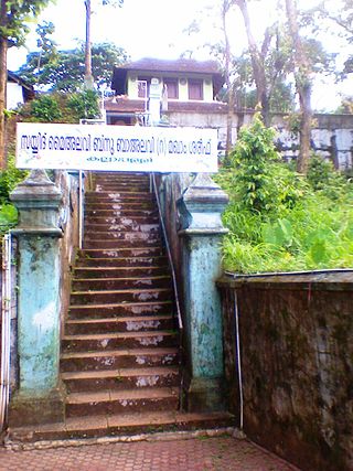
Panniyannur is a census town in Thalassery taluk of Kannur district in the Indian state of Kerala. It is part of Greater Mahé Region.

Pathiriyad is a census town in Kannur district in the Indian state of Kerala.

Pattiam is a census town in Kannur district in the Indian state of Kerala.

Mangattidam is a census town and a panchayat situated near Kuthuparamba in Thalassery taluk, Kannur district, Kerala, India.

Kayaralam is one of the villages in Mayyil Gram panchayat in the Kannur District, state of Kerala, India.

Cheruvanchery is a village in Kannur district in the Indian state of Kerala. A detailed history of the town for the first time was written in a blog "Cheruvanchery: A Tale of Erased Times".

Eramam is a village in Kannur district in Indian state of Kerala.

Kandamkunnu is a census town in Kannur district in the Indian state of Kerala.

Keezhallur is a census town in Kannur district in the Indian state of Kerala.

Malapattam is a village in Kannur district in the Indian state of Kerala.

Maniyoor is a census town in Kannur district in the Indian state of Kerala.

Mokeri is a census town in Mokeri panchayat of Kannur district in the Indian state of Kerala.

Panapuzha is a village in Kannur district in the Indian state of Kerala.

Panniyoor is a village in Kannur district in the Indian state of Kerala.

Perinthatta is a village in Kannur district in the Indian state of Kerala.

<span class="mw-page-title-main">Sivapuram, Kerala</span> Village in Kerala, India

Sivapuram is a village in Kannur district in the Indian state of Kerala.

Thrippangottur is a Village and a Grama Panchayat in Kannur district in the Indian state of Kerala.

Kolachery is a census town and Grama Panchayat in Kannur District of Kerala state, India. Kolachery is located 15 kilometres (9.3 mi) north east of Kannur city.

References

  1. "Census of India: Villages with population 5000 & above". Registrar General & Census Commissioner, India. Retrieved 10 December 2008.
  2. Kerala, Directorate of Census Operations. District Census Handbook, Kannur (PDF). Thiruvananthapuram: Directorateof Census Operations,Kerala. p. 154,155. Retrieved 14 July 2020.