
Taliparamba is a Municipality in Taliparamba taluk of Kannur district, Kerala, India. The municipal town spreads over an area of 18.96 square kilometres (7.32 sq mi) and is inhabited by 44,247 number of people.

Payyanur, is a municipal town and a taluk, a sub-district administrative unit, in the Kannur district of Kerala, India. Payyanur is the first municipality in Kerala to establish libraries in all its wards. On 10 March 2018, Kerala Chief Minister Pinarayi Vijayan inaugurated Payyanur as the fifth taluk in the district. Payyanur taluk comprises 22 villages including 16 de-linked from the Taliparamba taluk and six from the Kannur taluk. The town is situated on the banks of the Perumba River.
Irikkur is a town and grama panchayat in Kannur District of Kerala state, India.

Kalliasseri is a census town in Kannur district in the Indian state of Kerala. Kalliaseri Panchayat comprises two villages: Kalliasseri and Irinave.
Kannapuram is a census town and grama panchayat in Kannur district of North Malabar region in the Indian state of Kerala.

Pappinisseri is a census town and a suburb of Kannur city in Kannur district in the Indian state of Kerala. Pappinissery have consistently won the Swaraj Trophy for best Grama Panchayat from 2017-2018 to 2021. Pappinisseri Panchayat also bagged the third position in the Swaraj Trophy during 2015-2016. Also, Pappinissery has been declared as the best Grama Panchayat in Kerala by Kerala government. Pappinisseri Panchayat comprises two villages, viz Pappinisseri and Aroli. Pappinisseri better known for visha chikitsa kendram

Peralasseri is a census town and Panchayat headquarters in Kannur district in the Indian state of Kerala, situated on the Kannur-Kuthuparamba State Highway 38 (Kerala), 12 km from Kannur city, on the bank of Anjarakandy river.

Punnakkulangara is a significant part as well as a Municipal Ward of Anthoor Municipality in Kannur district of Kerala, India.

Naduvil is a small town in Kannur district in the Indian State of Kerala. The town is the headquarters of Naduvil Grama panchayat.

Pattuvam is a village in Kannur district in the Indian state of Kerala. It is bordered by the Kuppam river on the north, west and south. It shares a border with Taliparamba municipality on the east. A bridge over the river connects Pattuvam to Kottakkeel of Ezhome village in the northwest.
Alakode is an emerging town and a panchayat in Kannur district in the Indian state of Kerala. It is located 46 km (29 mi) north of district headquarters Kannur. Alakode is located on Taliparamba-Manakadavu-Coorg Road. Alakode was one of the major centers of Malabar Migration.

Cherukunnu is a census town in Kannur district in the Indian state of Kerala. Cherukunnu town is located on Valapattanam-Pappinisseri-Pazhayangadi main road, situated to the south of the Pazhayangadi in Kannur District in Kerala.
Aroli is a village of Pappinisseri Panchayat in Kannur district in the Indian state of Kerala.

Anthoor is a municipality, in Taliparamba taluk of the Kannur district in Kerala, India. The municipality had a population of 28,218 in the 2011 Indian census.

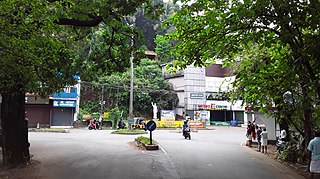
Dharmashala is a small town and headquarters of the Anthoor Municipality in Kannur district of the North Malabar region in the Indian state of Kerala. It is located near National Highway 66 between Kannur and Taliparamba. It is located about 16 kilometres (9.9 mi) north of Kannur. Dharmashala is an important educational and industrial hub in the Kannur district and also an important tourism destination of Malabar region. Dharmashala is a major government officials settlement area in Kannur. A large number of migrant labourers from various other states are working in the industrial development area in Dharmashala. Students from various parts of country study at institutes such as NIFT. Nearby important institutions and attractions are the Kerala Armed Police (KAP) 4th Battalion Mangattuparamba, Government College of Engineering Kannur, Kannur University, KELTRON, Vismaya water theme park, Parassinikkadavu Shree Muthappan temple, Doordarshan kendra, Parassinikkadavu Snake Park, Industrial Development Plot, Central School, EK Nayanar memorial women and child hospital, Si-met college of nursing, M.V.R memorial Ayurveda Medical College, Institute of Co-operative Management (ICM), National Institute of Fashion Technology, Vellikkeel eco tourism park, Hi-Five sports indoor stadium, Kerala Clays and Ceramics Ltd. etc.

Kannur district is politically organized into a complex web of taluks, blocks, panchayaths and villages. In addition, there are also parliamentary divisions called Assembly constituencies and Lok Sabha constituencies.
Irinave is a village of Kalliasseri Panchayat in Kannur district in the Indian state of Kerala.
Kannapuram railway station is an NSG–5 category Indian railway station in Palakkad railway division of Southern Railway zone. It is situated in Kannapuram village of the Kannur district.
Anchampeedika is a town in the Kannur district of the North Malabar region in the Indian state of Kerala. Anchampeedika is located roughly 13.5 km from the Kannur Corporation, and it is adjacent to the Taliparamba municipality.

Kadambery is a locality as well as a Municipal Ward of Anthoor Municipality in Kannur district of Kerala in India


