Madayi

Last updated

Madayi
Madayi para in feb.JPG
Madayippara
India Kerala location map.svg
Red pog.svg
Madayi
Location in Kerala, India
India location map.svg
Red pog.svg
Madayi
Madayi (India)
Coordinates: 11°58′0″N75°18′0″E / 11.96667°N 75.30000°E / 11.96667; 75.30000
CountryFlag of India.svg  India
State Kerala
District Kannur
Government
  Type Panchayati raj (India)
  BodyMadayi Grama panchayat
Area
  Total16.17 km2 (6.24 sq mi)
Population
  Total35,888
  Density2,200/km2 (5,700/sq mi)
Languages
  Official Malayalam, English
Time zone UTC+5:30 (IST)
PIN
670304
Vehicle registration KL-86
Madayippara in September Madayi para in sept.JPG
Madayippara in September
Madayi Fort Madayi kotta.JPG
Madayi Fort

Madayi (a.k.a. Madai). is a Census Town and Grama panchayat in Kannur district of Kerala state, India. [1] [2]

Contents

Demographics

As of 2011 Census, Madayi had a population of 35,888 which constitutes 16,168 (45.1%) males and 19,720 (54.9%) females. Madayi census town spreads over an area of 17.08 km2 (6.59 sq mi) with 6,687 families residing in it. The male female sex ratio was 1,220 higher than state average of 1,084. 13.6% of total population were children under 6 years. Madayi had overall literacy of 94.1% higher than state average of 94%. The male literacy stands at 96.6% and female literacy was 92.1%. [3]

Religion

As of 2011 Indian census, Madayi census town had population of 35,888, of which 22,585 (62.9%) are Muslims, 11,552 (32.2%) are Hindus, 1,657 (4.6%) are Christians and 0.3% others. [4]

History

This place was under the rule of Chirakkal Rajas during late medieval period. [5] According to the Legend of Cheraman Perumals, the first Indian mosque was built in 624 AD at Kodungallur with the mandate of the last the ruler (the Cheraman Perumal) of Chera dynasty, who converted to Islam during the lifetime of Muhammad (c. 570–632), and went pilgrimage to Mecca from Dharmadom near Kannur. [6] [7] [8] [9] According to Qissat Shakarwati Farmad , the Masjids at Kodungallur, Kollam, Madayi, Barkur, Mangalore, Kasaragod, Kannur, Dharmadam, Panthalayini, and Chaliyam, were built during the era of Malik Dinar, and they are among the oldest Masjids in Indian Subcontinent. [10] The Arabic inscription on a copper slab within the Madayi Mosque in records its foundation year as 1124 CE. [11] [5] The 16th century Tuhfat Ul Mujahideen also states about Madayi. [12] Madayi became a part of Chirakkal Taluk in Malabar District of Madras Presidency when the region came under British Raj. [5]

Plants

An account on the flora of Madayipara is given here to provide a picture of the kind of vegetation found on the laterite hill system with which the fauna frequenting the area are associated with, and also to stress upon the importance of the uniqueness of the flora supported by such laterite hill systems, often ignored by many. The midland hillocks of northern Kerala have its own characteristic floral composition supporting scrub jungles and cashew plantations on the hill slopes and grasslands and associated aquatic and semi-aquatic plants on the hilltops. Even though these hills are exposed directly to the sunlight and wind, they harbour rich species diversity. Recent plant explorations revealed more additions to the known plant species of the area some of which turned out to be new to science, and endemic to the locality. The vegetation of the hillocks may be classified mainly into grasslands and scrub jungles. The grasslands can again be categorised into wet phase and dry phase grasslands based on the seasons. Altogether 512 plant species have been recorded from Madayipara. The midland hillocks of northern Kerala have its own characteristic floral composition supporting scrub jungles and cashew plantations on the hill slopes and grasslands and associated aquatic and semi-aquatic plants on the hilltops. Even though these hills are exposed directly to the sunlight and wind, they harbour rich species diversity. Recent plant explorations revealed more additions to the known plant species of the area some of which turned out to be new to science, and endemic to the locality. The vegetation of the hillocks may be classified mainly into grasslands and scrub jungles. The grasslands can again be categorised into wet phase and dry phase grasslands based on the seasons. Altogether 512 plant species have been recorded from Madayipara.

Grasslands

Utharam Srambia, Madayi UTHARAM MASJID.jpg
Utharam Srambia, Madayi

Grasslands of Kerala have been classified into two types i.e., Low elevation grasslands and high elevation grasslands. The grasslands on the laterite hills of north Malabar are classified under low elevation dry grasslands, characterised by remarkable diversity. This type of natural grassland is the characteristic feature of the laterite hills of Kozhikode, Kannur, Kasaragod districts and the lower parts of Wayanad district. These grasslands are highly seasonal and interspersed with other herbaceous plants and scrub jungles. A total 55 species of grasses are recorded from Madayipara hills, many more remaining to be fully identified. The common grass species are the Eragrostis uniloides , Ischaemum indicum , Heteropogon contortus , Pennisetum polystachyon , Cynodon dactylon and species belonging to the genera Arundinella , Dimeria , Panicum , Themeda , etc. Species of Arundinella form the commonest grasses during the months of October and November. The pinkish inflorescence of these grasses makes the area appear as if burnt mixed here and there with green shades. According to Agarwal (1961), Arundinella form a higher stage in the succession. So it can be safely stated that Arundinella grasses represent a higher stage in grassland development in the areas where they occur. Recent plant explorations revealed some more new species of grasses from the laterite hills of north Malabar (Sreekumar and Nair, 1991), 11 out of 37 endemic grasses of Kerala are reported from this kind of locality. Thus, these hillocks are isolated ecological niches of conservation importance. However, a detailed account of the species association is lacking. Grasses control erosion, and several species are well known for their rich fodder value. When the monsoon recedes, the local people start cutting grasses for use as fodder for their cattle. A small plot, containing a thick growth of Themeda and other species of grasses fetches about rupees three thousand per season for a landowner.

Climate

Wet phase

The first fall of southwest monsoon during late May or early June stimulates the germination of seeds and the growth of annual plants. The first groups of plants seen are Neanotis spp., Eriocaulon spp. and grasses, followed by insectivorous plants such as Utricularia spp. and Drosera indica that dominate the land. The deep blue flowers of Utricularia and white flower heads of Eriocaulon and Rhamphicarpa literally paint the whole plateau in shades of blue, violet and white, amidst herbaceous plants such as Sopubia trifida , Lindernia , Polygala elongata , Justicia japonica , Leucas sp. and several others. The shallow depressions filled with water accommodate plants such as Blyxa , Nymphoides krishnakesara , Marsilea minuta , Cryptocoryne spiralis , Rotala malampuzhensis , Rotala malabarica and lsoetes coromandelina . The sparsely distributed south Indian endemic Chamaesyce katrajensis (syn. Euphorbia katrajensis ) can also be observed during this phase on the laterite rocks. Following the retreat of south west monsoon, during September, most of the early appearing plants give way to others such as Celosia argentea , Sesamum orientale and grasses such as Arundinella spp., Dimeria spp., Ischaemum indicum , Panicum spp., etc. which dominate subsequently. The abundance of grasses can be noticed during this period. The wet phase lasts up to the end of November.

Dry phase

Stronger winds during the month of January and the direct incidence of sunlight enhance the drying up process of the flora of Madayipara. The majority of the herbaceous plants dry up except for some grass species and the thorny Lepidagathis keralaensis , which may remain spread all over the rocky regions of the hill. The silver coloured, Polycarpaea corymbosa can also be seen against the black surfaces of the rocks.

Scrub jungles

The scrub jungles form the protective cover of the slopes of the hills. The thick grove adjacent to the clay mining site is one of the major vegetation patches of this hillock. The evergreen forest species such as Hydnocarpus pentandra , Holigrna arnottiana , Cinnamomum sp. are seen in this area. Ficus arnottiana one of the characteristic fig tree of this kind of ecosystem is seen in the southwestern part of the Plateau. The tree is locally called Kallarayal (Malayalam meaning - Peepal Tree of rocks). Other fig species such as Ficus benghalensis , Ficus religiosa , Ficus racemosa , Ficus tinctoria , Ficus exasperata and Ficus hispida also support large number of frugivorous birds and bats during their fruiting season. The small groves of Ixora coccinea , Ziziphus oenoplia , Ziziphus rugosa and thick clumps of Calycopteris flouribunda give refuge to a large number of small animals and birds in addition to providing nectar to butterflies and other insects during their flowering season. The forest dwelling species of Stereospermum colais is one of the major wonders of this woody area, with its large white flowers blooming during November and December. A large tree of Careya arborea situated in the compound of the tourist bungalow also support a large number of animals such as bats, birds, butterflies, etc.

Rare and endangered plants

The geographical and climatical features made Madayipara and the adjacent laterite hillock system in supporting a unique assemblage of species. It is the home of some unique and sparsely distributed endemic plants such as Nymphoides krishnakesara (Joseph and Sivarajan, 1990), Rotala malabarica (Pradeep et al., 1990), Justicia ekakusuma (Pradeep et al., 1991), Lepidagathis keralensis (Madhusoodanan and Singh, 1992) and Eriocaulon madayiparense , (Swapna et al., 2012).

Nymphoides krishnakesara is a small water lily appear during the wet phase in the small pools and ponds on the plateau. Rotala malabarica is a semi-aquatic plant seen largely in the temporary pools. Justicia ekakusuma (Pradeep et al., 1991), aptly named because of its nature of flower, is rare and seen in the rocky edges of the plateau. Lepidagathis keralensis (Madhusoodanan and Singh, 1992) described for the first time from this locality and flowers during the dry phase. It is observed that the number of Justicia ekakusuma has been declining drastically over the years, while other newly described species remain uniformly distributed. Eriocaulon madayiparense grows in temporary pools or wet areas during the wet phase.

Chamaesyce katrajensis (which now includes Euphorbia katrajensis var. kasaragodensis ), is an endemic species originally described from the similar habitats of Katraja hills of Maharashtra. The small yellowish to pinkish flowers of this species is seen during the wet phase. This plant is poorly distributed and individuals of the species can be seen on the elevated portions of rocks. Only very few individuals of this species are found in Madayipara. Curuma oligantha is another characteristic plant seen in the laterite habitats during the wet phase. It now includes plants described by Ansari et al. (1982) as Curcuma cannanorensis var. cannanorensis and var. lutea . It is also known from parts of Southern India, Sri Lanka and Myanmar. It also appears immediately after the first shower of the monsoon. Besides, the abundance of insectivorous plants such as Drosera indica and Utricularia spp. are worth mentioning.

Out of 513 species known from the Madayippara, 60 are Peninsular Indian endemics; of which 15 are narrow endemics of Kerala, confined to the laterite hillocks. Sevan species are Indian endemics and 28 species are known from confined to Peninsular Indian and Sri Lanka and 13 species to Indian region and Sri Lanka. The presence of endemic species belonging to various threat categories such as Hopea ponga , Capparis rheedei , Eriocaulon cuspidatum and Neanotis rheedei are also indicate the conservation significance of the area. Another interesting plant of this locality is the rare lycophyte, Isoetes coromandelina found near the temporary pools of Madayipara during the wet phase. It was once widely distributed in the wetlands and paddy fields of Kerala, but becoming rare due to changes in the habitats. Ophioglossum species such as O. costatum , O. nudicale and O. gramineum are also distributed sparsely and make their appearance during the wet phase.

The wet phase of the Laterite hillocks is the more active in terms of the appearance of plant and animals (Jafer Palot and Radhakrishnan, 2005). An analysis of the biological spectrum revels the fact that, majority of the herbaceous members appears along with the first showers, flourish during the monsoon season, complete their life cycle towards the end of the rainy season and enter into the dormant phase by shedding their fruits/seeds or in the form of rhizomes. The dry phase is characterized by the presence of highly adapted, xerophytic plants such as Lepidagathis , Chamaesyce , etc. They may remain fresh to some extent of the summer season, and may dry up leaving the perennial rootstock.

Conservation

The laterite hillock system has been facing serious danger of degradation over the years. Most part of the midland hillocks had been converted to plantations, building sites, minimizing sites, etc. The indiscriminate mining for laterite and soil demolishing the hillocks had been severely threatened the very existence of the biota, culture and also the water availability in most of the areas. The Madayippara and its adjacent hillocks are also not an exception. The mining for the ‘china clay’ has been causing severe damage to the system. It was strongly limited due to the positive intervention by the general public to some extent. However, such operations are going on in other areas. There was a proposal to mine the entire hillock of Madayippara for the lignite deposits. However, it was not yet executed due to the heavy protest from the general public. The ecological and cultural values of the laterite hillocks of the northern Kerala have not been got the due weightage it deserves. Majority of the general public is least bothered about its unique and rich biodiversity. The Madayippara and its environs survived over these years, by supporting its rich cultural and ecological features. However, it is a matter of great concerns that, whether it could continue in preserving its feature, without getting urgent conservation measures. The rate of pollution is very high over these years. It includes wastes such as from the vehicles, dumping of all sorts of wastes from house hold garbage to plastic and industrial debris, etc. The visitors also contribute their share by dumping plastic, cans of drinks, bottles, etc. The lack of awareness is the major reason for the pathetic condition of this type of unique ecosystem, which supports many endemic species. The local administrative bodies could do a lot in conserving this system. Adopting conservation practices such as bringing it under the protection of a community reserve only could save the Madayippara and its environs from degradation.

Transportation

The national highway passes through Taliparamba town. Goa and Mumbai can be accessed on the northern side and Cochin and Thiruvananthapuram can be accessed on the southern side. The road to the east of Iritty connects to Mysore and Bangalore. The nearest railway station is Pazhayangadi on Mangalore-Palakkad line. Trains are available to almost all parts of India subject to advance booking over the internet. There are airports at Kannur, Mangalore and Calicut. All of them are international airports but direct flights are available only to Middle Eastern countries.

See also

Related Research Articles

<span class="mw-page-title-main">Western Ghats</span> Mountain range along the western coast of India

The Western Ghats, also known as the Sahyadri mountain range, is a mountain range that covers an area of 160,000 km2 (62,000 sq mi) in a stretch of 1,600 km (990 mi) parallel to the western coast of the Indian peninsula, traversing the states of Gujarat, Maharashtra, Goa, Karnataka, Kerala and Tamil Nadu. It is a UNESCO World Heritage Site and one of the 36 biodiversity hotspots in the world. It is sometimes called the Great Escarpment of India. It contains a very large proportion of the country's flora and fauna, many of which are endemic to this region. The Western Ghats are older than the Himalayas. They influence Indian monsoon weather patterns by intercepting the rain-laden monsoon winds that sweep in from the south-west during late summer. The range runs north to south along the western edge of the Deccan Plateau and separates the plateau from a narrow coastal plain called the Western Coastal Plains along the Arabian Sea. A total of 39 areas in the Western Ghats, including national parks, wildlife sanctuaries and reserve forests, were designated as world heritage sites in 2012 – twenty of them in Kerala, ten in Karnataka, six in Tamil Nadu and four in Maharashtra.

<span class="mw-page-title-main">Horton Plains National Park</span> National park in Sri Lanka

Horton Plains National Park is a national park in the central highlands of Sri Lanka that was designated in 1988. It is located at an elevation of 2,100–2,300 m (6,900–7,500 ft) and encompasses montane grassland and cloud forest. It is rich in biodiversity and many species found here are endemic to the region. It is also a popular tourist destination and is situated 8 kilometres (5.0 mi) from Ohiya, 6 kilometres (3.7 mi) from the world-famous Ohiya Gap/Dondra Watch and 32 kilometres (20 mi) from Nuwara Eliya.

<span class="mw-page-title-main">South Western Ghats montane rain forests</span> Ecoregion in South India

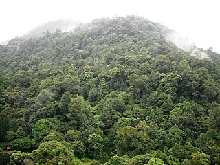
The South Western Ghats montane rain forests is an ecoregion in South India, covering the southern portion of the Western Ghats in Karnataka, Kerala and Tamil Nadu at elevations from 1,000 to 2,695 m. Annual rainfall in this ecoregion exceeds 2,800 mm (110 in).

<span class="mw-page-title-main">Kanhangad</span> Municipality in Kerala, India

Kanhangad is a major town, located in the Kasaragod District, state of Kerala, India.

<span class="mw-page-title-main">Shola</span> Patch of stunted tropical montane forest in South India

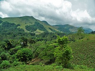
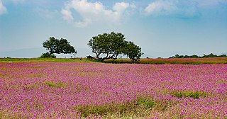
Sholas are the local name for patches of stunted tropical montane forest found in valleys amid rolling grassland in the higher montane regions of South India, largely in Kerala, Karnataka and Tamilnadu. These patches of shola forest are found mainly in the valleys and are usually separated from one another by undulating montane grassland. The shola and grassland together form the shola-grassland complex or mosaic. Not all such high-elevation grasslands have sholas in their valleys, especially if they are isolated from other such meadows, such as the meadows found in the Idamalayar Reserve Forest in Ernakulam district of Kerala. The word 'Shola' is probably derived from the Tamil language word cõlai (சோலை) meaning grove.

Kanayi is a village in Kannur district, Kerala, in South India. It is at a distance of 12 km from Payyannur. Vannathi Puzha and Meenkuzhi Dam are very important for its agriculture and fishing.

<span class="mw-page-title-main">Kannur</span> Metropolis in Kerala, India

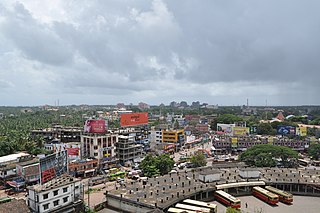
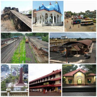
Kannur, formerly known in English as Cannanore, is a city and a municipal corporation in the state of Kerala, India. It is the administrative headquarters of the Kannur district and situated 274 kilometres (170 mi) north of the major port city and commercial hub Kochi and 137 kilometres (85 mi) south of the major port city and a commercial hub, Mangalore. During the period of British colonial rule in India, when Kannur was a part of the Malabar District, the city was known as Cannanore. Kannur is the sixth largest urban agglomeration in Kerala. As of 2011 census, Kannur Municipal Corporation, the local body which administers mainland area of city, had a population of 232,486.

The term Malabar rainforests refers to one or more distinct ecoregions recognized by biogeographers:

  1. the Malabar Coast moist forests formerly occupied the coastal zone to the 250 metre elevation
  2. the South Western Ghats moist deciduous forests grow at intermediate elevations
  3. the South Western Ghats montane rain forests cover the areas above 1000 metres elevation
<span class="mw-page-title-main">Ezhimala (hill, Kannur)</span>

Ezhimala, a hill reaching a height of 286 metres (938 ft), is located near Payyanur, in Kannur district of Kerala, South India. It is a part of a conspicuous and isolated cluster of hills, forming a promontory, 38 km (24 mi) north of Kannur (Cannanore). The Indian Naval Academy at Ezhimala is the Asia's largest, and the world's third-largest, naval academy.

<span class="mw-page-title-main">Periyar National Park</span> Protected area in Kerala

Periyar National Park and Wildlife Sanctuary (PNP) is a protected area located in the districts of Idukki and Pathanamthitta in Kerala, India. It is notable as an elephant reserve and a tiger reserve. The protected area encompasses 925 km2 (357 sq mi), of which 305 km2 (118 sq mi) of the core zone was declared as the Periyar National Park in 1982. The park is a repository of rare, endemic, and endangered flora and fauna and forms the major watershed of two important rivers of Kerala: the Periyar and the Pamba.

<span class="mw-page-title-main">Bidar district</span> District in Karnataka, India

Bidar district is the northernmost part of the Karnataka state in India. The administrative headquarters of district is Bidar city. Geographically, it resembles the "Crown of the State", occupying its northeastern end. It is bounded by Kamareddy and Sangareddy districts of Telangana state on the eastern side, Latur and Osmanabad districts of Maharashtra state on the western side, Nanded district of Maharashtra state on the northern side and Kalaburagi district on the southern side.

<span class="mw-page-title-main">Pazhayangadi</span> Town in Kerala, India

Pazhayangadi, is a small township, approximately 23 km (14 mi) north of district headquarters Kannur, 13.6 km (8.5 mi) south of Payyanur and 13.6 km (8.5 mi) west of Taliparamba in the Indian state of Kerala. In the local language of Malayalam it literally means "Old Market". The town is bounded by the Madayi Hills (Madayippara) on the west and by the Pazhayangadi River on the south. Ezhimala, a range of hills, that is believed to be home to a variety of medical herbs including mrithasanjeevini, and a very ancient recorded history, is situated nearly 8 km west of Pazhayangadi. Pazhayangadi town is spread over Madayi and Ezhome Grama Panchayats. Madayi Hill offers a splendid scene of Ezhimala which means a chain of seven mountains, where the Indian Naval Academy is situated.

<span class="mw-page-title-main">Sri Lanka dry-zone dry evergreen forests</span> Ecoregion in Sri Lanka

The Sri Lanka dry-zone dry evergreen forests are a tropical dry broadleaf forest ecoregion of the island of Sri Lanka.

<span class="mw-page-title-main">Rann of Kutch</span> Large area of salt desert in India and Pakistan

The Rann of Kutch is a large area of salt marshes that span the border between India and Pakistan. It is located mostly in the Kutch district of the Indian state of Gujarat, with a minor portion extending into the Sindh province of Pakistan. It is divided into the Great Rann and Little Rann.

<span class="mw-page-title-main">Victoria Plains tropical savanna</span> Ecoregion in Australia

The Victoria Plains tropical savanna is a tropical and subtropical grasslands, savannas, and shrublands ecoregion in northwestern Australia.

<span class="mw-page-title-main">Madayipara</span> Hillock and locality in Kerala, India

Madayipara is a flat-topped hillock located in the Madayi, of Kannur district of Kerala state in the Southern India. It overlooks the town of Payangadi on the northern bank of Kuppam River.

<span class="mw-page-title-main">Kas Plateau Reserved Forest</span> Wolrd Natural Heritage Site in Maharashtra, India

The Kas Plateau Reserved Forest, also known as the Kaas Pathar, is a plateau situated 25 kilometres west from Satara city in Maharashtra, India. It falls under the Sahyadri Sub Cluster of the Western Ghats, and it became a part of a UNESCO World Natural Heritage Site in 2012.

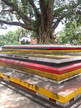
Kannur, India has a number of tourist attractions including beaches, hills, temples and other monuments.

<i>Rotala malabarica</i> Species of flowering plant

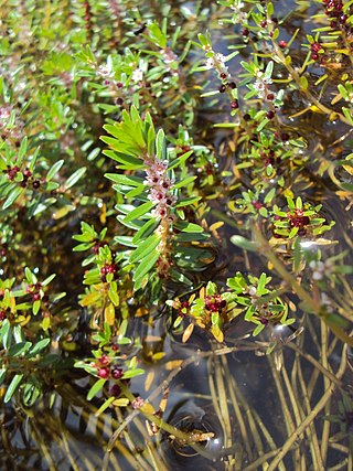
Rotala malabarica, the Malabar rotala, is a short-lived annual plant endemic to southern India, where it is known from only one location. It is considered critically endangered and may be extinct.

Sri Lanka exhibits a remarkable biological diversity and is considered to be the richest country in Asia in terms of species concentration.

References

  1. "Kerala (India): Districts, Cities and Towns - Population Statistics, Charts and Map".
  2. "Census of India: Villages with population 5000 & above". Registrar General & Census Commissioner, India. Archived from the original on 8 December 2008. Retrieved 10 December 2008.{{cite web}}: CS1 maint: others (link)
  3. Kerala, Directorate of Census Operations. District Census Handbook, Kannur (PDF). Thiruvananthapuram: Directorateof Census Operations,Kerala. p. 186,187. Retrieved 14 July 2020.
  4. "Religion – Kerala, Districts and Sub-districts". Census of India 2011. Office of the Registrar General.
  5. 1 2 3 Charles Alexander Innes (1908). Madras District Gazetteers Malabar (Volume-I). Madras Government Press. p. 423-424.
  6. Jonathan Goldstein (1999). The Jews of China. M. E. Sharpe. p. 123. ISBN   9780765601049.
  7. Edward Simpson; Kai Kresse (2008). Struggling with History: Islam and Cosmopolitanism in the Western Indian Ocean. Columbia University Press. p. 333. ISBN   978-0-231-70024-5 . Retrieved 24 July 2012.
  8. Uri M. Kupferschmidt (1987). The Supreme Muslim Council: Islam Under the British Mandate for Palestine. Brill. pp. 458–459. ISBN   978-90-04-07929-8 . Retrieved 25 July 2012.
  9. Husain Raṇṭattāṇi (2007). Mappila Muslims: A Study on Society and Anti Colonial Struggles. Other Books. pp. 179–. ISBN   978-81-903887-8-8 . Retrieved 25 July 2012.
  10. Prange, Sebastian R. Monsoon Islam: Trade and Faith on the Medieval Malabar Coast. Cambridge University Press, 2018. 98.
  11. Muhammad, K. M. (1999). Arab Relations with Malabar Coast from 9th to 16th centuries. Proceedings of the Indian History Congress. pp. 226–234.
  12. S. Muhammad Hussain Nainar (1942). Tuhfat-al-Mujahidin: An Historical Work in The Arabic Language. University of Madras.