Iriveri

Last updated

Iriveri
India Kerala location map.svg
Red pog.svg
Iriveri
Location in Kerala, India
India location map.svg
Red pog.svg
Iriveri
Iriveri (India)
Coordinates: 11°52′18″N75°28′52″E / 11.871745°N 75.481007°E / 11.871745; 75.481007 Coordinates: 11°52′18″N75°28′52″E / 11.871745°N 75.481007°E / 11.871745; 75.481007
CountryFlag of India.svg  India
State Kerala
District Kannur
Government
  Type Panchayati raj (India)
  BodyChembilode Panchayat
Area
  Total11.77 km2 (4.54 sq mi)
Population
 (2011)
  Total17,231
  Density1,500/km2 (3,800/sq mi)
Languages
  Official Malayalam, English
Time zone UTC+5:30 (IST)
ISO 3166 code IN-KL
Vehicle registration KL 13

Iriveri is a census town in Kannur district in the Indian state of Kerala. [1]

Contents

Demographics

As of 2011 Census, [2] Iriveri had a population of 17,232 with 7,873 males and 9,358 females. Iriveri census town has an area of 11.77 km2 (4.54 sq mi) with 3,564 families residing in it. The average sex ratio was 1189 higher than the state average of 1084. Iriveri had an average literacy rate of 96.5%, higher than the state average of 94%: male literacy was 98.2%, and female literacy was 95.1%. In Iriveri, 11.76% of the population was under 6 years of age.

Economy

Agriculture, coconut and cashew plantations, Paddy and farmings are major occupation. Chakkarakkal is the nearest economical hub.


Temples

One of the major attractions in Iriveri is the Iriveri Kavu, situated inside of a small forest, and is famous for Theyyam, a folk art performance during February. Ambiliyad Sri Krishna Temple and Manikkiyil Bhagavati Temple are also in Iriveri.

Masjids

North Kerala's famous Muslim pilgrimage center Iriveri Juma Masjid and Makham situated in the middle of Iriveri and is famous for traditional Islamic Uroos and Nerchas, Iriveri Masjid was established in AD 702 by Khasi Hussain Madani (Ra).

Transportation

The national highway passes through Kannur town. Goa and Mumbai can be accessed on the northern side and Cochin and Thiruvananthapuram can be accessed on the southern side. The road to the east of Iritty connects to Mysore and Bangalore. The nearest railway station is Kannur on Mangalore-Palakkad line. Trains are available to almost all parts of India subject to advance booking over the internet. There are airports at Mattanur, Mangalore and Calicut. All of them are international airports but direct flights are available only to Middle Eastern countries.

Related Research Articles

Kadirur Census Town in Kerala, India

Kadirur is a census town within the Thalassery Taluk of Kannur District in the State of Kerala, India. Kadirur is located about 8 km (5.0 mi) from the Thalassery Township on the Tellicherry-Mysore road.

Irikkur Census Town in Kerala, India

Irikkur is a census town in Kannur District of Kerala state, India.

Eranholi Census Town in Kerala, India

Eranholi is a census town near Thalassery in Kannur district in the state of Kerala, India, and located on Tellichery Mysore highway. The nearest town is Thalassery. Eranholi bridge built across Eranholi river in 1937 connect Eranholi with Tellicherry.

Cheruthazham Census Town in Kerala, India

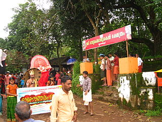
Cheruthazham is a Census Town and Grama Panchayat in Kannur district in the state of Kerala, India. It is the location of the famous Hanumarambalam, dedicated to Sri Rama and Hanuman.Cherutazham is also the birthplace of Kalamandalam Krishnan Nair who gave a new dimension to the art of Kathakali. There are many artists in Cherutazham who are experts in the traditional musical items like "panchavadyam", "taayambaka", "chenda melam" etc. The new generation of Cherutazham is also getting trained in these art forms.

Kannadiparamba Census Town in Kerala, India

Kannadiparamba is a census town in Kannur district in the Indian state of Kerala.

Mavilayi Census Town in Kerala, India

Mavilayi is a census town in Kannur district in the Indian state of Kerala. Situated in Peralasseri Panchayath on Kannur-Kuthuparamba State Highway, 15 km away from Kannur Town.

Narath Census Town in Kerala, India

Narath is a census town in Kannur district in the Indian state of Kerala.

Paduvilayi Census Town in Kerala, India

Paduvilayi is a census town in Kannur district in the Indian state of Kerala.

Panniyannur Census Town in Kerala, India

Panniyannur is a census town in Thalassery taluk of Kannur district in the Indian state of Kerala. It is part of Greater Mahé Region.

Pathiriyad Census Town in Kerala, India

Pathiriyad is a census town in Kannur district in the Indian state of Kerala.

Pattiom Census Town in Kerala, India

Pattiam is a census town in Kannur district in the Indian state of Kerala.

Peralasseri Census Town in Kerala, India

Peralasseri is a census town and Panchayat headquarters in Kannur district in the Indian state of Kerala, situated on the Kannur-Kuthuparamba State Highway 38 (Kerala), 12 km from Kannur city, on the bank of Anjarakandy river.

Peringathur Census Town in Kerala, India

Peringathur is a census town in Thalassery taluk of Kannur district in the Indian state of Kerala. It is a part of Panoor municipality.

Mangattidam Census Town in Kerala, India

Mangattidam is a census town and a panchayat situated near Kuthuparamba in Thalassery taluk, Kannur district, Kerala, India.

Cherukunnu Census Town in Kerala, India

Cherukunnu is a census town in Kannur district in the Indian state of Kerala. Cherukunnu town is located on Valapattanam-Pappinisseri-Pazhayangadi main road, situated to the south of the Pazhayangadi in Kannur District of North Malabar region in Kerala.

Ezhome Census Town in Kerala, India

Ezhome is a census town in Kannur district in the Indian state of Kerala.

Manantheri Census Town in Kerala, India

Manantheri is a census town near Kuthuparamba in Kannur district in the Indian state of Kerala.

Mokeri Census Town in Kerala, India

Mokeri is a Census Town in Mokeri panchayat of Kannur district in the Indian state of Kerala.

Sivapuram, Kerala Village in Kerala, India

Sivapuram is a village in Kannur district in the Indian state of Kerala.

Aroli Village in Kerala, India

Aroli is a village of Pappinisseri Panchayat in Kannur district in the Indian state of Kerala.

References

  1. "Census of India 2001: Data from the 2001 Census, including cities, villages and towns (Provisional)". Census Commission of India. Archived from the original on 16 June 2004. Retrieved 1 November 2008.
  2. Kerala, Directorate of Census Operations. District Census Handbook, Kannur (PDF). Thiruvananthapuram: Directorateof Census Operations,Kerala. p. 204,205. Retrieved 14 July 2020.