Mangattidam

Last updated

Mangattidam
India Kerala location map.svg
Red pog.svg
Mangattidam
Location in Kerala, India
India location map.svg
Red pog.svg
Mangattidam
Mangattidam (India)
Coordinates: 11°51′40″N75°33′45″E / 11.86111°N 75.56250°E / 11.86111; 75.56250 Coordinates: 11°51′40″N75°33′45″E / 11.86111°N 75.56250°E / 11.86111; 75.56250
CountryFlag of India.svg  India
State Kerala
District Kannur
Government
  Type Panchayati raj (India)
Area
  Total16.38 km2 (6.32 sq mi)
Population
  Total18,627
  Density1,100/km2 (2,900/sq mi)
Languages
  Official Malayalam, English
Time zone UTC+5:30 (IST)
ISO 3166 code IN-KL
Vehicle registration KL-58

Mangattidam is a census town and a panchayat situated near Kuthuparamba in Thalassery taluk, Kannur district, Kerala, India. [1]

Contents

Demographics

As of 2011 Census, Mangattidam had a population of 18,627. Males constitute 47.3% of the population and females 52.7%. Mangattidam census town has an area of 16.38 km2 (6.32 sq mi) with 4,169 families residing in it. Average sex ratio was 1115 higher than state average of 1084. Mangattidam had an average literacy rate of 95.6%, higher than the state average of 94%: male literacy stands at 97.9%, and female literacy was 93.6%. In Mangattidam, 9.8% of the population was under 6 years of age. [2]

Education

Nirmalagiri college, Kuthuparamba is situated in Mangattidam panchayat.

Transportation

The national highway passes through Thalassery town. Mangalore, Goa and Mumbai can be accessed on the northern side and Cochin and Thiruvananthapuram can be accessed on the southern side. The road to the east of Iritty connects to Mysore and Bangalore. The nearest railway station is Thalassery on Mangalore-Palakkad line. Trains are available to almost all parts of India subject to advance booking over the internet. There are airports at Kannur ( Mattannur ) Mangalore and Calicut. Both of them are international airports but direct flights are available only to Middle Eastern countries.

See also

Related Research Articles

Kadirur Census Town in Kerala, India

Kadirur is a census town within the Thalassery Taluk of Kannur District in the State of Kerala, India. Kadirur is located about 8 km (5.0 mi) from the Thalassery Township on the Tellicherry-Mysore road.

Kuthuparamba Municipality in Kerala, India

Kuthuparamba is a town and a municipality in the Kannur district, state of Kerala, India. It is about 24 km south east of Kannur and 14 km east of Thalassery.

Eranholi Census Town in Kerala, India

Eranholi is a census town near Thalassery in Kannur district in the state of Kerala, India, and located on Tellichery Mysore highway. The nearest town is Thalassery. Eranholi bridge built across Eranholi river in 1937 connect Eranholi with Tellicherry.

Kottayam-Malabar Village in Kerala, India

Kottayam-Malabar is a census town near Kuthuparamba in Kannur district of Kerala state in India. It is different from the city of Kottayam in Kottayam district of the same state.

Mavilayi Census Town in Kerala, India

Mavilayi is a census town in Kannur district in the Indian state of Kerala. Situated in Peralasseri Panchayath on Kannur-Kuthuparamba State Highway, 15 km away from Kannur Town.

New Mahe Town in Kerala, India

New Mahe is a census town in Thalassery taluk of Kannur district in the Indian state of Kerala. It is part of Greater Mahé Region.

Palayad town in Kerala, India

Palayad is a census town in Thalassery Taluk in the Indian state of Kerala.

Panniyannur Census Town in Kerala, India

Panniyannur is a census town in Thalassery taluk of Kannur district in the Indian state of Kerala. It is part of Greater Mahé Region.

Pathiriyad Census Town in Kerala, India

Pathiriyad is a census town in Kannur district in the Indian state of Kerala.

Pattiom Census Town in Kerala, India

Pattiam is a census town in Kannur district in the Indian state of Kerala.

Peralasseri Census Town in Kerala, India

Peralasseri is a census town and Panchayat headquarters in Kannur district in the Indian state of Kerala, situated on the Kannur-Kuthuparamba State Highway 38 (Kerala), 12 km from Kannur city, on the bank of Anjarakandy river.

Peringathur Town in Kerala, India

Peringathur is a census town in Thalassery taluk of Kannur district in the Indian state of Kerala. It is a part of Panoor municipality.

Anjarakkandy Census Town in Kerala, India

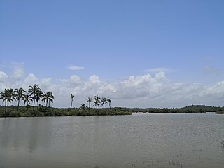
Anjarakandy is a census town and grama panchayat in Kannur district of Kerala, India. Anjrakandy river is flowing through Anjarakandy town.

Aralam Village in Kerala, India

Aralam is a village and Grama Panchayat in Kannur district in the Indian state of Kerala.

Cheruvanchery village in Kerala, India

Cheruvanchery is a village in Kannur district in the Indian state of Kerala. A detailed history of the town for the first time was written in a blog "Cheruvanchery: A Tale of Erased Times".

Kanichar Village in Kerala, India

Kanichar is a village and Grama Panchayat in Kannur district in the Indian state of Kerala.

Kannavam village in Kerala, India

Kannavam is a small Village in Thalassery Taluk in Kannur District of Kerala State, India. It comes under Chittaripparamba Panchayat. It belongs to North Kerala Division. It is located at 36 km towards East from District headquarters, Kannur; 12 km from Kuthuparamba and 466 km from State capital Thiruvananthapuram

Manantheri Census Town in Kerala, India

Manantheri is a census town near Kuthuparamba in Kannur district in the Indian state of Kerala.

Mokeri Census Town in Kerala, India

Mokeri is a Census Town in Mokeri panchayat of Kannur district in the Indian state of Kerala.

Thrippangottur Village in Kerala, India

Thrippangottur is a Village and a Grama Panchayat in Kannur district in the Indian state of Kerala.

References

  1. "Census of India 2001: Data from the 2001 Census, including cities, villages and towns (Provisional)". Census Commission of India. Archived from the original on 16 June 2004. Retrieved 1 November 2008.
  2. Kerala, Directorate of Census Operations. District Census Handbook, Kannur (PDF). Thiruvananthapuram: Directorateof Census Operations,Kerala. p. 204,205. Retrieved 14 July 2020.