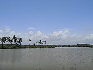
Kadirur is a census town within the Thalassery Taluk of Kannur District in the State of Kerala, India. Kadirur is located about 8 km from the Thalassery Township on the Tellicherry-Mysore road.

Eranholi is a census town near Thalassery in Kannur district in the state of Kerala, India, and located on Tellichery Mysore high way nearest town is Thalassery.Eranholi bridge built across Eranholi river in 1937 connect Eranholi with Tellicherry.

Mavilayi is a census town in Kannur district in the Indian state of Kerala. Situated in Peralasseri Panchayath on Kannur-Kuthuparamba State Highway, 15 km away from Kannur Town

New Mahe is a census town in Thalassery taluk of Kannur district in the Indian state of Kerala. It is part of Greater Mahé Region.

Palayad is a census town in Thalassery Taluk in the Indian state of Kerala.

Panniyannur is a census town in Talassery taluk of Kannur district in the Indian state of Kerala. It is part of Greater Mahé Region.

Pathiriyad is a census town in Kannur district in the Indian state of Kerala.

Pattiam is a census town in Kannur district in the Indian state of Kerala.

Peringathur is a census town in Thalassery taluk of Kannur district in the Indian state of Kerala. It is a part of Panoor municipality.

Mangattidam is the name of a revenue village and a village panchayath situated near Kuthuparamba in Thalassery taluk, Kannur district, Kerala, South India.

Cheruvanchery is a small village in Kannur district in the Indian state of Kerala. A detailed history of the town for the first time was written in a blog "Cheruvanchery: A Tale of Erased Times".

Kandamkunnu is a village in Kannur district in the Indian state of Kerala.

Kanichar is a village in Kannur district in the Indian state of Kerala. Kanichar is a Grama Panchayath,. The current political party in charge of the Panchayath is the UDF, and its president is Smt.Celin Mani Chemparathickal. There are thirteen wards in Grama Panchayath, there are many attractive tourist places like Elapeedika and Kadanmala.

Kannavam is a small Village/hamlet in Thalassery Taluk in Kannur District of Kerala State, India. It comes under Chittaripparamba Panchayath. It belongs to North Kerala Division. It is located at 36 km towards East from District headquarters, Kannur; 12 km from Kuthuparamba and 466 km from State capital Thiruvananthapuram
Kolavelloor is a village in Kannur district in the Indian state of Kerala.
Manantheri is a village near Kuthuparamba in Kannur district in the Indian state of Kerala.

Mokeri is a village in Kannur district in the Indian state of Kerala.

Muzhakkunnu is a village in Kannur district in the Indian state of Kerala.

Nuchiyad is a village in Kannur district in the Indian state of Kerala.

Kariyad is a small town in Talassery taluk of Kannur district in the Indian state of Kerala. It is part of Greater Mahé Region. It is 57.31 km.2 The total population according to the 1991 census is 123,628.


