Cheleri

Last updated

Cheleri
India Kerala location map.svg
Red pog.svg
Cheleri
Location in Kerala, India
India location map.svg
Red pog.svg
Cheleri
Cheleri (India)
Coordinates: 11°57′36″N75°24′53″E / 11.9599000°N 75.414740°E / 11.9599000; 75.414740 Coordinates: 11°57′36″N75°24′53″E / 11.9599000°N 75.414740°E / 11.9599000; 75.414740
CountryFlag of India.svg  India
State Kerala
District Kannur
Government
  BodyKolachery Grama Panchayat
Area
  Total8.56 km2 (3.31 sq mi)
Population
 (2011)
  Total10,848
  Density1,300/km2 (3,300/sq mi)
Languages
  Official Malayalam, English
Time zone UTC+5:30 (IST)
PIN
670604
ISO 3166 code IN-KL
Nearest cityKannur
Lok Sabha constituencyKannur
Vidhan Sabha constituencyTaliparamba

Cheleri is a census town in Kannur district in the Indian state of Kerala. [1]

Contents

Demographics

As of 2011 Census, Cheleri had a population of 10,848 with 4,873 males and 5,975 females. Cheleri census town spreads over an area of 8.56 km2 with 2,150 families residing in it. The sex ratio was 1,226 higher than state average of 1,084. In Cheleri, population of children under 6 years was 12.76%. Cheleri had overall literacy of 94%, higher than national average of 59% and same as state average of 94%. [2]

Religion

As of 2011 India census, Cheleri census town had total population of 10,848 which constitute 45.6% Hindus, 53.9% Muslims and 0.5% others. [3]

Administration

Cheleri census town is situated in Kolachery Grama Panchayat. It includes localities like Karayapa, Kayyankode, Munderikkadavu, Cheleri Mukkil, Nonheri, Dalil palli, Kappanapparamba, Kayachira, Vaidyar Kandi, Valavil Cheleri etc.

Education

There are two U.P. schools in this village: Cheleri A.U.P. School and Noorul Islam Madrassa U.P. School. The first one is the government-aided. The second one does not receive aid from the government but is recognized by the government. There is only one government school in this village. It is Cheleri Govt. Mopla L.P. School. Cheleri Mopla A.L.P. School, Noonheri A.L.P. School, Karayappa A.L.P. School, and Malot A L.P. School are other schools in this village.

Transportation

The national highway passes through Valapattanam town. Goa and Mumbai can be accessed on the northern side and Cochin and Thiruvananthapuram can be accessed on the southern side. The road to the east of Iritty connects to Mysore and Bangalore. The nearest railway station is Kannur on Mangalore-Palakkad line. Trains are available to almost all parts of India subject to booking over the internet. There are airports at Mattanur, Mangalore and Calicut. All of them are international airports but direct flights are available only to Middle Eastern countries.

Related Research Articles

Kadirur Census Town in Kerala, India

Kadirur is a census town within the Thalassery Taluk of Kannur District in the State of Kerala, India. Kadirur is located about 8 km (5.0 mi) from the Thalassery Township on the Tellicherry-Mysore road.

Matool village in Kerala, India

Mattool is a village in Kannur district of Kerala State, India. Mattool is located 19 kilometres (12 mi) north of Kannur city. The Valapattanam River and Kuppam River meet the Arabian sea at Mattool. Mattool can be reached from Kannur via Azheekal crossing the Mattool - Azheekal ferry. And via Madakkara-Matool Bridge From Irinavu Road.

Cheruthazham Census Town in Kerala, India

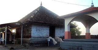
Cheruthazham is a census town in Kannur district in the state of Kerala, India. It is the location of the famous Hanumarambalam, dedicated to Sri Rama and Hanuman.Cherutazham is also the birthplace of Kalamandalam Krishnan Nair who gave a new dimension to the art of Kathakali. There are many artists in Cherutazham who are experts in the traditional musical items like "panchavadyam", "taayambaka", "chenda melam" etc. The new generation of Cherutazham is also getting trained in these art forms.

Kannadiparamba Census Town in Kerala, India

Kannadiparamba is a census town in Kannur district in the Indian state of Kerala.

Narath Census Town in Kerala, India

Narath is a census town in Kannur district in the Indian state of Kerala.

Paduvilayi Census Town in Kerala, India

Paduvilayi is a census town in Kannur district in the Indian state of Kerala.

Pattiom Census Town in Kerala, India

Pattiam is a census town in Kannur district in the Indian state of Kerala.

Mayyil Census Town in Kerala, India

Mayyil is a Census Town and Grama Panchayat in Kannur District of Kerala State. Mayyil Panchayat established in 1962 by merging the villages of Kayaralam, Mayyil and Kandakkai.

Anjarakkandy Census Town in Kerala, India

Anjarakandy is a census town and grama panchayat in Kannur district of Kerala, India. Anjrakandy river is flowing through Anjarakandy town.

Koodali Census Town in Kerala, India

Koodali is a census town in Thalassery taluk of Kannur district in Kerala state, India. Koodali is located 15.5 km east of Kannur city on Kannur-Mattanur road.

Kelakam, India Town in Kerala, India

Kelakam is a village and Grama Panchayat in the Kannur district of Kerala, India.

Aralam Village in Kerala, India

Aralam is a village and Grama Panchayat in Kannur district in the Indian state of Kerala.

Kandamkunnu Census Town in Kerala, India

Kandamkunnu is a census town in Kannur district in the Indian state of Kerala.

Kanichar Village in Kerala, India

Kanichar is a village and Grama Panchayat in Kannur district in the Indian state of Kerala.

Manantheri Census Town in Kerala, India

Manantheri is a census town near Kuthuparamba in Kannur district in the Indian state of Kerala.

Maniyoor Census Town in Kerala, India

Maniyoor is a census town in Kannur district in the Indian state of Kerala.

Mokeri Census Town in Kerala, India

Mokeri is a Census Town in Mokeri panchayat of Kannur district in the Indian state of Kerala.

Thrippangottur Village in Kerala, India

Thrippangottur is a Village and a Grama Panchayat in Kannur district in the Indian state of Kerala.

Vellora village in Kerala, India

Vellora is a village in Kannur district in the Indian state of Kerala. It has state road connectivity, schools, hospitals, post office, and bank dating back to the 1950s.

Kolachery Census Town in Kerala, India

Kolachery is a census town and Grama Panchayat in Kannur District of Kerala state, India. Kolachery is located 15 kilometres (9.3 mi) north east of Kannur city.

References

  1. "Census of India : Villages with population 5000 & above". Registrar General & Census Commissioner, India. Archived from the original on 8 December 2008. Retrieved 10 December 2008.
  2. Kerala, Directorate of Census Operations. District Census Handbook, Kannur (PDF). Thiruvananthapuram: Directorateof Census Operations,Kerala. p. 180,181. Retrieved 14 July 2020.
  3. "Religion – Kerala, Districts and Sub-districts". Census of India 2011. Office of the Registrar General.