
Malappuram, is one of the 14 districts in the Indian state of Kerala, with a coastline of 70 km (43 mi). It is the most populous district of Kerala, which is home to around 13% of the total population of the state. The district was formed on 16 June 1969, spanning an area of about 3,554 km2 (1,372 sq mi). It is the third-largest district of Kerala by area, as well as the largest district in the state, bounded by Western Ghats and Arabian Sea to either side. The district is divided into seven Taluks: Eranad, Kondotty, Nilambur, Perinthalmanna, Ponnani, Tirur, and Tirurangadi.

Chaliyar River is the fourth longest river in Kerala at 169 km in length. The Chaliyar is also known as Chulika River, Nilambur River or Beypore River as it nears the sea. Pothukal, Chungathara, Nilambur, Mampad, Edavanna, Kavanoor, Perakamanna, Areekode, Kizhuparamba, Elamaram, Cheekkode, Vazhakkad, Vazhayur, Cheruvadi, Edavannappara, Mavoor, Peruvayal, Feroke and Beypore are some of the towns/villages situated along the banks of Chaliyar. It mainly flows through Malappuram district. Its tributaries flow through both the districts of Malappuram and Kozhikode. The bank of river Chaliyar at Nilambur region is also known for natural Gold fields. Explorations done at the valley of the river Chaliyar in Nilambur has shown reserves of the order of 2.5 million cubic meters of placers with 0.1 gram per cubic meter of gold. It originates at Ilambaleri hills of Nilgiri Mountains in Nilgiris district, which is also near Wayanad-Malappuram district border. It flows mainly through the erstwhile region of Eranad, and finally empties into the Arabian Sea at Beypore port, opposite to Chaliyam harbour.
Vengara is a Place in Kannur District, Kerala, India that is known for its landscapes and lush greenery. The village is between the Arabian Sea and Ezhimala Hill. It is a part of Madayi Gramapanchayath
Feroke, is a Municipality and a part of Kozhikode metropolitan area under Kozhikode Development Authority (K.D.A) in the Kozhikode district of the Indian state of Kerala.

Tanur is a coastal town, a municipality, and a block located in Tirur Taluk, Malappuram district, Kerala, India. It is located on the Malabar Coast, 9 kilometres (5.6 mi) north of Tirur and 9 kilometres south of Parappanangadi. It is the 17th-most populated municipality in the state, the fourth-most populated municipality in the district, and the second-most densely populated municipality in Malappuram district, having about 3,568 residents per square kilometre as of the year 2011. Tanur town is located south of the estuary of Poorappuzha River, which is a tributary of Kadalundi River. Tanur was one of the major ports in the southwestern coast of India during the medieval period. It was ruled by the Kingdom of Tanur, also known as Vettathunadu, who were vassals to the Zamorin of Calicut. In the early medieval period, under the chiefs of Kozhikode and Tanur, Tanur developed as one of the important maritime trade centre on the Malabar Coast. Later it became a part of Vettathunadu Taluk in Malabar District under British Raj, which was merged with the Ponnani taluk in 1860–1861. Tanur railway station is a part of the oldest Railway line of Kerala laid in 1861 from Tirur to Chaliyam. Presently, the status of Tanur is reduced to a major fishing centre in Kerala.

Madayi. is a Census Town and Grama panchayat in Kannur district of Kerala state, India. Bhagavathy shrine, Madayi Kavu where devotees worship Bhadrakali, is located here. The Goddess is one of the family deity of the Chirakkal Royal family, and the temple is known for the Koyikalasham. The temple was one of the few to survive desecration by the armies of Tippu Sultan, which devotees attribute to the grace of the Goddess. The Kolathiri Rajahs were the administrators of the temple, however recently the administration was transferred to the Malabar Devaswom Board. Nearby is the Vadukunnu Temple dedicated to Shiva. The temple was razed by followers of Tippu Sultan in the 18th century, but the temple has been rebuilt and is a vibrant centre of religion in the region.

Kunnumpuram is a small town in Malappuram district of Kerala. It is located south to Kondotty, west to Vengara and north to Tirurangadi. Kunnumpuram is famous for its Palliative Care Unit.

Parappanangadi is a major town and a municipality in Tirurangadi taluk of Malappuram district, Kerala, India. It is a coastal town located close to the Arabian sea. Parappanangadi railway station is one of the oldest railway stations in Kerala. It was a part of the first rail route (Tirur–Chaliyam) in Kerala. Parappanangadi is located 9 km (5.6 mi) north of Tanur on Tirur-Kadalundi Tipu Sultan Road. The town lies on the bank of Kadalundi River. Parappanangadi town is located north of the estuary of Poorappuzha River, which is a tributary of Kadalundi River, and south of the estuary of Kadalundi River, which lies in Vallikkunnu. Parappanangadi was one of the major ports in the southwestern coast of India during the medieval period. It was ruled by the kingdom of Parappanad, who were vassals to the Zamorin of Calicut, and had the jurisdiction up to Beypore port to the north. In the early medieval period, under the chiefs of Kozhikode and Parappanangadi, Parappanangadi developed as one of the important maritime trade centre on the Malabar Coast. Later it became a part of Eranad Taluk in Malabar District under British Raj.

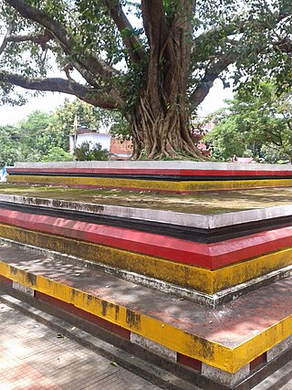
Nediyiruppu is a region of the Kondotty municipality in Malappuram district, Kerala, India. It is situated 24 kilometres (15 mi) from Malappuram, the district headquarters. Important places in Nediyiruppu village are Musliyarangadi, Colony Road Junction, Kottukkara, Meleparambu, Chiryil Chungam, Kodangad, and Kuruppath. Historically, Nediyiruppu was important as the capital Zamorin dynasty. Nediyiruppu Swaroopam Road, in Poyilikkave, was named in remembrance of that heritage.

Vallikkunnu is a village in Tirurangadi Taluk of Malappuram district in the state of Kerala, India with an area of 25 km2. It is located 5 km north of Parappanangadi town and comes under the jurisdiction of Parappanangadi Police Station and Parappanangadi Judicial First Class Magistrate Court. Its latitude and longitude are 11'07" N and 7'51"E respectively. Vallikkunnu was awarded the best panchayath of Kerala in 1997. Vallikunnu is situated on Tirur-Kadalundi Road. Vallikkunnu is also a part of the Oldest Railway Line of Kerala laid in 1861 from Tirur to Chaliyam via Tanur, Parappanangadi, Vallikkunnu, and Kadalundi.

Kadalundi is a village in Kozhikode district, Kerala, India. It is a coastal village close to the Arabian Sea. Kadalundi is famous for its bird sanctuary, which is home to various migratory birds during certain seasons and has been recently declared as a bio-reserve. The Kadalundi-Vallikkunnu community reserve is the first community reserve in Kerala. The Kadalundi River and the Chaliyar river, two of the longest rivers of Kerala, merges with the Arabian Sea at Kadalundi. The first railway line in Kerala was laid in 1861 from Tirur to Chaliyam through Tanur, Parappanangadi, Vallikkunnu, and Kadalundi.
Kingdom of Tanur was one of the numerous feudal principalities on Malabar Coast during the Middle Ages. It was ruled by a Hindu dynasty, claiming Kshatriya status, known as Tanur dynasty. The kingdom comprised parts of the coastal Taluks of Tirurangadi, Tirur, and Ponnani taluks in present-day Malappuram district and included places such as Tanur, Tirur (Trikkandiyur) and Chaliyam. The coastal villages of Kadalundi and Chaliyam in the southernmost area of Kozhikode district was also under Tanur Swaroopam.
Eranad also known as Ernad refers to the erstwhile province in the midland area of Malabar, consisting of Malappuram and nearby regions such as Anakkayam, Manjeri, Kondotty, Nilambur, etc. Currently Eranad Taluk is a Taluk in Malappuram district. Eranad was ruled by a Samanthan Nair clan known as Eradis, similar to the Vellodis of neighbouring Valluvanad and Nedungadis of Nedunganad. The rulers of Eranad were known by the title Eralppad/Eradi. They also used the title Thirumulpad.
Muttumpuram is a small village in Vengara, Malappuram district, Kerala state of India. Most part of Muttumpuram is included in Kannamangalam Panchayath. In the village there is a small town to fulfill the needs of living people. The city is border of some wards of Kannamangalam panchayath and Vengara Panchayath. The village is included in Vengara Assembly constituency and Malappuram Lokhasabha constituency.
Parappanad was a former feudal city-state in Malabar, India. The headquarters of Parappanad Royal family was at the town Parappanangadi in present-day Malappuram district. In 1425, the country divided into Northern Parappanad and Southern Parappanad. Southern Parappanad included parts of Tirurangadi Taluk and the town Parappanangadi. Northern Parappanad included Panniyankara, Beypore, and Cheruvannur of Kozhikkode Taluk. Parappanad royal family is a cousin dynasty of the Travancore royal family.

Arakkal Kingdom was a Muslim kingdom in Kannur town in Kannur district, in the state of Kerala, South India. The king was called Ali Raja and the ruling queen was called Arakkal Beevi. Arakkal kingdom included little more than the Cannanore town and the southern Laccadive Islands, originally leased from the Kolattiri. The royal family is said to be originally a branch of the Kolattiri, descended from a princess of that family who converted to Islam. They owed allegiance to the Kolattiri rulers, whose ministers they had been at one time. The rulers followed the Marumakkathayam system of matrilineal inheritance, a system that is unique to a section of Hindus of Kerala. Under Marumakkathayam, the succession passes to the male offspring of its female members, in other words from a man to his sister's son and so forth. As the only Muslim rulers in Malabar, they saw the rise of Hyder Ali, de facto ruler of the Mysore Sultanate as the opportunity to increase their own power at the expense of Chirakkal, and invited him to invade Kerala.

Poocholamad is a village in Kannamangalam in the Malappuram district, state of Kerala, India. It is part of the Gram Panchayat government. It is also included in Vengara Assembly constituency and Malappuram Lokhasabha constituency.
Chaliyam is a village situated at the estuary of Chaliyar in Kozhikode district of Kerala, India. Chaliyam forms an island, bounded by the Chaliyar in the north, and River Kadalundi in south, and the Conolly Canal in the east. It is located just opposite to Beypore port. Chaliyam was the former terminus of the South-West Line of the Madras Railway. Chaliyam is also famous for the Guinness World Records holder Muhammed Adil, a P.M who covered around seven km in the Chaliyar River with his hand and legs tied with ropes.
Madayi Mosque is mosque at Pazhayangadi in Kannur district, northern Kerala. It is one of the oldest mosques in Kerala, with local legends dating back to the 7th century AD. It is believed to have been established by Malik ibn Dinar and contains a block of white marble said to have been brought from Mecca by ibn Dinar. It is one of the several mosques around Pazhayangadi/Payangadi. It is situated on the banks of Kuppam River, which joins Valapattanam River at its estuary.
Malappuram is one of the 14 districts in the South Indian state of Kerala. The district has a unique and eventful history starting from pre-historic times. During the early medieval period, the district was the home to two of the four major kingdoms that ruled Kerala. Perumpadappu was the original hometown of the Kingdom of Cochin, which is also known as Perumbadappu Swaroopam, and Nediyiruppu was the original hometown of the Zamorin of Calicut, which is also known as Nediyiruppu Swaroopam. Besides, the original headquarters of the Palakkad Rajas were also at Athavanad in the district.


