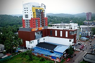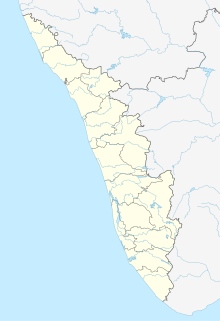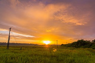
Alappuzha district, is one of the 14 districts in the state of Kerala in India. It was formed as Alleppey district on 17 August 1957, the name of the district being changed to Alappuzha in 1990, and is the smallest district in Kerala. Alleppey town, the district headquarters, was renamed Alappuzha in 2012, even though the anglicised name is still commonly used to describe the town as well as the district.

Malappuram is one of the 14 districts in the Indian state of Kerala, with a coastline of 70 km (43 mi). It is the most populous district of Kerala, which is home to around 13% of the total population of the state. The district was formed on 16 June 1969, spanning an area of about 3,554 km2 (1,372 sq mi). It is the third-largest district of Kerala by area, as well as the largest district in the state bounded by Western Ghats and Arabian Sea to the two sides. Malappuram is the third major contributing district to the Gross State Domestic Product of Kerala as of 2019, after Ernakulam and Thiruvananthapuram. The district is divided into seven Taluks - Eranad, Kondotty, Nilambur, Perinthalmanna, Ponnani, Tirur, and Tirurangadi. Economically booming towns in Malappuram district include Malappuram, Manjeri, Tirur, Ponnani, Perinthalmanna, Kottakkal, Nilambur, Parappanangadi, Tanur, Kondotty, Valanchery, Tirurangadi, Chemmad, Edappal, Wandoor, Areekode, Edakkara, Chungathara, Kalikavu, and Puthanathani. Having 12 municipalities in total, the district has the second-highest number of Municipal towns in the state lying just behind Ernakulam (13).

Kasaragod ([kɑːsɑrɡoːɖɨ̆] formerly known in English as Kassergode, and Malayalam as Kanhirakode, is a municipal town and administrative headquarters of Kasaragod district of Kerala state in India. Established in the year 1966, Kasaragod was the first municipal town in Kasaragod district. It is the northernmost district of Kerala and is also known as Saptha Bhasha Sangama Bhoomi.

Nilambur is a major town, a municipality and a Taluk in the Malappuram district of the Indian state of Kerala. It is located close to the Nilgiris range of the Western Ghats on the banks of the Chaliyar River. This place is also known as 'Teak Town' because of the abundance of Nilambur teaks in this area; Which is a variety of a large, deciduous tree that occurs in mixed hardwood forests. Unlike many Municipalities of India; Nilambur is covered with large amounts of vegetation making it close to nature and hence make it very scenic and inspiring.

Irinjalakuda is a municipal town in Thrissur district, Kerala, India. It is the headquarters of Irinjalakuda Revenue Division and Mukundapuram Taluk. The place is well-known for Koodalmanikyam Temple and the Thachudaya Kaimals who had princely status until 1971.
Kollam district is one of 14 districts of the state of Kerala, India. The district has a cross-section of Kerala's natural attributes; it is endowed with a long coastline, a major Laccadive Sea seaport and an inland lake. The district has many water bodies. Kallada River is one among them, and the east side land of river is East Kallada and the west side land is West Kallada.

Feroke, IPA: [fɐroːkːɨ̆], is a Municipality and a part of Kozhikode metropolitan area under Kozhikode Development Authority (K.D.A) in the Kozhikode district of the Indian state of Kerala.

Alappuzha, also known by its former name Alleppey, is the administrative headquarters of Alappuzha district in the Indian state of Kerala. Alleppey is a city and a municipality in Kerala with an urban population of 174,164 and ranks third among the districts in literacy rate in the state. In 2016, the Centre for Science and Environment rated Alappuzha as the cleanest town in India. Alappuzha is considered to be the oldest planned city in this region and the lighthouse built on the coast of the city is the first of its kind along the Laccadive Sea coast.

Thrissur is a district of Kerala situated in the central part of that state. Spanning an area of about 3,032 km2 (1,171 sq mi), Thrissur district is home to over 9% of Kerala's population.

Ranni is a Town in the Pathanamthitta district of Kerala, in India. The taluk headquarters is a township on both sides of the Pamba River. Ranni is also one of the largest taluks in Kerala. The renowned Hindu temple of Sabarimala is in this taluk, situated approximately 66 km from the main town, Ittiyappara. Ranni is known for its natural environment, forests, hills, river and good climate.

Kasaragod is one of the 14 districts in the southern Indian state of Kerala. Its northern border Thalappady is located just 10 km south to Ullal, which is the southernmost portion of the major port city Mangalore, on the southwestern Malabar coast of India.

Aloor is a panchayath in Chalakudy-Mukundapuram taluks in Thrissur district of Kerala, India. It is near the towns of Irinjalakuda and Chalakudi. The postal index number (PIN) of Aloor is 680683 since Aloor and a few other post offices fall under the Main Post Office of Kallettumkara. Since 1901, the name "Aloor" has been simplified to Alur by the Cochin State and the Central Government Departments. The telephone code of Aloor is +480 followed by a seven-digit phone number.

Karoor is a village in Aloor Panchayath Aloor, Kerala in Thrissur district of Kerala, India. Karoor is located 30 km from the city of Thrissur and 12 km from Irinjalakuda Town and 8 km from Chalakudy Town and 8 km from Mala, Kerala Town.

Cherukunnu is a census town in Kannur district in the Indian state of Kerala.

Kallettumkara is a village which is the epi-centre town of Aloor Panchayat and is in Thrissur district in the state of Kerala. Kaletumkara is the Western border of newly formed Chalakudy Taluk although it elects it Legislative Assembly Candidate from Irinjalakuda Constituency, India. Kalletumkara is popular as the place where Irinjalakuda Railway Station is located and is 8km away from the Irinjalakuda Town.
State Highway 61 is a State Highway in Kerala, India that starts in Potta and ends in Moonupeedika. This highway is 21 km long. It is connecting National Highway 66 to National Highway 544 which are main highways in Kerala. Irinjalakuda Town is situated in this road which is Headquarters of the Mukundapuram Taluk.

Thrissur District has four types of administrative hierarchies:

Chalakudy taluk comes under Irinjalakuda Revenue Division of Thrissur district in Kerala, India. It is one of the 77 taluks of Kerala. Chalakudy taluk was formed in the year 2013 by the UDF Government, led by Oommen Chandy. 31 villages from the former subdistrict of Mukundapuram taluk form the new subdistrict.


