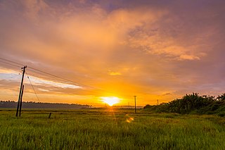
Vazhakulam is a village in Muvattupuzha Taluk is in Ernakulam district in the Indian state of Kerala. This town is known as Pineapple City due to its large-scale pineapple farms.

Thrissur, anglicised as Trichur, is one of the 14 districts in the Indian state of Kerala. It is situated in the central region of the state. Spanning an area of about 3,032 km2 (1,171 sq mi), the district is home to over 9% of Kerala's population.

Batlagundu is a town in Nilakottai block in Dindigul district in the Madurai Region state of Tamil Nadu, India. The name Vetrilaikkundru later transformed and changed to Vathalagundu. The town is the major gateway to Kodaikanal. Subramaniya Siva was a writer, Indian Freedom Fighter, and activist born in Batlagundu. Batlagundu is the fifth-largest town in the Dindigul district. The town is located in such a way connecting three main districts of South Tamil Nadu. Batlagundu has most of the voters in Nilakottai Constituency.

Kadungalloor, IPA:[kɐɖuŋːɐlːuːr], is a village situated near Aluva. The village belongs to the Paravur Taluk of the Ernakulam district in the Indian state of Kerala. The industrial estates of Muppathadam and Edayar are located in Kadungalloor.
Karunguzhi is a town in Chengalpattu district in the Indian state of Tamil Nadu.

Madambakkam is a neighborhood in the city of Tambaram, situated within the Chennai Metropolitan Area, Tamil Nadu, India.
Sembakkam is a neighborhood in the city of Tambaram, situated within the Chennai Metropolitan Area, Tamil Nadu, India.

Singaperumal Koil is a satellite town city of Chennai located between Chengalpattu and Maraimalai Nagar in Chengalpattu district in the Indian state of Tamil Nadu. It is a part of the area Chennai Metropolitan Development Authority (CMDA) and a vital locality in Chennai Metropolitan Area.

Virudhachalam, also called Vriddhachalam, is a Municipality and taluk headquarters in Cuddalore district in the Indian state of Tamil Nadu. The ancient name of this town is Thirumudhukundram. As per the 2011 census, the town had a population of 73,585 of which 37,066 are males while 36,519 are females. Population of children in the ages of 0-6 is 7735 which is 10.51 % of the total population. The Virudhagiriswarar temple dedicated to Lord Shiva is located in the heart of town. This is the 41st Devaram Padal Petra Siva Thiruthalam and 9th Thiruthalam in Nadu Naadu(நடுனாடு). Moovar has sung hymns in praise of Lord Siva of this temple. The temple was constructed by one of the Chola Emperors. The famous Kolanjiappar Temple is located 3 km away from the town. Both of them are situated near Cuddalore - Salem highway in Virudhachalam. The temple has been mentioned in the travalogue Tirtha Prabandha written by Madhwa saint Vadiraja tirtharu in sixteenth century.
Kulanada is a village in the district of Pathanamthitta bordering with Alappuzha district in Kerala state within India. Kulanada assumed its name from the combination of words "Kulam" and "Nada". Kulam meaning pond and Nada meaning the temple where the king of Pandalam worshiped.
Periapalayam is a village about 40 km north of Chennai, in Tiruvallur district, Tamil Nadu State, India. The nearest Railway station is Thiruninravur.It is in Ellapuram block which stretches from east Thanakulam village, west Uthukottai, north Kosavanpettai and in the south up to Komakambedu village. It has one of the main routes to Andhra Pradesh.

Rayamangalam is a village in the Ernakulam district of Kerala state, India.

Pavithreswaram is a village in Kottarakkara taluk of Kollam district in the state of Kerala, India.
Pattithara is a village in Palakkad district in the state of Kerala, India.
Payyanadam is a village in Palakkad district in the Indian state of Kerala.
Kunnamthanam is a census village in Kunnamthanam gram panchayat in the Mallapally taluk of the district of Pathanamthitta in Kerala. As of 2011, it had a population of 20,573.

Ottasekharamangalam is a village in Thiruvananthapuram district in the state of Kerala, India.
Vattappara is a village in Thiruvananthapuram district in the state of Kerala, India. , well known for its geographical peculiarities with quarries that are generally used for extracting building materials (rock).This town is by the side of MC Road connecting Trivandrum and Kottayam and 14 km away from Trivandrum City. The nearest township is Nedumangad.There is no recorded history on the origin of this place. The major occupation in Vattappara is farming(Rubber, Coconut).

Vatanappally (Vatanappilly/) is a panchayat and census town in Thrissur district, in the state of Kerala, India.
Thachur is a village in Kallakurichi district in the state of Tamil Nadu, India. It is a Grama Panchayat consisting of few villages.


