Related Research Articles

Kasaragod is a municipal town and administrative headquarters of Kasaragod district in the state of Kerala, India. Established in 1966, Kasaragod was the first municipal town in the district. It is the northernmost district of Kerala and is also known as Sapta Bhasha Sangama Bhumi.

South Canara was a district of the Madras Presidency of British India, located at 13.00°N 75.40°E. It comprised the towns of Kassergode and Udipi and adjacent villages, with the administration at Mangalore city. South Canara was one of the most heterogeneous areas of Madras Presidency, with Tulu, Malayalam, Kannada, Konkani, Marathi, Urdu, and Beary languages being spoken side by side. It was succeeded by the Tulu-speaking areas of Dakshina Kannada district, the Malayalam-speaking area of Kasaragod district and the Amindivi islands sub-division of the Laccadives, in the year 1956.

The Chandragiri River, also known as the Payaswini River in Karnataka and as the Perumpuzha River in Kerala, is the longest river in Kasaragod district, Kerala, India. The River Is A Historical Treasure Of Chemnad. It was named after the Mauryan emperor Chandragupta Maurya.

Udma is a census town in Kasaragod district in the Indian state of Kerala.

Kumbla is a small town in Kasaragod district of Kerala state in India. It is located 12 km north of Kasaragod town.

Kasaragod is one of the 14 districts in the southern Indian state of Kerala. Its northern border Thalappady is located just 9 km south to Ullal, which is the southernmost portion of the major port city Mangalore, on the southwestern Malabar coast of India.
Kadannapalli is a census town in Kannur district of Kerala state, India.

Badiyadka officially known as "Badiadka" is a town and gram panchayat in the Kasaragod district, state of Kerala, India.
Perumbala is a village in Chemnad Panchayat Kasaragod district in the state of Kerala, India. Perumbala is a small village located in Kasaragod taluk of Kasaragod district in Kerala with total 1,677 families residing. The Perumbala village has population of 8,096 of which 3,789 are males while 4,307 are females as per Population Census 2011. It is located 7 km (4.3 mi) south east of Kasaragod town, 60 km (37 mi) south of Mangalore city and 24 km (15 mi) north of Bekal Fort.

Hosdurg is one of four taluks that constitute the Kasaragod District, Kerala. Others are Kasaragod, Manjeshwaram and Vellarikundu taluks. In the north, it borders Kasaragod taluk; in south, the Kannur District; in the east, Vellarikundu taluk; and in the west, the Arabian Sea. With an area of 900.3 km2, it was the smaller of the two taluks. Then Hosdurg bifurcated into Vellarikund and Hosdurg taluks in 2013 for ease of administration. Kanhangad and Nileshwaram are the municipalities within the taluk. Hosdurg is a kilometer south of Kanhangad town, the latter being the taluk headquarters. Other major settlements include Trikarpur, Cheruvathur and Udma. Bekal Fort tourism is situated in the taluk.

Kasaragod District is the northernmost district in the southwestern Indian coastal state of Kerala. The district has a long history starting from pre-historic times to the modern period.

Mulleria is a small town located in Karadka Panchayath, Kasaragod district in Kerala, India.

Chittur is one among the 6 taluks in Palakkad district of Indian state of Kerala. There are 30 revenue villages in chittur taluk. It is situated on the eastern side of Palakkad district.
Padre is a village in Manjeshwaram Taluk of Kasaragod district in Kerala, India.
Edanad is a village in Manjeshwaram Taluk of Kasaragod district in Kerala, India.
Mugu is a village in Manjeshwaram Taluk of Kasaragod district in Kerala, India.
Parappa is a village and block panchayat in Vellarikundu taluk of Kasaragod district in the Indian state of Kerala.
Adoor is a village in Kasaragod district in the Indian state of Kerala. Adoor is located 38 km east of Kasaragod town and 7 km away from State Highway 55 or Cherkala-Jalsoor road.
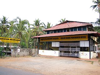
Kallar is a village in Kasaragod district in the Indian state of Kerala. Kallar is located on Kanhangad-Panathur road of 40 km south east of Kasaragod town and 27 km north east of Kanhangad.
Bare is a census town in Udma Grama Panchayat of Hosdurg taluk in Kasaragod district in Indian state of Kerala.
References
- ↑ "Vidyanagar Pin Code, Vidyanagar, Kasargod Map, Latitude and Longitude, Kerala". indiamapia.com. Retrieved 18 March 2019.
- ↑ indcareer.com (31 July 2012). "Central University of Kerala, Vidyanagar". IndCareer.com. Retrieved 18 March 2019.
- ↑ "villages in kasaragod taluk".
- ↑ "Religion – Kerala, Districts and Sub-districts". Census of India 2011. Office of the Registrar General.
- ↑ "Census of India - Language". censusindia.gov.in. Retrieved 17 April 2020.