Delampady

Last updated

Delampady
village
Kottiyodi bridge. Karadukka.jpg
Kottiyadi bridge
India Kerala location map.svg
Red pog.svg
Delampady
Location in Kerala, India
India location map.svg
Red pog.svg
Delampady
Delampady (India)
Coordinates: 12°35′50″N75°17′30″E / 12.5973°N 75.2917°E / 12.5973; 75.2917
CountryFlag of India.svg  India
State Kerala
District Kasaragod
Taluk Kasaragod
Government
  Type Panchayati Raj (India)
  BodyDelampady Grama Panchayat
Area
  Total79.5 km2 (30.7 sq mi)
Population
 (2011) [1]
  Total22,773
  Density290/km2 (740/sq mi)
Languages
  Official Malayalam, English, Kannada
Time zone UTC+5:30 (IST)
Vehicle registration KL-14

Delampady is a village and Grama Panchayat in Kasaragod district in the state of Kerala, India. [2]

Contents

Demographics

As of 2011 Census, Delampady village had population of 7,291 with 3,693 males and 3,598 females. Delampady village has an area of 15.68 km2 (6.05 sq mi) with 1,314 families residing in it. The average female sex ratio was 974 lower than the state average of 1084. In Delampady, 10.8% of the population was under 6 years of age. Delampady had an average literacy of 84.93% lower than the state average of 94%; male literacy was 89.55% and female literacy was 80.16%.

Delampady Grama Panchayat had total population of 22,773 with 11,360 males and 11,413 females. Total families residing in the rural panchayat limit was 4,371. Delampady Panchayat has administration over the villages of Delampady and Adoor. [3]

Transportation

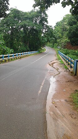
The western main road to Kasaragod have access to NH.66 which connects to Mangalore in the north and Calicut in the south. The road to the east connects to Sullia in Karnataka from where Mysore and Bangalore can be accessed. The nearest railway station is Kasaragod on Mangalore-Palakkad line. There is an airport at Mangalore.

Delampady is a Kerala village but it has no road access to Kerala. Delampady has an area of 89 km2. and 45% of the village is forest land. Delampady has 1457 houses and the total population is 6,000. There are nine roads for entering Delampadi and all of them are connected to Karnataka state only. The village territory is zigzagging between Kerala and Karnataka and at every 300 metres, you can find either a Kerala territory or a Karnataka territory. The only connection to Kerala is the two kilometre long forest track called Mayyala-Parappa road which is dangerous to walk because of the constant threat of moving herds of wild elephants. This road is six-metre wide but bus facility is not available because there is no tar surface on the road. This road is only two kilometre long but elephants are found almost all the time in this area. [4]

Facilities

Most of the people in Delampady depend upon Ishwaramangala village in Karnataka for their provisions. Adoor town is 13 km away and Mulleria town is 20 km away. Puttur City is 36 km away. Border villages in this locality include Kottyadi Bridge, Jalsoor Road, Pallathur Bridge, Parapa-Mudoor, Panchikkal, Kalladukka-Derkkaje, Ujjampadi-Munchikkan, Salathadukka-Panchuvadi, Kombode and Nunjubettu-Erikkadappu. There is a forest outpost at Kottyadi village. For emergency health issues, the people of Delampady village depend upon the small health centre located at Ujjampadi Anganavadi building.

The headquarters of the Delampady village is Adoor Town and the panchayath office is also located here. Almost all the government offices are also located in Adoor. The main agricultural activity of Delampady village is rubber plantation. [4]

See also

Related Research Articles

<span class="mw-page-title-main">Udma</span> Census Town in Kerala, India

Udma is a census town in Kasaragod district in the Indian state of Kerala.

<span class="mw-page-title-main">Pulingome</span> Village in Kerala, India


Pulingome is a village in Kannur District of Kerala state, India.

<span class="mw-page-title-main">Cherupuzha, Kannur</span> Town in Kerala, India

Cherupuzha is a town in Kannur district, Kerala, India. It is the headquarters of the Cherupuzha Panchayat which is a special grade panchayat in Kerala.

Kuttikole is a village and Gram Panchayat in the Kasaragod district in the Indian state of Kerala.

<span class="mw-page-title-main">Adhur</span> Village in Kerala, India

Adhur is a village in Kasaragod district in the state of Kerala, India.

<span class="mw-page-title-main">Badiyadka</span> Town in Kerala, India

Badiyadka officially known as "Badiadka" is a town and gram panchayat in the Kasaragod district, state of Kerala, India.

Balal is a village and a Grama Panchayat in Kasaragod district in the state of Kerala, India.

<span class="mw-page-title-main">Bandadka</span> Small Town in Kerala, India

Bandadka is a small town in Kasaragod district in the state of Kerala, India. It is also called as Kottakal because of Bandadka Fort. It comes under Kuttikole Grama Panchayat. It is located 38 km (24 mi) towards east from District headquarters Kasaragod, 568 km (353 mi) away from State capital Thiruvananthapuram, 5 km (3.1 mi) west of Karnataka border and 20 km (12 mi) away from Sullia. Bandadka Pin code is 671541 and postal head office is Chengala.

Bedadka is a village in Kasaragod district in the state of Kerala, India.

<span class="mw-page-title-main">Karadka</span> Village in Kerala, India

Karadka is a village, block panchayat and grama panchayat in Kasaragod district in the state of Kerala, India.

<span class="mw-page-title-main">Muliyar</span> Town in Kerala, India

Muliyar is a village and Grama Panchayat and in Kasaragod district in the Indian state of Kerala.

<span class="mw-page-title-main">Paivalike</span> Village in Kerala, India

Paivalike is a village in Kasaragod district in the state of Kerala, India. Paivalike is 11 km (6.8 mi) east of Uppala town and 40 km (25 mi) south of Mangalore city.

<span class="mw-page-title-main">Vorkady</span> Gram Panchayat in Kerala, India

Vorkady is a Gram Panchayat in Kasaragod district in the state of Kerala, India.

Meenja is a grama Panchayat in Manjeshwaram Taluk of Kasaragod district in the state of Kerala, India. It consists of 7 revenue villages. Kaliyoor, Koliyoor, Talakala, Meenja, Kadambar, Moodambail and [Kuloor]

<span class="mw-page-title-main">Pallikkara, Bekal</span> Village in Kerala, India

Pallikkara is a census town and a grama panchayat in Hosdurg Taluk of Kasargod district in the state of Kerala, India. This place was once famous for its Tobacco plants until the late 1980s and the Historical landmark Bekal Fort lies in this Village. A beach park near to the fort also attracts tourists to this place.

<span class="mw-page-title-main">Perla, Kasaragod</span> Town in Kerala, India

Perla is an administrative capital of Enmakaje Panchayat, which is in Kasaragod district, Kerala, India.

Adoor is a village in Kasaragod district in the Indian state of Kerala. Adoor is located 38 km east of Kasaragod town and 7 km away from State Highway 55 or Cherkala-Jalsoor road.

<span class="mw-page-title-main">Kallar (Kasaragod)</span> Village in Kerala, India

Kallar is a village in Kasaragod district in the Indian state of Kerala. Kallar is located on Kanhangad-Panathur road of 40 km south east of Kasaragod town and 27 km north east of Kanhangad.

Kolthur is a village in Kasaragod taluk of Kasaragod district in Indian state of Kerala.

Thimiri is a village in Hosdurg taluk of Kasaragod district in Kerala state, India. Thimiri is located 3 km east of Cheruvathur on Cheruvathur-Cheemeni road.

References

  1. "കാസര്‍ഗോഡ്‌ ജില്ലയിലെ ഗ്രാമ പഞ്ചായത്തുകളുടെ അടിസ്ഥാന വിവരങ്ങള്‍ | Deparyment of Panchayats".
  2. "Census of India : Villages with population 5000 & above". Registrar General & Census Commissioner, India. Archived from the original on 8 December 2008. Retrieved 10 December 2008.
  3. Kerala, Directorate of Census Operations. District Census Handbook, Kasaragod (PDF). Thiruvananthapuram: Directorateof Census Operations,Kerala. p. 86,87,156,162. Retrieved 14 July 2020.
  4. 1 2 "ഒമ്പത് റോഡും കര്‍ണാടകം അടച്ചു, കേരളത്തിലേക്ക് വനപാത; 1700 മീറ്ററില്‍ തൂങ്ങി ആറായിരം ജീവിതങ്ങള്‍". Archived from the original on 25 April 2020. Retrieved 21 April 2020.