Perumbala

Last updated
Perumbala
village
India Kerala location map.svg
Red pog.svg
Perumbala
Location in Kerala, India
Coordinates: 12°30′0″N75°1′25″E / 12.50000°N 75.02361°E / 12.50000; 75.02361 Coordinates: 12°30′0″N75°1′25″E / 12.50000°N 75.02361°E / 12.50000; 75.02361
CountryFlag of India.svg  India
State Kerala
District Kasaragod
Population
(2001)
  Total6,889
Languages
  Official Malayalam, English
Time zone UTC+5:30 (IST)
Vehicle registration KL-

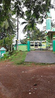
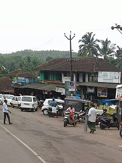
Perumbala is a village in chemnad Panchayat Kasaragod district in the state of Kerala, India. Perumbala is a large village located in Kasaragod Taluka of Kasaragod district, Kerala with total 1677 families residing. The Perumbala village has population of 8096 of which 3789 are males while 4307 are females as per Population Census 2011. [1] It is located around 60 km south of Mangalore city and 24 km from Bekal fort.

Kasaragod district Place in Kerala, India

Kasaragod District is one of the 14 districts in the southern Indian state of Kerala. Kasaragod became part of Kannur district following the reorganisation of states due to predominance of Malayalam speakers. Kasaragod was declared as a district on 24 May 1984.

Kerala State in southern India

Kerala is a state on the southwestern, Malabar Coast of India. It was formed on 1 November 1956, following passage of the States Reorganisation Act, by combining Malayalam-speaking regions. Spread over 38,863 km2 (15,005 sq mi), Kerala is the twenty-second largest Indian state by area. It is bordered by Karnataka to the north and northeast, Tamil Nadu to the east and south, and the Lakshadweep Sea to the west. With 33,387,677 inhabitants as per the 2011 Census, Kerala is the thirteenth-largest Indian state by population. It is divided into 14 districts with the capital being Thiruvananthapuram. Malayalam is the most widely spoken language and is also the official language of the state.

Mangalore Corporation City in Karnataka, India

Mangalore, officially known as Mangaluru, is the chief port city of the Indian state of Karnataka. It is located about 352 km (219 mi) west of the state capital, Bangalore, between the Arabian Sea and the Western Ghats mountain range. It is the second major city in Karnataka state in all aspects after the capital city Bangalore. It is the only city in Karnataka to have all modes of transport — Air, Road, Rail and Sea along with 5 other major cities in India. It is also known as the Gateway of Karnataka. It is the largest city in the Tulu Nadu region of Karnataka. Mangalore is the second best business destination in Karnataka after Bangalore & 13th best in India. The population of the urban agglomeration was 623,841, according to the provisional results of the 2011 national census of India.

Demographics

As of 2001 India census, Perumbala had a population of 6889 with 3305 males and 3584 females. [1]

Census Acquiring and recording information about the members of a given population

A census is the procedure of systematically acquiring and recording information about the members of a given population. The term is used mostly in connection with national population and housing censuses; other common censuses include agriculture, business, and traffic censuses. The United Nations defines the essential features of population and housing censuses as "individual enumeration, universality within a defined territory, simultaneity and defined periodicity", and recommends that population censuses be taken at least every 10 years. United Nations recommendations also cover census topics to be collected, official definitions, classifications and other useful information to co-ordinate international practice.

Related Research Articles

Trikaripur Census Town in Kerala, India

Trikaripur or Elambachi is a village in Kasaragod District in the state of Kerala, India.

Manjeshwar Town in Kerala, India

Manjeshwar, also known as Manjeshwaram is a town at the northern tip of the India state of Kerala. It is situated at a distance of 584 kilometres (360 mi) from the state capital Thiruvanathapuram, 610 Km from Parassala, 670 Km from Kanyakumari (Agasteeshwaram) and 27 kilometres (20 mi) south of Mangalore city in neighboring Karnataka. It is a coastal town in Kasaragod district.

Udma Small town in Kerala, India

Udma is a census town in Kasaragod district in the Indian state of Kerala.

Badiyadka Town in Kerala, India

Badiadka is a panchayath in Kasaragod Taluk in Kasaragod District of Kerala State, India. It belongs to North Kerala Division. It is located 13 km to the east of District Headquarters Kasaragod. 17 km from Manjeshwara. 60 km from Mangaluru.

Balal village in Kerala, India

Balal is the Headquarters of Balal Panchayath in Kasaragod district in the state of Kerala, India.

Bandadka Small Town in Kerala, India

Bandadka is a Small Town in Kasaragod district in the state of Kerala, India. Kottakkal, which means near to Kotta(the fort) became Bandadka, which is a kannada version of kottakkal,ie,Bandh(Fort)+adka(Near). It comes under Kuttikol Panchayath. It belongs to North Kerala Division. It is located 37 KM towards East from District head quarters Kasaragod and 592 KM from State capital Thiruvananthapuram.

Karadka village in Kerala, India

Karadka is a village in Kasaragod district in the state of Kerala, India.

Karivedakam village in Kerala, India

Karivedakam is a village in Kasaragod district in the state of Kerala, India.

Kunjathur Town in Kerala, India

Kunjathur is a village in Kasaragod district in the state of Kerala, India. It is 19 km (12 mi) south of Mangalore city.

Mogral village in Kerala, India

Mogral (മൊഗ്രാല്‍) is a village in Kasaragod district in the state of Kerala, India. Mogral is part of Kumbla gram panchayat. The Mogral River flows in southern border of Mogral.

Munnad village in Kerala, India

Munnad is a village in Kasaragod district in the state of Kerala, India.

Paivalike Village in Kerala, India

Paivalike is a village in Kasaragod district in the state of Kerala, India. Paivalike is 8 km far from the Uppala town and 38 km far from Mangalore city. A union of Pyvalicanz formed in UAE named as United Pyvalicanz.

Panathady village in Kerala, India

Panathady is a village in Kasaragod district in the state of Kerala, India. Panathady Panchayat is in Vellarikundu. It is 36 kilometers away from the nearest municipality, Kanhangad, and it is 8 kilometers away from the Kerala-Karnataka border, Panathur.

Panayal village in Kerala, India

Panayal is a village in Kasaragod district in the state of Kerala, India. It is situated approximately 6 km inland from the coastal town of Bekal. Panayal is around 17 km by road from Kasaragod and around 16 km from Kanhangad. Sri Mahalingeshwara Aided Upper Primary School and the Sri Mahalingeshwara Shiva temple are located here. Panayal is known for the Theyyam art form performed in the many family shrines in the area.

Pavoor Village in Kerala, India

Pavoor is a village in Kasaragod district in the state of Kerala, India.

Periya, Kasaragod village in India

Periya is a little township in Kasaragod District, India.

Perla, Kasaragod Town in Kerala, India

Perla is an administrative capital of Enmakaje Panchayath, which is in Kasaragod District, Kerala, India.

Alampady town in Kerala, India

Alampady is a town located in Muttathody, Kasaragod, Kerala, India. It comes under Chengala Panchayath.

Mulleria, Kasaragod Town in Kerala, India

Mulleria is a Major town and Located in Karadka Panchayath, Kasaragod district in Kerala, India.

References

  1. 1 2 "Census of India : Villages with population 5000 & above" . Retrieved 2008-12-10.|first1= missing |last1= in Authors list (help)