Ubrangala

Last updated

Ubrangala
village
India Kerala location map.svg
Red pog.svg
Ubrangala
Location in Kerala, India
India location map.svg
Red pog.svg
Ubrangala
Ubrangala (India)
Coordinates: 12°34′0″N75°6′0″E / 12.56667°N 75.10000°E / 12.56667; 75.10000 Coordinates: 12°34′0″N75°6′0″E / 12.56667°N 75.10000°E / 12.56667; 75.10000
CountryFlag of India.svg  India
State Kerala
District Kasaragod
Talukas Kasaragod
Languages
  Official Malayalam, English
Time zone UTC+5:30 (IST)
PIN
6XXXXX
Vehicle registration KL-

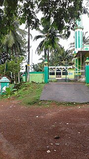
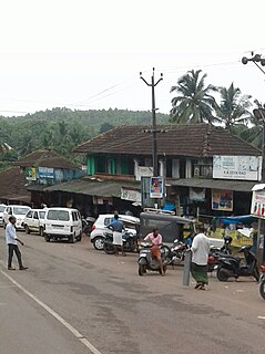
Ubrangala is a village in Kasaragod district in the state of Kerala, India. [1]

Kasaragod district Place in Kerala, India

Kasaragod District is one of the 14 districts in the southern Indian state of Kerala. Kasaragod became part of Kannur district following the reorganisation of states due to predominance of Malayalam speakers. Kasaragod was declared as a district on 24 May 1984.

Kerala State in southern India

Kerala is a state on the southwestern, Malabar Coast of India. It was formed on 1 November 1956, following passage of the States Reorganisation Act, by combining Malayalam-speaking regions. Spread over 38,863 km2 (15,005 sq mi), Kerala is the twenty second largest Indian state by area. It is bordered by Karnataka to the north and northeast, Tamil Nadu to the east and south, and the Lakshadweep Sea and Arabian Sea to the west. With 33,387,677 inhabitants as per the 2011 Census, Kerala is the thirteenth-largest Indian state by population. It is divided into 14 districts with the capital being Thiruvananthapuram. Malayalam is the most widely spoken language and is also the official language of the state.

India Country in South Asia

India, also known as the Republic of India, is a country in South Asia. It is the seventh largest country by area and with more than 1.3 billion people, it is the second most populous country as well as the most populous democracy in the world. Bounded by the Indian Ocean on the south, the Arabian Sea on the southwest, and the Bay of Bengal on the southeast, it shares land borders with Pakistan to the west; China, Nepal, and Bhutan to the northeast; and Bangladesh and Myanmar to the east. In the Indian Ocean, India is in the vicinity of Sri Lanka and the Maldives, while its Andaman and Nicobar Islands share a maritime border with Thailand and Indonesia.

Transportation

The western main road to Kasaragod have access to NH.66 which connects to Mangalore in the north and Calicut in the south. The road to the east connects to Sullia in Karnataka from where Mysore and Bangalore can be accessed. The nearest railway station is Kasaragod on Mangalore-Palakkad line. There is an airport at Mangalore.

Mangalore Corporation City in Karnataka, India

Mangalore, officially known as Mangaluru, is the chief port city of the Indian state of Karnataka. It is located about 352 km (219 mi) west of the state capital, Bangalore, between the Arabian Sea and the Western Ghats mountain range. It is the second major city in Karnataka state in all aspects after the capital city Bangalore. It is the only city in Karnataka to have all modes of transport — Air, Road, Rail and Sea along with 5 other major cities in India. It is also known as the Gateway of Karnataka. It is the largest city in the Tulu Nadu region of Karnataka. Mangalore is the second best business destination in Karnataka after Bangalore & 13th best in India. The population of the urban agglomeration was 623,841, according to the provisional results of the 2011 national census of India.

Karnataka State in southern India

Karnataka is a state in the south western region of India. It was formed on 1 November 1956, with the passage of the States Reorganisation Act. Originally known as the State of Mysore, it was renamed Karnataka in 1973. The state corresponds to the Carnatic region. The capital and largest city is Bangalore (Bengaluru).

Palakkad City in Kerala

Palakkadpronunciation , also known as Palghat, is a city and municipality in the state of Kerala in southern India, spread over an area of 26.60 km2 and is the administrative headquarters of the Palakkad District. The city is situated about 350 kilometres (217 mi) north of state capital Thiruvananthapuram and 54 kilometers south west of Coimbatore, and 66 km north east of Thrissur on the Salem-Kanyakumari National Highway NH 47.

Related Research Articles

Adhur village in Kerala, India

Adhur is a village in Kasaragod district in the state of Kerala, India.

Delampady village in Kerala, India

Delampady is a village in Kasaragod district in the state of Kerala, India.

Karadka village in Kerala, India

Karadka is a village in Kasaragod district in the state of Kerala, India.

Paivalike Village in Kerala, India

Paivalike is a village in Kasaragod district in the state of Kerala, India. Paivalike is 8 km far from the Uppala town and 38 km far from Mangalore city. A union of Pyvalicanz formed in UAE named as United Pyvalicanz.

Panayal village in Kerala, India

Panayal is a village in Kasaragod district in the state of Kerala, India. It is situated approximately 6 km inland from the coastal town of Bekal. Panayal is around 17 km by road from Kasaragod and around 16 km from Kanhangad. Sri Mahalingeshwara Aided Upper Primary School and the Sri Mahalingeshwara Shiva temple are located here. Panayal is known for the Theyyam art form performed in the many family shrines in the area.

Pavoor Village in Kerala, India

Pavoor is a village in Kasaragod district in the state of Kerala, India.

Chippar village in Kerala, India

Chippar is a village in Kasaragod district in the state of Kerala, India.

Heroor village in Kerala, India

Heroor is a village in Kasaragod district in the state of Kerala, India.

Kaliyoor, Kasaragod village in Kerala, India

Kaliyoor is a village in Kasaragod district in the state of Kerala, India.

Katukukke is a village in Kasaragod district in the state of Kerala, India.

Kayyar village in Kerala, India

Kayyar is a village in Kasaragod district in the state of Kerala, India.

Kidoor village in Kerala, India

Kidoor is a village in Kasaragod district in the state of Kerala, India.

Kodibail Locality in Kerala, India

Kodibail is a locality of Uppala in Kasaragod district in the state of Kerala, India. It is in the central region of Uppala.

Koliyoor village in Kerala, India

Koliyoor is a village in Kasaragod district in the state of Kerala, India.

Majibail village in Kerala, India

Majibail is a village in Kasaragod district in the state of Kerala, India.

Maniyat village in Kerala, India

Maniyat is a village in Kasaragod district in the state of Kerala, India.

Meenja Village in Kerala, India

Meenja is a grama Panchayat in manjeshwar taluk Kasaragod district in the state of Kerala, India who's capital is Miyapadav

Moodambail village in Kerala, India

Moodambail is a village in Kasaragod district in the state of Kerala, India.

Talikala is a village in Kasaragod district in the state of Kerala, India.

Mulleria, Kasaragod Town in Kerala, India

Mulleria is a Major town and Located in Karadka Panchayath, Kasaragod district in Kerala, India.

References

  1. "Census of India : List of villages by Alphabetical : Kerala". Registrar General & Census Commissioner, India. Retrieved 2008-12-10.