
Dehu is a holy place and a census town in Pune district in the state of Maharashtra, India.
Thiruninravur is a neighbourhood situated on the western part of Chennai, India. It is located around 29 km from Chennai Central railway station. Thirunindravur comes under Chennai Metropolitan Area. The neighbourhood is served by Thiruninravur railway station. It is famous for its temples. The Tiruninravur lake serves the neighbourhood for its water needs.

Nandivaram-Guduvancheri is a panchayat town located in Kancheepuram district in the Indian state of Tamil Nadu.

Padianallur is a census town in northern suburb of Chennai, Thiruvallur district in the Indian state of Tamil Nadu.

Raipur Rani is a census town in Panchkula district in the Indian state of Haryana. It is Located on the Chandigarh- Nahan-Paonta Sahib-Dehradun highway 30 kilometers east from the Chandigarh-Mohali-Panchkula urban cities combine. It is about 20 kilometers from the Dera Bassi Industrial belt and 10 kilometers from the Barwala industrial estate. Narayangarh in the Ambala District is the next large town in its proximity.

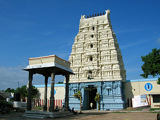
Turuvekere is a panchayat town and Taluk in Tumkur district in the Indian state of Karnataka.

Kanathur is a village in Turvekere taluk of Tumkur district, in the Indian state of Karnataka. There is a Venugopalaswamy temple in Kanathur.Just next to the temple, there is a house in which the Patel of Kanathur, K.H.Adi Narayana Rao lived.

Kottukkal is a village in Kollam district of Kerala, India. The historical importance of the village is linked to Kottukal cave temple, built before 800 CE. The village comes under Ittiva panchayath and it is the most prominent town in this panchayath. The village has many libraries such as Safder Hashmi library and Kairaly library. Attractions include the district agricultural farm. Ancient temples here include more than 6 temples surrendered in 3 kilometers of Kottukkal, such as the Cave temple.
Thrikkovilvattom is a village in Kollam district in the state of Kerala, India.
Kodumon is a village in Adoor Taluk of Pathanamthitta district in the state of Kerala, India.

Chundale is a town in Wayanad district in the state of Kerala, India. Chundale is located near Kalpetta, the district headquarters of Wayanad.
Aigali is a village in the southern state of Karnataka, India. It is located in the Athani taluk of Belgaum district in Karnataka.
Hirekudi is a village in the southern state of Karnataka, India. It is located in the Chikodi taluk of Belgaum district in Karnataka.
Itagi is a village in the southern state of Karnataka, India. It is located in the Khanapur taluk of Belgaum district in Karnataka.
Nandikurali is a village in the southern state of Karnataka, India. It is located in the Raybag taluk of Belgaum district in Karnataka.
Pattankudi is a village in the southern state of Karnataka, India. It is located in the Chikodi taluk of Belgaum district in Karnataka.
Telsang is a village in the southern state of Karnataka, India. It is located in the Athni taluk of Belgaum district in Karnataka. In Telsang, there are several temples, such as Venkateshwar Temple, Ellamma Temple, Sri Mallikarjuna and Basavanna Temple, Vithoba Temple, Shankarlinga Temple, Hanuman Temple and more in this village five great Matha Hirematha, Virakta matha, Sidramappan Matha Andani Matha and Horatti Matha.
Saunshi is a village in the northern state of Karnataka, India. It is located in the Kundgol taluk of Dharwad district in Karnataka. largest grma Panchayat in Dharwad District

Karimba is a gram panchayat in the Palakkad district, state of Kerala, India, near the National Highway 213. The largest town in Karimba panchayath is Kalladikode. It borders with Thachampara, Kongad and Mundur. Recently, it was awarded the Nirmal Gram Title (sanitation). It is the local government organisation that serves the villages of Karimba-I and Karimba-II.


