Azhikode | |
---|---|
![]() Gulikan Theyyam at Puthiya Mundayat | |
Coordinates: 11°54′27″N75°20′41″E / 11.907620°N 75.344630°E Coordinates: 11°54′27″N75°20′41″E / 11.907620°N 75.344630°E | |
Country | ![]() |
State | Kerala |
District | Kannur |
Government | |
• Type | Panchayati raj (India) |
Area | |
• Total | 15.98 km2 (6.17 sq mi) |
Population (2011) [1] | |
• Total | 47,323 |
• Density | 3,000/km2 (7,700/sq mi) |
Languages | |
• Official | Malayalam, English |
Time zone | UTC+5:30 (IST) |
PIN | 670009 |
ISO 3166 code | IN-KL |
Vehicle registration | KL-13 |
Nearest city | Kannur |
Azhikode is a coastal town situated in Kannur district of Kerala, India. Azhikode town is divided into Azhikode North and Azhikode South. The northern end of the Azhikode North is called Azhikkal. [2] The place is the birthplace of Sukumar Azhikode, an influential thinker and literary critic. It is about 12 km (7.5 mi) from Kannur city.
As of 2011 India Census, Azhikode north census town had population of 22,128 which constitutes 10,157 males and 11,971 females. Azhikode north has an area of 8.54 km2 (3.30 sq mi) with 4,503 families residing in it. Azhikode south census town had population of 25,195 where 11,369 are males and 13,826 are females. Azhikode south has an area of 7.44 km2 (2.87 sq mi) with 5,512 households.
Azhikode panchayat consists of Azhikode north and Azhikode south census towns. Azhikode Panchayat had total population of 47,323 which constitutes 21,526 males and 25,797 females. The male female sex ratio was 1198 higher than state average of 1084. Population in the age group 0-6 was 4,948 (10.45%). Azhikode panchayat had overall literacy of 97% higher than state average of 94%. Male literacy stands at 98.4% and Female literacy was 96%. [3]
Azhikode is famous for its beaches like
Kannur city is connected to Azhikode and Azhikkal from Payyambalam beach through Palliyamoola beach, Chal beach, Azhikode South, Meenkunnu Beach, Azhikode North and finally Azhikkal. Villages like Alavil, Manal, Chalad, Chirakkal, Puthiyatheru and Valapattanam are connected to Azhikode. There is a widespread demand to merge Azhikode, Valapattanam and Chirakkal panchayaths to Kannur Corporation.[ citation needed ]
The main areas of Azhikode North are Azhikkal, Chal beach and Kappakadavu and that of Azhikode South are Vankulathuvayal, Poothappara, Meenkunnu Beach, Neerkadavu Beach and Kappila peedika. Vankulathvayal is one of largest commercial centre in Azhikode.
Pin code of Azhikode is 670009
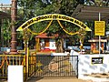
It is also the birthplace of famous personalities like Sukumar Azhikode and Shihabbuddin Poythumkadavu. Azhikode has large number of temples and mosques and is well connected with roads. Valapattanam railway station is the nearest railway station. It is well connected to the Kannur City via roads. Steady flow of buses in all directions provide a fluent system of transport.
Azhicode assembly constituency is part of Kannur (Lok Sabha constituency). [4]
Azhikkal estuary is the northern end of Azhikode village, where Valapattanam River empties into Arabian Sea. The place has bus stand, a small river port and a fishing harbour. It is the site for a proposed expanded cargo port. [5] The Indian Coast Guard Academy is under construction at Irinave, near to Azhikkal. [6]
Kannur is one of the 14 districts along the west coast in the state of Kerala, India. The city of Kannur is the district headquarters and gives the district its name. The old name, Cannanore, is the anglicized form of the Malayalam name "Kannur". Kannur district is bounded by Kasaragod District to the north, Kozhikode district to the south, Mahé district to the southwest and Wayanad District to the southeast. To the east, the district is bounded by the Western Ghats, which forms the border with the state of Karnataka. The Arabian Sea lies to the west. Paithalmala is the highest point in Kannur District (1,372m). Enclosed within the southern part of the district is the Mahé district of the Union Territory of Puducherry. The district was established in 1957.
Taliparamba is a Municipality in Taliparamba taluk of Kannur district, Kerala, India. The municipal town spreads over an area of 18.96 square kilometres (7.32 sq mi) and is inhabited by 44,247 number of people.
Kannur, formerly known in English as Cannanore, Arabic as Kannanur, and Portuguese as Cananor, is a city and a Municipal Corporation in the state of Kerala, India. It is the administrative headquarters of the Kannur district and situated 274 kilometres (170 mi) north of the major port city & commercial hub Kochi & 137 kilometres (85 mi) south of the major port city & a commercial hub, Mangalore. During the period of British colonial rule in India, when Kannur was a part of the Malabar District, the city was known as Cannanore. Kannur is 6th largest urban agglomeration in Kerala. As of 2011 census, Kannur Municipal Corporation, the local body which administers mainland area of city, had a population of 232,486.
Payyannur, IPA: [pɐjːɐn̺ːuːɾ], is a Municipal town and a Taluk in Kannur district of Kerala, India. On 10 March 2018, Kerala Chief Minister Pinarayi Vijayan inaugurated Payyannur as the fifth taluk in the district. Payyanur taluk comprises 22 villages including 16 de-linked from the Taliparamba taluk and six from the Kannur taluk. The town is situated on the banks of the Perumba River.
Valapattanam is a census town in the Kannur district, located in the Indian state of Kerala. It is also the smallest panchayat in Kerala. Its area is 2.04 sqr Km. It is about 7 km north of Kannur. Valapattanam is known for its communal harmony. On one side Kalarivathukkal Temple is located and on the other bank there is "Kakkulangara Mosque".
Kannur Beach is a group of five beaches on the western side of Kannur city in Kerala, India. They are
Chalad is a town which is near to Kannur city in Kerala state, South India. It is part of the Kannur Municipal Corporation.
Pappinisseri is a census town in Kannur district in the Indian state of Kerala. Pappinisseri Panchayat comprises two villages viz Pappinisseri and Aroli. Pappinisseri better known for visha chikitsa kendram
Udma is a census town in Kasaragod district in the Indian state of Kerala.
Mayyil is a Census Town and Grama Panchayat in Kannur District of Kerala State. Mayyil Panchayat established in 1962 by merging the villages of Kayaralam, Mayyil and Kandakkai.
Sreekandapuram is a municipality in Kannur district, in the Indian state of Kerala.
Chirakkal is a census town in Kannur district in the state of Kerala, India. It is a suburb of Kannur city of about 7 km away.
Koodali is a census town in Thalassery taluk of Kannur district in Kerala state, India. Koodali is located 15.5 km (9.6 mi) east of Kannur city on Kannur-Mattanur road.
Cherupuzha is a town in Kannur district, Kerala, India. It is the headquarters of the Cherupuzha Panchayat which is a special grade panchayat in Kerala.
Cherukunnu is a census town in Kannur district in the Indian state of Kerala. Cherukunnu town is located on Valapattanam-Pappinisseri-Pazhayangadi main road, situated to the south of the Pazhayangadi in Kannur District of North Malabar region in Kerala.
Kannur, India has a number of tourist attractions including beaches, hills, temples and other monuments.
Kannur district is politically organized into a complex web of taluks, blocks, panchayaths and villages. In addition, there are also parliamentary divisions called Assembly constituencies and Lok Sabha constituencies.
Kolachery is a census town and Grama Panchayat in Kannur District of Kerala state, India. Kolachery is located 15 kilometres (9.3 mi) north east of Kannur city.
Kannur taluk is an administrative division of Kannur district of Kerala, India. Kannur district is divided into five taluks, Thalassery, Kannur, Payyanur, Iritty and Taliparamba. Thalassery has 35 villages, Kannur has 28, Payyanur has 22, Taliparamba has 28 villages and Iritty has 19 villages.
The Kannur Corporation, also known as Corporation of Cannanore, is the municipal corporation that administers the city of Kannur (Cannanore), Kerala. Established in 2015, the Corporation's first mayor was E. P. Latha. Kannur Corporation has two assembly constituencies – Kannur and Azhikode – both of which are part of the Kannur parliamentary constituency. The Corporation is headed by a Mayor and council, and manages 78.35 km2 of Kannur city, with a population of about 232,486 within that area.
![]() | Wikimedia Commons has media related to Azhikode, Kannur . |