Thana, Kannur

Last updated

Thana
Commercial Centre
Sadhoo Kalyana Mandapam, Kannur.jpg
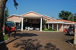
Sadhoo Auditorium, Thana, Kannur.
India Kerala location map.svg
Red pog.svg
Thana
Location in Kerala, India
Coordinates: 11°52′0″N75°22′0″E / 11.86667°N 75.36667°E / 11.86667; 75.36667 Coordinates: 11°52′0″N75°22′0″E / 11.86667°N 75.36667°E / 11.86667; 75.36667
CountryFlag of India.svg  India
State Kerala
District Kannur
Government
  TypeMunicipal Corporation
  Body Kannur Municipal Corporation
Languages
  Official Malayalam, English
Time zone UTC+5:30 (IST)
ISO 3166 code IN-KL
Vehicle registration KL-13

Thana is a commercial center in the city of Kannur in Kerala, South India.

Contents

It is a main Commercial center and junction in NH 66 (National Highway 66) within Kannur Municipal Corporation. From this junction the highway proceeds south to Thalassery, and proceeds north towards Taliparamba. The road to east goes to Kakkad, and the road to west goes to the Kannur old City.

Some shopping centres and private hospitals are situated around Thana. The District Ayurvada Hospital is situated very near to this junction. The headquarters of North Malabar Chamber of Commerce is also situated nearby.

Hospitals

Schools

Photos

Karuvalli Kavu Temple, Thana, Kannur Karuvalli-Kavu-Thana.JPG
Karuvalli Kavu Temple, Thana, Kannur

Related Research Articles

Taliparamba Municipality in Kerala, India

Taliparamba is a Municipality in Taliparamba taluk of Kannur district, Kerala, India. The municipal town spreads over an area of 18.96 square kilometres (7.32 sq mi) and is inhabited by 44,247 number of people.

Iritty Municipality in Kerala, India

Iritty is a Municipality and a Taluk of Kannur district in Kerala State, India. The town is the main market place for the farmer communities in the surrounding regions. Iritty is known as The Coorg Valley in God's Own Country. Iritty is one of the fastest upcoming towns in Kerala with the distance of 19.5 km (12.1 mi) from Kannur International Airport and one among five taluks in Kannur district. Iritty is one of the major towns lies between Coorg and Kannur international airport -Mattanur.

Vatakara Municipality in Kerala, India

Vatakara, also spelled Vadakara, IPA: [ʋɐɖɐgɐɾɐ], French: Bargaret, is a coastal town in the Kozhikode district in the state of Kerala, India. Vatakara is located between Kannur and Quilandy. The municipality of Vatakara covers an area of 23.33 km2 (9.01 sq mi) and is bordered by Mahé to the north and Payyoli to the south. It is the headquarters of Vatakara taluk, which consists of 22 panchayats. During the reign of the Kolathiris and Zamorins, Vatakara was known as Kadathanadu. During the British Raj, it was part of the North Malabar region of Malabar District in the state of Madras. The historic Lokanarkavu temple, made famous by the Vadakkan Pattukal, is situated in Vatakara. A new tardigrade species collected from Vadakara coast has been named after Kerala State; Stygarctus keralensis.

Mattanur Municipality in Kerala, India

Mattanur, also spelled Mattannur, is a town, municipality, and an aerotropolis in Kannur district, Kerala, India. Mattanur is about 27 km east of Kannur and Thalassery, two major towns of the district.

Kuthuparamba Municipality in Kerala, India

Kuthuparamba is a town and a municipality in the Kannur district, state of Kerala, India. It is about 24 km south east of Kannur and 14 km east of Thalassery.

Kannur South Small Town in Kerala, India

Kannur South or Chovva or Thottada is a heart of Kannur and also a residential suburb in Kannur District of Kerala, India, which mainly consists of two areas - Thazhe Chovva and Mele Chovva. The National Highway 66 runs through both Thazhechovva and Melechovva. The name Chovva is believed to be derived from the Malayalam word "Chovvu" meaning propriety. Mele and Thazhe are Upper and Lower respectively, indicating that Mele Chovva is relatively at higher altitude compared with Thazhe chovva

Pappinisseri Census Town in Kerala, India

Pappinisseri is the only grama panchayath in Kannur district in the Indian state of Kerala to have consistently won the Swaraj Trophy for best grama panchayath from 2017-2018 to 2021. Pappinisseri Panchayat also bagged the third position in the Swaraj Trophy during 2015-2016. Pappinisseri Panchayat comprises two villages viz Pappinisseri and Aroli. Pappinisseri better known for visha chikitsa kendram

Peralasseri Census Town in Kerala, India

Peralasseri is a census town and Panchayat headquarters in Kannur district in the Indian state of Kerala, situated on the Kannur-Kuthuparamba State Highway 38 (Kerala), 12 km from Kannur city, on the bank of Anjarakandy river.

Vengad Town in Kerala, India

Vengad is a gram panchayat situated in Thalassery taluk, Kannur district, Kerala, India, on the banks of the Anjarakandi River. Vengad is famous for its black pepper and handloom. One state seed farm is located in Vengad. Vengad gram panchayat consists of 21 wards; viz Pattathari (1), Kallayi (2), Vengad Angadi (3), Vengad Metta (4), Vengad Theru (5), Oorppalli (6), Kaitheripoyil (7), Valankichal (8), Pathiriyad (9), Pachapoika (10), Parambayi (11), Kelalur (12), Mambaram (13), Poyanad (14), Keezhathur Balavadi (15), Keezhathur Vayanasala (16), Kuzhiyil Peedika (17), Mailulli (18), Kunnirikka (19), Paduvilayi (20) and Thattari (21).

Anjarakkandy Census Town in Kerala, India

Anjarakandy is a census town and grama panchayat in Kannur district of Kerala, India. Anjrakandy river is flowing through Anjarakandy town.

Sreekandapuram Municipality in Kerala, India

Sreekandapuram is a municipality in Kannur district, in the Indian state of Kerala.

Uppala Town in Kerala, India

Uppala is a town and Headquarters of Manjeshwaram Taluk in Kasaragod district, Kerala, India. It is geographically located midway from Kasaragod to Mangalore. It is 22 km north of Kasaragod and one of the fastest growing urban settlements in Kasaragod district. It is well known as an important trade hub in the northernmost part of Kerala state.

Punnakkulangara village in Kerala, India

Punnakkulangara is a significant part as well as a Municipal Ward of Anthoor Municipality in Kannur district of Kerala, India.

Cherupuzha (Kannur) Town in Kerala, India

Cherupuzha is a town in Kannur district, Kerala, India. It is the headquarters of the Cherupuzha Panchayat which is a special grade panchayat in Kerala.

Pattuvam Village in Kerala, India

Pattuvam is a village in Kannur district, Kerala, India. It is bounded by Kuppam river on the north-west-south directions. It shares border with Taliparamba municipality on the east. A joint-less bridge over Kuppam river which connects Pattuvam to Kottakkeel of Ezhome village in northwest direction was inaugurate by Chief Minister of Kerala Pinarayi Vijayan in January 2017.

Chemperi Town in Kerala, India

Chemperi is a town on the bank of the Chemperi River, in the Western Ghat, in the Kannur district of South India. Chemperi is often referred as the education city of Kannur with the establishment of Vimal Jyothi Engineering College, Chemperi. It is characterized by its production and export of rubber and spices, its beautiful hillocks, and its serene streams. Village and Panchayath of Chemperi is Eruvessi. Both Panchayath and Village offices of Eruvessi are located in Chemperi. Also Lourde Matha Forane Church, Chemperi is another attraction.Paithalmala and Palakkayam thatt is also a few kilometres away from here.

Cherukunnu Census Town in Kerala, India

Cherukunnu is a census town in Kannur district in the Indian state of Kerala. Cherukunnu town is located on Valapattanam-Pappinisseri-Pazhayangadi main road, situated to the south of the Pazhayangadi in Kannur District of North Malabar region in Kerala.

Muttom, Thodupuzha Gram Panchayat in Kerala, India

Muttom is a rural area in Idukki district in the Indian state of Kerala. This place is 66 km away from Cochin. Geographically this place is part of Midland or Idanad region of Kerala. Hindus, Christians and Muslims are living peacefully in the area.

Chakkalakkal is a place in Kozhikode district in Kerala, India, located about 20 km east of Kozhikode city on the Kunnamangalam-Nanminda road or Kappad-Thusharagiri-Adivaram road. Nearby places are Koduvally, Narikkuni, and Arambram. The only government-aided higher secondary school in Madavoor village is situated in Chakkalakkal. Chakalakal is a populous place with a population of over 1000. This place has come into news due to the protest against destruction of knolls for the Chakkalakkal higher secondary school.

Dharmashala, Kannur Town in Kerala, India

Dharmashala is a small town and headquarters of the Anthoor Municipality in Kannur district of the North Malabar region in the Indian state of Kerala. It is located near National Highway 66 between Kannur and Taliparamba. It is located about 16 kilometres (9.9 mi) north of Kannur. Dharmashala is an important educational and industrial hub in the Kannur district and also an important tourism destination of Malabar region. Dharmashala is a major government officials settlement area in Kannur. A large number of migrant labourers from various other states are working in the industrial development area in Dharmashala. Students from various parts of country study at institutes such as NIFT. Nearby important institutions and attractions are the Kerala Armed Police (KAP) 4th Battalion Mangattuparamba, Government College of Engineering Kannur, Kannur University, KELTRON, Vismaya water theme park, Parassinikkadavu Shree Muthappan temple, Doordarshan kendra, Parassinikkadavu Snake Park, Industrial Development Plot, Central School, EK Nayanar memorial women and child hospital, Si-met college of nursing, M.V.R memorial Ayurveda Medical College, Institute of Co-operative Management (ICM), National Institute of Fashion Technology, Vellikkeel eco tourism park, Hi-Five sports indoor stadium, Kerala Clays and Ceramics Ltd. etc.