Kannur is one of the 14 districts along the west coast in the state of Kerala, India. The city of Kannur is the district headquarters and gives the district its name. The old name, Cannanore, is the anglicized form of the Malayalam name "Kannur". Kannur district is bounded by Kasaragod District to the north, Kozhikode district to the south, Mahé district to the southwest and Wayanad District to the southeast. To the east, the district is bounded by the Western Ghats, which forms the border with the state of Karnataka. The Arabian Sea lies to the west. Paithalmala is the highest point in Kannur District (1,372m). Enclosed within the southern part of the district is the Mahé district of the Union Territory of Puducherry. The district was established in 1957.

Kannur, formerly known in English as Cannanore, Arabic as Kannanur, and Portuguese as Cananor, is a city and a Municipal Corporation in the state of Kerala, India. It is the administrative headquarters of the Kannur district and situated 274 kilometres (170 mi) north of the major port city & commercial hub Kochi & 137 kilometres (85 mi) south of the major port city & a commercial hub, Mangalore. During the period of British colonial rule in India, when Kannur was a part of the Malabar District, the city was known as Cannanore. Kannur is 6th largest urban agglomeration in Kerala. As of 2011 census, Kannur Municipal Corporation, the local body which administers mainland area of city, had a population of 232,486.

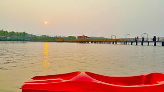
Kannur Beach is a group of five beaches on the western side of Kannur city in Kerala, India. They are
- Payyambalam Beach
- Meenkunnu Beach
- Adikadalayi Beach
- Baby Beach
- Thayyil Beach

St. Angelo Fort is a fort facing the Arabian Sea, situated 3 km from Kannur, a city in Kerala state, south India.

Tellicherry Fort is in Thalassery (Tellicherry) a town in Kannur District of Kerala state in south India. Thalassery was one of the most important European trading centers of Kerala. The Fort lies on the group of low wooden hill running down to sea and protected by natural waters. It has been the main opening for the rich spices, hill products and timber of the vast inter-land.
The Sultan Ali Raja or Ali Raja or Adi Raja was the title of the Muslim king of Arakkal kingdom from the sixteenth to early nineteenth century.

Malabar District, also known as Malayalam District, was an administrative district on the southwestern Malabar Coast of Bombay Presidency (1792-1800) and Madras Presidency (1800-1947) in British India, and independent India's Madras State (1947-1956). It was the most populous and the third-largest district in the erstwhile Madras State. The British district included the present-day districts of Kannur, Kozhikode, Wayanad, Malappuram, Palakkad, Chavakad Taluk and parts of Kodungallur Taluk of Thrissur district, and Fort Kochi area of Ernakulam district in the northern and central parts of present Kerala state, the Lakshadweep Islands, and a major portion of the Nilgiris district in Tamil Nadu. The detached settlements of Tangasseri and Anchuthengu, which were British colonies within the kingdom of Travancore in southern Kerala, also formed part of Malabar District until 1927. Malayalam was administrative as well as most spoken Lingua franca of Malabar District during British Rule. Jeseri, a distinct dialect of Malayalam, was spoken in the Laccadive Islands. Malabar District merged with the erstwhile state of Travancore-Cochin (1950-1956) to form Kerala according to the States Reorganisation Act, 1956. On the same day, the present Kasaragod district of South Canara District was also attached to Malabar, and the Laccadive&Minicoy Islands of Malabar were reorganised to form a new Union Territory. Malabar was trifurcated to form the districts of Kannur, Kozhikode, and Palakkad, on 1 January 1957.
Irikkur is a census town in Kannur District of Kerala state, India.
Ayikkara is one of the 55 divisions of Kannur Municipal Corporation in Kannur district of Kerala state, India. Kannur fort, and the Mappila Bay is near Ayikkara.

Marakkarkandy is a small coastal village in Kannur district of Kerala state, south India. It is 2 km from Kannur City and 6 km from Kannur town. People from all religions reside in this small city and is famous for its communal harmony. It was under the rule of Arakkal Adi Raja before independence. Rajiv Gandhi Mini Stadium located in this small village plays a major role in enhancing and developing sports and other related activities among youths. Shamna Kasim, one of the most talented and leading actresses in Indian movies hails from this town.

Dharmadom or Dharmadam is a census town in Thalassery taluk of Kannur district in the state of Kerala, India. This town is located in between Anjarakandi River and Ummanchira river, and Palayad town and Arabian sea. It is known for the 100-year-old Government Brennen College and Dharmadam Island. Dharmadam is also home to famous Andaloor Kavu. The annual festival here draws thousands of devotees. A variety of theyyams are performed during the week-long fest in February. During the festive season the entire village follows vegetarian diet and offers rice flakes, jaggery and plantains to all guests. India's premier circus Academy, Circus Academy Thalassery is also located at Dharmadam. There is a small railway station in Dharmadam where only the local passenger trains stop.

Kannur Cantonment, situated in Burnassery or Burnshire(the anglicized name), is a cantonment town in Kannur district in the Indian state of Kerala, between Kannur town and Kannur City. The cantonment was a military camp for Portuguese, Dutch and British rulers, and is now the headquarters of Defence Security Corps.

The Arakkal Museum is a museum dedicated to the Arakkal family, the only Muslim royal family in Kerala, India. The museum is actually a section of the Arakkalkettu. The durbar hall section of the palace has been converted into a museum by the Government of Kerala. It was opened in July 2005 after a Rs. 9,000,000 renovation.

The Kannur Lighthouse is located near the Payyambalam Beach, a few kilometers from Kannur town, in Kerala state, south India. It is adjacent to the Sea View Park and the Government Guest House. The lighthouse is still active and overlooks the Arabian Sea.
North Malabar refers to the geographic area of southwest India covering the state of Kerala's present day Kasaragod, Kannur, and Wayanad districts, and the taluks of Vatakara, Koyilandy, and Thamarassery in the Kozhikode District of Kerala and the entire Mahé Sub-Division of the Union Territory of Puducherry. Traditionally North Malabar is defined as the northern portion of erstwhile Malabar District which lies between Chandragiri River and Korapuzha River. The region between Netravathi River and Chandragiri River, which included the portions between Mangalore and Kasaragod, are also often included in the term North Malabar, as the Kumbla dynasty in the southernmost region of Tulu Nadu, had a mixed lineage of Malayali Nairs and Tuluva Brahmins.

Arakkal kingdom was a Muslim kingdom in Kannur town in Kannur district, in the state of Kerala, South India. The king was called Ali Raja and the ruling queen was called Arakkal Beevi. Arakkal kingdom included little more than the Cannanore town and the southern Laccadive Islands, originally leased from the Kolattiri. The royal family is said to be originally a branch of the Kolattiri, descended from a princess of that family who converted to Islam. They owed allegiance to the Kolattiri rulers, whose ministers they had been at one time. The rulers followed the Marumakkathayam system of matrilineal inheritance, a system which is unique to a section of Hindus of Kerala. Under Marumakkathayam, the succession passes to the male offspring of its female members, in other words from a man to his sister's son and so forth. As the only Muslim rulers in Malabar, they saw the rise of Hyder Ali, de facto ruler of the Mysore Sultanate as the opportunity to increase their own power at the expense of Chirakkal, and invited him to invade Kerala. Arakkal Sultan is a living descendant of the Arakkal dynasty at Konni in Pathanamthitta district.

Kannur, formerly known in English as Cannanore, Arabic as Kannanur, and Portuguese as Cananor, is a city and a Municipal Corporation in North Malabar region, state of Kerala, India. It is the largest city in North Malabar, which is the northernmost region of Kerala. It is sometimes identified Kolathunadu, which was ruled by the Kolathiris. In the 12th and 13th centuries there was trade with Persia and Arabia.
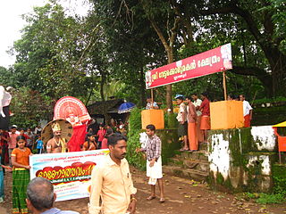
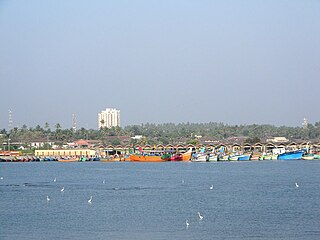
Kannur, India has a number of tourist attractions including beaches, hills, temples and other monuments.

The Kannur Corporation, also known as Corporation of Cannanore, is the municipal corporation that administers the city of Kannur (Cannanore), Kerala. Established in 2015, the Corporation's first mayor was E. P. Latha. Kannur Corporation has two assembly constituencies – Kannur and Azhikode – both of which are part of the Kannur parliamentary constituency. The Corporation is headed by a Mayor and council, and manages 78.35 km2 of Kannur city, with a population of about 232,486 within that area.


