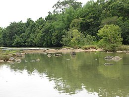
Pathanamthitta District, is one of the 14 districts in the Indian state of Kerala. The district headquarters is in the town of Pathanamthitta. There are four municipalities in Pathanamthitta: Adoor, Pandalam, Pathanamthitta and Thiruvalla.

Wayanad is a district in the north-east of the Indian state of Kerala, with administrative headquarters at the municipality of Kalpetta. It is the only plateau in Kerala. The Wayanad Plateau forms a continuation of the Mysore Plateau, the southern portion of the Deccan Plateau. It is set high in the Western Ghats with altitudes ranging from 700 to 2,100 meters. Vellari Mala, a 2,240 m (7,349 ft) high peak situated on the trijunction of Wayanad, Malappuram, and Kozhikode districts, is the highest point in Wayanad district. The district was formed on 1 November 1980 as the 12th district in Kerala, by carving out areas from Kozhikode and Kannur districts. An area of 885.92 km2 in the district is forested. Wayanad has three municipal towns—Kalpetta, Mananthavady and Sulthan Bathery. There are many indigenous tribes in this area. The Kabini River, a tributary of the Kaveri River, originates at Wayanad. Wayanad district, along with the Chaliyar valley in the neighbouring Nilambur in Malappuram district, is known for natural gold fields, which are also seen in other parts of the Nilgiri Biosphere Reserve. The Chaliyar river, which is the fourth longest river of Kerala, originates on the Wayanad plateau. The historically important Edakkal Caves are located in Wayanad district.

Ponmudi is a hill station in the Peringamala gramapanchayath of Trivandrum District of Kerala in India. It is located 22km west of Vithura town, 53 km north-east of Trivandrum City, 78 km south-east of Varkala town and 69 km north-east of Kovalam Beach at an altitude of 1,100 m (3,600 ft). Ponmudi (Varayadumotta) peak is a part of the Western Ghats mountain range that runs parallel to the Arabian Sea. Ponmudi is a popular honeymoon destination in South India. The normal temperature of Ponmudi is between 18 and 25 °C.
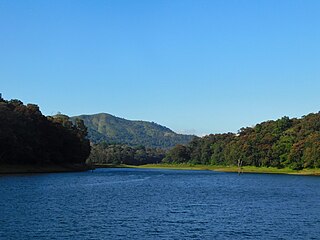
Thekkady is a town near Periyar National Park, an important tourist attraction in the Kerala state of India. The name Thekkady is derived from the word "thekku" which means teak. Temperatures are lowest in the months of December–January and highest in the months of April–May.

The Kerala backwaters are a network of brackish lagoons and canals lying parallel to the Arabian Sea of the Malabar coast of Kerala state in south-western India. It also includes interconnected lakes, rivers, and inlets, a labyrinthine system formed by more than 900 km (560 mi) of waterways, and sometimes compared to bayous. The network includes five large lakes linked by canals, both man made and natural, fed by 38 rivers, and extending virtually half the length of Kerala state. The backwaters were formed by the action of waves and shore currents creating low barrier islands across the mouths of the many rivers flowing down from the Western Ghats range. In the midst of this landscape there are a number of towns and cities, which serve as the starting and end points of backwater cruises. There are 34 backwaters in Kerala. Out of it, 27 are located either closer to Arabian Sea or parallel to the sea. The remaining 7 are inland navigation routes.
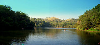
Pookode Lake is a scenic freshwater lake in the Wayanad district in Kerala, South India. A major tourist destination in the district, Pookode is a natural freshwater lake nestling amid evergreen forests and mountain slopes at an elevation of 770 meters above sea level. It is 15 km away from Kalpetta. It is the smallest and highest elevation freshwater lake in Kerala.

The Kabini River(Kapila River) is one of the major tributaries of the river Cauvery in southern India, It originates near Kavilumpara in Kozhikode district of Kerala state by the confluence of the Panamaram River and the Mananthavady River. It flows eastward through Wayanad district, entering Mysore district of Karnataka, to join the Kaveri River in Mysore district of Karnataka.
The term Malabar rainforests refers to one or more distinct ecoregions recognized by biogeographers:
- the Malabar Coast moist forests formerly occupied the coastal zone to the 250 metre elevation
- the South Western Ghats moist deciduous forests grow at intermediate elevations
- the South Western Ghats montane rain forests cover the areas above 1000 metres elevation

Wayanad Wildlife Sanctuary is a wildlife sanctuary in Wayanad, Kerala, India with an extent of 344.44 km2 (132.99 sq mi) and four hill ranges namely Sulthan Bathery, Muthanga, Kurichiat and Tholpetty. A variety of large wild animals such as gaur, Indian elephant, deer and Bengal tiger are found there. There are also quite a few unusual birds in the sanctuary. In particular, Indian peafowl tend to be very common in the area. Wayanad Wildlife Sanctuary is the second largest wildlife sanctuary in Kerala. It is bestowed with lush green forests and rich wildlife. This wildlife area houses some of the rare and endangered species of both flora and fauna.

Periyar National Park and Wildlife Sanctuary (PNP) is a protected area located in the districts of Pathanamthitta and Idukki in Kerala, India. It is a renowned Elephant and Tiger reserve. The protected area encompasses 925 km2 (357 sq mi), of which 305 km2 (118 sq mi) of the main zone was declared as the Periyar National Park in 1982. The park is a repository of rare, endemic, and endangered flora and fauna and forms the major watershed of two important rivers of Kerala: the Periyar and the Pamba.
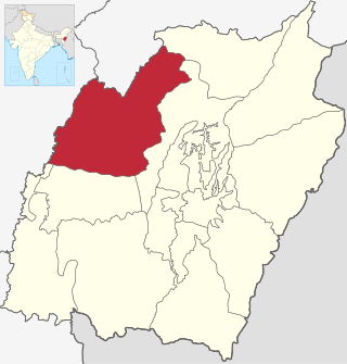
Tamenglong district is one of the 16 districts of Manipur state in northeastern India. In 2011, Tamenglong was the least populous district in Manipur. In 2016, the Nungba subdivision was separated as a separate district.

Chalakudy River or Chalakudy Puzha is the fifth longest river in Kerala, India. The river flows through Thrissur district, Palakkad district and Ernakulam district of Kerala. The total drainage area of the river is 1704 km2. Out of this, 1404 km2 lies in Kerala and the rest in Tamil Nadu. The length of the river is 145.5 km. Though Chalakudy River in strict geological sense is a tributary of the Periyar river, for all practical purposes it is treated as a separate river by Government and other agencies. The river has gained its name since it flows along the banks of the Chalakudy Town, the major settlement along the course of the river. It is perhaps the most unpolluted and pristine river in the state and even in India due to the limited amount of industries and wastage disposal around it. Chalakudy River and its basin area were one of the most affected rivers during the 2018 Kerala floods.

Kerala, a state situated on the tropical Malabar Coast of southwestern India, is one of the most popular tourist destinations in the country. Named as one of the ten paradises of the world by National Geographic Traveler, Kerala is famous especially for its ecotourism initiatives and beautiful backwaters. Its unique culture and traditions, coupled with its varied demography, have made Kerala one of the most popular tourist destinations in the world. Several international agencies ranging from UNESCO to National Geographic have recognised the state's tourism potential. Kerala was named by TIME magazine in 2022 among the 50 extraordinary destinations to explore in its list of the World's Greatest Places. In 2023, Kerala was listed at the 13th spot in The New York Times' annual list of places to visit and was the only tourist destination listed from India.

Lakkidi is a rain forest located in a gateway of the Wayanad district of the Indian state of Kerala. During British Raj, a horse track in Wayanad attracted European investors and traders. They cultivated Malabar pepper, spices, tea, and coffee. National Highway 766 connects Kozhikode in Kerala with Kollegal in Karnataka via Mysore, creating business opportunities in tourism and agriculture. Lakkidi is surrounded by a biodiverse environment and unspoiled nature which attracts visitors interested in bird-watching, trekking, and off-roading. Jawahar Navodaya Vidyalaya is situated there.

Chempanoda/Chempanod is a village located in the northeastern part of the Kozhikode district of Kerala, India. It is situated near the popular tourist destination of Peruvannamuzhi.

Kattikkulam (Kartikulam) is a small town near Mananthavady in Wayanad district, Kerala, India.The office of the Thirunelly Gramapanchayath is located at Kartikulam.
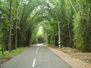
The Wayanad District of Kerala, India has a wide variety of tourist attractions ranging from religious sites to natural and historical sites. This district is divided into three towns: Kalpetta, Sultan Bathery and Mananthavady. All Major Tourism destinations in the district are maintained by the District Tourism Promotion Council.

Tsitongambarika is a 58,597 ha protected area of lowland forest in the Anosy region of southeast of Madagascar, to the north of Fort-Dauphin. The area supports rare species of amphibians, birds, lemurs and reptiles, many of which are endemic. In 2001, the site was designated as an Important Bird Area by BirdLife International, and in 2015 an area of 58,957 ha received protection by the government under Decree No. 2015-720 of 21 April 2015.
Khadim Nagar National Park is a major national park and nature reserve in Bangladesh. The park is located at Sylhet Sadar Upazila, Sylhet District in the North-East region of the country. It is located mainly on the Hills and is surrounded by Kalagool, Bhurjan and Goolni tea estates. Khadim Nagar National Park covers approximately 679 ha (6.79 km2) of evergreen forests Biome. The British colonial people cleared the land for extensive tea plantations. After 1950 tree plantations of teak, Garjan, Bamboo, Champa, Agar, Akashmoni, Eucalyptus and Acacia Mangium was carried out by Forest Department. The Forest was declared as national park by the Bangladesh government on 13 April 2006 under the Bangladesh wildlife (Preservation) Amendment Act of 1947. The present forest is divided into 6 forest working circles. The forest area has LR plantations- 380 Ha, SR Plantations-10 Ha, Bamboo Plantations-150Ha, Cane plantations-258Ha and Agar Plantations-40ha.

