
Alappuzha district, is one of the 14 districts in the Indian state of Kerala. It was formed as Alleppey district on 17 August 1957, the name of the district being changed to Alappuzha in 1990, and is the smallest district of Kerala. Alleppey town, the district headquarters, was renamed Alappuzha in 2012, even though the anglicised name is still commonly used to describe the town as well as the district.

Kumarakom is a popular tourism destination located near the city of Kottayam, in Kerala, India, famous for its backwater tourism. It is set in the backdrop of the Vembanad Lake, the largest lake in the state of Kerala. In January 2023, when Kerala was chosen by the New York Times as one among the 52 must-see tourist destinations in the world, Kumarakom got a special mention for its backwater tourism.

The Kerala backwaters are a network of brackish lagoons and canals lying parallel to the Arabian Sea of the Malabar coast of Kerala state in south-western India. It also includes interconnected lakes, rivers, and inlets, a labyrinthine system formed by more than 900 km (560 mi) of waterways, and sometimes compared to bayous. The network includes five large lakes linked by canals, both man made and natural, fed by 38 rivers, and extending virtually half the length of Kerala state. The backwaters were formed by the action of waves and shore currents creating low barrier islands across the mouths of the many rivers flowing down from the Western Ghats range. In the midst of this landscape there are a number of towns and cities, which serve as the starting and end points of backwater cruises. There are 34 backwaters in Kerala. Out of it, 27 are located either closer to Arabian Sea or parallel to the sea. The remaining 7 are inland navigation routes.
Vembanad is the longest lake in India, as well as the largest lake in the state of Kerala. The lake has an area of 230 square kilometers and a maximum length of 96.5 km. Spanning several districts in the state of Kerala, it is known as Vembanadu Lake in Kottayam, Vaikom, Changanassery, Punnamada Lake in Alappuzha, Punnappra, Kuttanadu and Kochi Lake in Kochi. Several groups of small islands including Vypin, Mulavukad, Maradu, Udayamperoor, Vallarpadam, and Willingdon Island are located in the Kochi Lake portion. Kochi Port is built around the Willingdon Island and the Vallarpadam island.

Kuttanad is a region covering the Alappuzha, Kottayam and Pathanamthitta Districts, in the state of Kerala, India, well known for its vast paddy fields and geographical peculiarities. The region has the lowest altitude in India, and is one of the few places in the world where farming is carried on around 1.2 to 3.0 metres below sea level. Kuttanad is historically important in the ancient history of South India and is the major rice producer in the state. Farmers of Kuttanad are famous for Biosaline Farming. Food and Agriculture Organization (FAO) has declared the Kuttanad Farming System as a Globally Important Agricultural Heritage System (GIAHS) in 2013.

Pampady is a fast growing town in Kottayam district of Kerala, Southern India. It lies midway between the backwaters of Western Kerala and the mountains of the Western Ghats.

Marari Beach is a beach at Mararikulam village in Alappuzha District of Kerala, India, 11 km from Alappuzha (Alleppey) town.

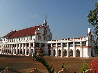
Uzhavoor is an expanding town in Kottayam district, Kerala in India. It is just 32 km away from the administrative capital Kottayam District. Most of its residents are either wealthy farmers or businessmen. Many of the houses belong to NRIs. The tenth President of India, K. R. Narayanan, was born and brought up in this village. The newly expanded road which connects the city of Pala and other destinations such as Sabarimala to the city of Muvattupuzha passes through Uzhavoor. The town is 177 km from the state capital Thiruvananthapuram.
Alappuzha or Alleppey is the administrative headquarters of Alappuzha district in state of Kerala, India. The Backwaters of Alappuzha are one of the most popular tourist attractions in India which attracts millions of domestic and international tourists.

Kainakary is a village in Kuttanad Taluk in Alappuzha District of the Indian state of Kerala.
Edathua is a small village in Kuttanad, Alappuzha district, Kerala, India. It is located 12 km from Thiruvalla city center, National Highway 183 and the Thiruvalla railway station.

Kerala State Water Transport Department (SWTD) is a governmental department that regulates the inland navigation systems in the Indian state of Kerala and provides inland water transport facilities. It stands for catering to the traffic needs of the inhabitants of the waterlogged areas of the Districts of Alappuzha, Kottayam, Kollam, Ernakulam, Kannur and Kasaragod. The department is headed by the State Minister in charge of transportation.

Neelamperoor is a village in Kuttanad Alappuzha district, Kerala. It is famous for its backwaters, lakes and paddy fields. People comprises both Hindu and Christian denominations.

Champakulam is a village in Kerala, India. It is in Alappuzha district. Champakulam is part of Kuttanad, the rice bowl of Kerala, and is resplendent in green paddy fields, coconut groves and water fowl. Champakulam is an important tourist spot and is famous for the Moolam boat race. The river Pampa flows through the village, splitting it into two. It is connected by road to Alappuzha, Changanassery and Edathua.
Thumpoly is coastal town in the Alappuzha district and is a famous well-known Christian Marian pilgrimage shrine of Kerala. Thumpoly church - is an ancient and is a heritage church built by the Portuguese and was established in the year 1600(With stone and wood). This church Includes under the Diocese of Alleppey- Roman Catholic Diocese of Alleppey. In the 06th century AD, a few Christians migrated to Thumpoly and established a small thatched church there called ``Thomapally. Thus began the Christian tradition of Thumpoly. In AD-820 the bishops of Syria, Mar Sapor and Mar Proth, on their way from Manakodam to Kollam, visited Thumpoly, where the cross established and later the said cross came to be known as ``Muthappan Kurish. Thumpoly Church, the second most important church in the Diocese of Alleppey, is expected to receive the status of the second `Minor Basilica´ in the Diocese. Thumpoly It is located at a distance of 80 km from Kochi International Airport, 60 Km from Kochi Cochin City, 6 km from Alappuzha city, 20 km from Cherthala, 25 km from kuttanadu, 34 Km from Changanassery and 52 km from kayamkulam. It is connected to Alappuzha, Arthunkal, Kochi, Ernakulam by road and railway. It is located on the edge of NH 66 .The National Highway 66 cuts through the middle of the town. The Arabian Sea is on one side, and a small lake on the other, with the beach of Chakara in Kerala. It is a natural habitat of many rare birds. Thumpoly is known for its canals, which end their course in the Arabian Sea. There are fishing villages on the beaches. The local population are also involved in coir making. Thumpoly is located on the border of Alappuzha Municipality. Thumpoly shares border with Alappuzha Municipality and Aryad Grama Panchayat. Thumpoly church is the largest landmark of Thumpoli.

Vechoor is a village in Vaikom taluk, Kottayam district in the state of Kerala, India. Vechoor is a short drive away from one of Kerala's tourist destinations, Kumarakom. The Vechur Cow breed of cattle is named after this village.

The West Coast Canal or National Waterway No 3 is a 205 km (127 mi) long inland navigational route located in Kerala, India, which runs from Kollam to Kottapuram. It was declared a National Waterway in 1993. In addition to the main stretch, Champakara and Udyogmandal canals are navigable and connect the industrial centers of Kochi to Kochi port Inland Waterways Authority of India (IWAI) under the Ministry of Shipping is coordinating the task for developing, monitoring and administering national waterways. It is the first National Waterway in the country with 24-hour navigation facilities along the entire stretch. It has been extended to Kozhikode by the National Waterways Act, 2016. The National Waterway 3 mainly passes through the previous Thiruvananthapuram–Shoranur canal.
Puthukkary is a small village in Kuttanadu Taluk. It is located in Ramankary Panchayat. It is 2 km far from Mampuzhakkary, at AC Road and, 5 km far from Edathua at Thiruvalla-Ambalappuzha Road. It is believed that this region was a very big forest in ancient years but later destroyed by a forest fire. Still we can see "kari" if we dig deep into the soil. So this place's name ended up with Kari. Mampuzhakkary-Edathua Road Passing through Puthukkary, 2 kilometers to Mampuzhakary and 5.5 kilometers to Edathua. Major Christian church is St Xaviers Church, now under the Archdiocese of Changanassery. Nearby villages are Kalangara Mithrakary, Oorukkary, Thekke Puthukkary, Kalangara, Koduppunna, Mampuzhakary, Edathua etc. Most of the villagers here are farmers and mainly depend on Alappuzha and Changanacherry for their day-to-day life.
Pallithode is a village in the Alappuzha district, in the state of Kerala, India, on the shores of the Arabian Sea. Pallithode is within the Gram Panchayat of Kuthiathode, Pattanakad Block, of Cherthala Taluk. During the 20th century, more than half of its width was eroded away by the action of river backwaters and the sea. The village is very densely populated and has a wet, maritime tropical climate. It has an important role in the fishing industry.

Kollam KSWTD Boat Jetty or Kollam KSWTD Ferry Station is an transport hub in the city of Kollam in Kerala, India, one of 14 ferry stations owned by the Kerala State Water Transport Department.


