
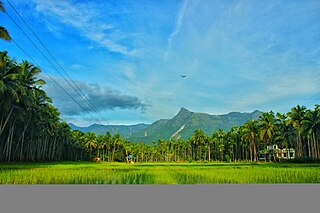
Dhoni is situated around 15 Kilometers from Palakkad town in Kerala, India. It is the location of Dhoni Waterfalls and the Western Ghat
Dhoni is situated around 15 Kilometers from Palakkad town in Kerala, India. It is the location of Dhoni Waterfalls and the Western Ghat
Dhoni is bordered by Western Ghats on the north. Dhoni Waterfalls is located around 15 km from Palakkad and around 34 km from Kollengode Town in Palakkad. [1] [2]


Palakkad is one of the 14 districts in the Indian state of Kerala. It was carved out of the southeastern region of the former Malabar District on 1 January 1957. It is located at the central region of Kerala and is the second largest district in the state after Idukki. The city of Palakkad is the district headquarters. Palakkad is bordered on the northwest by the Malappuram district, on the southwest by the Thrissur district, on the northeast by Nilgiris district, and on the east by Coimbatore district of Tamil Nadu. The district is nicknamed "The granary of Kerala". Palakkad is the gateway to Kerala due to the presence of the Palakkad Gap, in the Western Ghats. The 2,383 m high Anginda peak, which is situated in the border of Palakkad district, Nilgiris district, and Malappuram district, in Silent Valley National Park, is the highest point of elevation in Palakkad district. Palakkad city is about 347 kilometres (216 mi) northeast of the state capital, Thiruvananthapuram.
Nilambur is a major town, a municipality and a Taluk in the Malappuram district of the Indian state of Kerala. It is located close to the Nilgiris range of the Western Ghats on the banks of the Chaliyar River. This place is also known as 'Teak Town' because of the abundance of Nilambur teaks, which is a variety of a large, deciduous tree that occurs in mixed hardwood forests. Unlike many Municipalities of India; Nilambur is covered with large amounts of vegetation, making it very scenic.

Ponmudi is a hill station in the Peringamala gramapanchayath of Trivandrum District of Kerala in India. It is located 22km west of Vithura town, 53 km north-east of Trivandrum City, 78 km south-east of Varkala town and 69 km north-east of Kovalam Beach at an altitude of 1,100 m (3,600 ft). Ponmudi (Varayadumotta) peak is a part of the Western Ghats mountain range that runs parallel to the Arabian Sea. Ponmudi is a popular honeymoon destination in South India. The normal temperature of Ponmudi is between 18 and 25 °C.

Palakkad Gap or Palghat Gap is a low mountain pass in the Western Ghats between Coimbatore in the Indian state of Tamil Nadu and Palakkad in the state of Kerala. It has an average elevation of 140 metres (460 ft) with a width of 24–30 kilometres (15–19 mi). The pass is located between the Nilgiri Hills to the north and Anaimalai Hills to the south.

The Anamala or Anaimalai, also known as the Elephant Mountains, are a range of mountains in the southern Western Ghats of central Kerala and span the border of western Tamil Nadu in Southern India. The name anamala is derived from the Malayalam word aana and the Tamil word yaanai, meaning elephant, or from tribal languages. Mala or Malai means 'mountain', and thus literally translatable as 'Elephant mountain'.

Malampuzha is a town in Palakkad district of Kerala, India. It is located about 3.5 km (2.2 mi) from Malampuzha Dam and 14 km (8.7 mi) from Palakkad city.

Chalakudy River or Chalakudy Puzha is the fifth longest river in Kerala, India. The river flows through Thrissur district, Palakkad district and Ernakulam district of Kerala. The total drainage area of the river is 1704 km2. Out of this, 1404 km2 lies in Kerala and the rest in Tamil Nadu. The length of the river is 145.5 km. Though Chalakudy River in strict geological sense is a tributary of the Periyar river, for all practical purposes it is treated as a separate river by Government and other agencies. The river has gained its name since it flows along the banks of the Chalakudy Town, the major settlement along the course of the river. It is perhaps the most unpolluted and pristine river in the state and even in India due to the limited amount of industries and wastage disposal around it. Chalakudy River and its basin area were one of the most affected rivers during the 2018 Kerala floods.
Kizhakkancherry is a gram panchayat in the Palakkad district, state of Kerala, India. It is a local government organisation that serves the villages of Kizhakkencheri-I and Kizhakkencheri-II. It was formed in the year of 1951 and is the fourth largest grama panchayath in Kerala. It covers an area of 112.56 km2 and comprises 22 wards. The boundaries are Vadakkencherry (north), Pananjeri (south), Vandazhy (east) and Kannambra (west). The village is located 37.4 km from the city of Palakkad and 34.9 km from Thrissur.

Mannarkkad, formerly known as Mannarghat, is a major municipal town in Palakkad district of the Indian state of Kerala. The Silent Valley National Park and the Attappadi Reserve Forest are located in Mannarkkad Taluk. Mannarkkad is situated 36 km away from district headquarters Palakkad on National Highway 966. It is the traditional seat of the Mannarghat Moopil Nair.

Kerala is situated between the Lakshadweep Sea to the west and the Western Ghats to the east. Kerala's coast runs some 590 km in length, while the state itself varies between 35–120 km in width. Geologically, pre-Cambrian and Pleistocene formations comprise the bulk of Kerala's terrain. The topography consists of a hot and wet coastal plain gradually rising in elevation to the high hills and mountains of the Western Ghats. Kerala lies between northern latitude of 8°.17'.30" N and 12°. 47'.40" N and east longitudes 74°.27'.47" E and 77°.37'.12" E. Kerala's climate is mainly wet and maritime tropical, heavily influenced by the seasonal heavy rains brought up by the monsoon Weather.

Palakkad, also known as Palghat, historically known as Palakkattussery, is a city and municipality in the Indian state of Kerala. It is the administrative headquarters of Palakkad District. Palakkad is the most densely populated municipality and the fourth-most densely populated city in the state. It was established before Indian independence under British rule and known by the name Palghat. Palakkad is famous for the ancient Palakkad Fort, which is in the heart of the city and was captured and rebuilt by Hyder Ali in 1766 which later fell into the hands of Zamorin in 1784. The city is about 347 kilometres (216 mi) northeast of the state capital, Thiruvananthapuram.

Thrissur, anglicised as Trichur, is one of the 14 districts in the Indian state of Kerala. It is situated in the central region of the state. Spanning an area of about 3,032 km2 (1,171 sq mi), the district is home to over 9% of Kerala's population.

Malampuzha Dam is the second largest dam and reservoirs in Kerala, located near Palakkad, in the state of Kerala in South India, built post independence by the then Madras state. Situated in the scenic hills of the Western Ghats in the background it is a combination of a masonry dam with a length of 1,849 metres and an earthen dam with a length of 220 metres making it the longest dam in the state. The dam is 355 feet high and impounds the Malampuzha River, a tributary of Bharathappuzha, Kerala's second longest river. There is a network of two canal systems that serve the dam's reservoir of 42,090 hectares.

Wadakkancherry is a major town in Thrissur, Kerala. Up until 1860, this area was part of Chelakkara Taluk. Now, it is the headquarters of Talappilly Taluk. Wadakkanchery obtained municipality status from the government by merging with the Mundathikode panchayath and it is the only town in Thrissur District to be raised as municipality recently. There are two places with similarly pronounced names: Wadakanchery and Vadakkenchery.
Karuvarakundu is a semi-urban area in the eastern part of Malappuram district, Kerala, India. It is situated 32 kilometres (20 mi) east of Manjeri, 26 kilometres (16 mi) northeast of Perinthalmanna and 30 km southeast of Nilambur. The Olippuzha River, a tributary of the Kadalundipuzha, flows through the town. Karuvarakundu is close to the Western Ghats and hence prone to landslides.
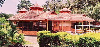
Vandithavalam is a village in the Palakkad district, state of Kerala, India. It is among the villages administered by the Perumatty Gram Panchayat.

Kakkadampoyil, is a small village in Malappuram district, Kerala, India bordered with Kozhikode district.This is located in Nilambur. The village has recently emerged as a major tourist destination in the district.
Elivai Mala is a 2,088-metre-tall (6,850 ft) peak in the Western Ghats(Sahyadri Mountains) of South India. The mountain lies in Palakkad district of Kerala, close to the border with Tamil Nadu. With a topographic prominence of 1,540 metres it is one of the ultra prominent peaks of South Asia. It forms the highest point in the Western Ghats to the immediate north of the Palakkad Gap. It is the highest peak in between Anamalai Hills and Nilgiri Hills in Western Ghats.
Palakkad district has a large number of temples, churches, mosques and other tourist attractions. Palakkad district is situated in the middle of Kerala state in South India. The nearest airports are at Coimbatore in Tamil Nadu and Cochin in Kerala.

South Malabar refers to a geographical area of the southwestern coast of India covering some parts of the present-day Kerala state. South Malabar covers the regions included in present-day Kozhikode taluk of Kozhikode district, the whole area of Malappuram district, Chavakkad taluk of Thrissur district, and Palakkad district, excluding parts of Chittur taluk. The Fort Kochi region of Kochi city also historically belongs to South Malabar. The term South Malabar refers to the region of the erstwhile Malabar District south to the river Korapuzha, and bears a high cultural similarity to both the Cochin and the North Malabar regions.
| | This article related to a location in Palakkad district, Kerala, India is a stub. You can help Wikipedia by expanding it. |