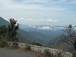
Agali, Palakkad

Last updated

Agali
Village
India Kerala location map.svg
Red pog.svg
Agali
Location in Kerala, India
India location map.svg
Red pog.svg
Agali
Agali (India)
Coordinates: 11°06′04″N76°38′51″E / 11.1012°N 76.6474°E / 11.1012; 76.6474
CountryFlag of India.svg  India
State Kerala
District Palakkad
Government
  Type Gram Panchayat
Area
  Total76 km2 (29 sq mi)
Population
  Total22,327
  Density290/km2 (760/sq mi)
Languages
  Official Malayalam, English
  Regional Malayalam,Irula,Tamil [1]
Time zone UTC+5:30 (IST)
Vehicle registration KL-50
Agali Road Attappadi Hills 5.jpg
Agali Road
'Civilized' Agali Mobile Tower at Agali.JPG
'Civilized' Agali

Agali is a village in Palakkad district in the state of Kerala, India. It forms a part of the Agali Grama Panchayat. [2]

Contents

Silent Valley National Park

Agali is the nearest town for travelling to Silent Valley National Park. There are three Lodges and several resorts in Agali town catering to tourists coming to Silent Valley, as the town is only 16 kilometers from the Park.

Demographics

As of 2011 Indian census, Agali village had population of 22,327 with an area spread over 76 km2 where males constitute 11,239 and females constitute 11,088. Population of children in the age group of 0-6 was 2,346 where 1,195 are males and 1,151 are females. Overall literacy of Agali village was 79.9% lower than state average of 94% among which male literacy was 84.2% and female literacy was 75.5%.

Agali grama panchayat had total population of 34,941 with an area spread over 153 km2. Among which males constitute 17,393 and females constitute 17,548. Total number of households were 8,695 in the panchayat limits. Agali panchayat has administration over 2 revenue villages like Agali and Kallamala. Population in the age group 0-6 was 3,786. Total literacy of Agali grama panchayat was 82.7%. [3]

Transportation

Agali is 38 km from Mannarkkad in Kerala. The little town of Anakkatti on Tamil Nadu border is only 18 km from Agali. Buses from Anaikatti come to Agali through Anakkatti - Mannarkkad road and the distance is 18 km.

In Attappadi all stops have QR Code for transportation. This project introduced by Makkal Raja Productions.

Related Research Articles

<span class="mw-page-title-main">Palakkad district</span> District in Kerala, India

Palakkad is one of the 14 districts in the Indian state of Kerala. It was carved out of the southeastern region of the former Malabar District on 1 January 1957. It is located at the central region of Kerala and is the second largest district in the state after Idukki. The city of Palakkad is the district headquarters. Palakkad is bordered on the northwest by the Malappuram district, on the southwest by the Thrissur district, on the northeast by Nilgiris district, and on the east by Coimbatore district of Tamil Nadu. The district is nicknamed "The granary of Kerala". Palakkad is the gateway to Kerala due to the presence of the Palakkad Gap, in the Western Ghats. The 2,383 m high Anginda peak, which is situated in the border of Palakkad district, Nilgiris district, and Malappuram district, in Silent Valley National Park, is the highest point of elevation in Palakkad district. Palakkad city is about 347 kilometres (216 mi) northeast of the state capital, Thiruvananthapuram.

<span class="mw-page-title-main">Puthunagaram</span> Town in Kerala, India

Puthunagaram is a town and gram panchayat in the Palakkad district, state of Kerala, India. It is about 10 km south of Palakkad and 8 Km from Kollengode. Palakkad-Pollachi railway line passes through this town.

Padiyoor is a small town in Kannur district of Kerala state, India. Padiyoor village is part of Padiyoor-Kalliad Grama Panchayat in Iritty taluk.

<span class="mw-page-title-main">Attappadi</span> Taluk in Kerala, India

Attappadi (HQ:Agali) is a tribal taluk in Kerala state covering an area of 735 km2 (284 sq mi). It is carved out from Mannarkkad taluk in Palakkad district in February 2021. Attappadi Reserve Forest is a protected area comprising 249 km2 of land area in the western parts of Attappadi. It is one among the reserved forests and protected forests of India. Attappadi valley in Palakkad district along with the neighbouring Chaliyar valley of the Nilambur region in Malappuram district is known for natural Gold fields which are also seen in the other regions of Nilgiri Biosphere Reserve.

<span class="mw-page-title-main">Mannarkkad</span> Municipality in Kerala, India

Mannarkkad, formerly known as Mannarghat, is a major municipal town in Palakkad district of the Indian state of Kerala. The Silent Valley National Park and the Attappadi Reserve Forest are located in Mannarkkad Taluk. Mannarkkad is situated 36 km away from district headquarters Palakkad on National Highway 966. It is the traditional seat of the Mannarghat Moopil Nair.

Pariyaram is a Grama Panchayat consisting of two villages viz. Pariyaram census town and Kuttiyeri village. Pariyaram is a suburb of Taliparamba on National Highway between Taliparamba and Payyanur in Kerala state of India. Mini villages of Thiruvattoor, Koran Peedika, Mukkunnu & Chithappile Poyil are parts of Pariyaram.

<span class="mw-page-title-main">Cheruthazham</span> Census Town in Kerala, India

Cheruthazham is a Census Town and Grama Panchayat in Kannur district in the state of Kerala, India. It is the location of the famous Hanumarambalam, dedicated to Sri Rama and Hanuman.Cherutazham is also the birthplace of Kalamandalam Krishnan Nair who gave a new dimension to the art of Kathakali. There are many artists in Cherutazham who are experts in the traditional musical items like "panchavadyam", "taayambaka", "chenda melam" etc. The new generation of Cherutazham is also getting trained in these art forms.

<span class="mw-page-title-main">Kannadiparamba</span> Census Town in Kerala, India

Kannadiparamba is a census town in Kannur district in the Indian state of Kerala.

<span class="mw-page-title-main">Panniyannur</span> Census Town in Kerala, India

Panniyannur is a census town in Thalassery taluk of Kannur district in the Indian state of Kerala. It is part of Greater Mahé Region.

<span class="mw-page-title-main">Udma</span> Census Town in Kerala, India

Udma is a census town in Kasaragod district in the Indian state of Kerala.

<span class="mw-page-title-main">Mayyil</span> Census Town in Kerala, India

Mayyil is a Census Town and Grama Panchayat in Kannur District of Kerala State. Mayyil Panchayat established in 1962 by merging the villages of Kayaralam, Mayyil and Kandakkai.

Koodali is a census town and grama panchayat in Thalassery taluk of Kannur district in Kerala state, India. Koodali is located 15.5 km (9.6 mi) east of Kannur city on Kannur-Mattanur road.

<span class="mw-page-title-main">Kanichar</span> Village in Kerala, India

Kanichar is a village and Grama Panchayat in Kannur district in the Indian state of Kerala.

<span class="mw-page-title-main">Karivellur</span> Census town in Kerala, India

Karivellur is a census town and Gram Panchayat in Kannur district of Kerala state, India.

<span class="mw-page-title-main">Muzhakkunnu</span> Village in Kerala, India

Muzhakkunnu is a Village and Grama Panchayat in Kannur district in the Indian state of Kerala.

<span class="mw-page-title-main">Paivalike</span> Village in Kerala, India

Paivalike is a village in Kasaragod district in the state of Kerala, India. Paivalike is 11 km (6.8 mi) east of Uppala town and 40 km (25 mi) south of Mangalore city.

Kallamala is a village in the Palakkad district, state of Kerala, India. It is administrated by the Agali gram panchayat.

Padavayal is a village in the Palakkad district, state of Kerala, India. It is administrated by the Pudur Grama Panchayat.

Kolachery is a census town and Grama Panchayat in Kannur District of Kerala state, India. Kolachery is located 15 kilometres (9.3 mi) north east of Kannur city.

Kottathara is a village in the Sholayur grama panchayat of Palakkad district in Kerala state, India. It was earlier part of Mannarkkad taluk prior to the formation of Attappady taluk.

References

  1. "Table C-16 Population by Mother Tongue: Kerala". www.censusindia.gov.in. Registrar General and Census Commissioner of India.
  2. "Reports of National Panchayat Directory". Ministry of Panchayati Raj. Archived from the original on 30 December 2013. Retrieved 30 December 2013.
  3. https://censusindia.gov.in  › 3...PDF Web results Palakkad - DISTRICT CENSUS HANDBOOK (ref page nos:106,107,260,261)