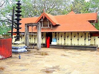
Puthunagaram is a village and gram panchayat in the Palakkad district, state of Kerala, India.

Akathethara is a village in Palakkad district in the state of Kerala, India. Akathethara belongs to central Kerala Division.It is located to 2 km towards North from District headquarters Palakkad and 5 km from renowned Malampuzha garden. Here situated NSS College of Engineering, one of the prominent engineering institutes in Kerala.
Erimayur is a gram panchayat in the Palakkad district, state of Kerala, India. It is a local government organization that serves the villages of Erimayur-I and Erimayur-II.
Kizhakkancherry is a gram panchayat in the Palakkad district, state of Kerala, India. It is a local government organisation that serves the villages of Kizhakkencheri-I and Kizhakkencheri-II. It was formed in the year of 1951 and is the fourth largest grama panchayath in Kerala. It covers an area of 112.56 km2 and comprises 22 wards. The boundaries are Vadakkencherry (north), Pananjeri (south), Vandazhy (east) and Kannambra (west). The village is located 37.4 km from the city of Palakkad and 34.9 km from Thrissur.

Ayiloor is a village in the Palakkad district, state of Kerala, India. It forms a part of the Ayiloor gram panchayat.
Eruthempathy is a village in the Palakkad district, state of Kerala, India. It forms a part of the Eruthampathy gram panchayat.

Kairady is a village in the Palakkad district, state of Kerala, India. It forms a part of the Ayiloor gram panchayat.
Kozhipathy is a village in the Palakkad district, state of Kerala, India. It forms a part of the Eruthampathy gram panchayat.

Kumaramputhur is a village in Palakkad district in the state of Kerala, India. It is administered, along with some other villages, by the Kumaramputhur gram panchayat.
Kuzhalmannam-I is a village in the Palakkad district, state of Kerala, India. It forms a part of the Kuzhalmannam gram panchayat, along with Kuzhalmannam-II.
Kuzhalmannam-II is a village in Palakkad district in the state of Kerala, India. It forms a part of the Kuzhalmannam gram panchayat, along with Kuzhalmannam-I.

Mannur is a village and gram panchayat in the Palakkad district, state of Kerala, India.

Palakkayam is a village in the Palakkad district, state of Kerala, India. It is administrated by the Thachampara grama panchayath. Palakkayam is about 16 km from Siruvani Dam Eco tourism spot, connected to Edakkurussi on Palakkad-Kozhikode National Highway about 33 km from Palakkad and 120 km from Kozhikode. Kanjirapuzha Dam, a masonry earth dam built for providing irrigation is located is located about 6 km from Palakkayam. The nearest airport is Coimbatore, about 100 km and nearest Rly Stn is Palakkad Jn, about 30 km.the nearest hospital assumption hospital kanjirapuzha.nearest school carmel hss palakkayam.

Parli-I is a village in Palakkad district in the state of Kerala, India. Parli-I and Parli-II come under the administration of the Parli gram panchayat.

Parli-II is a village in Palakkad district in the state of Kerala, India. Parli-I and Parli-II come under the administration of the Parli gram panchayat.

Payyanadam is a village in Palakkad district in the Indian state of Kerala.

Agali is a small town in Palakkad district in the state of Kerala, India. It forms a part of the Agali gram panchayat.
Elappully is a gram panchayat in the Palakkad district, state of Kerala, India. It is a local government organisation that serves the villages of Elappully-I and Elappully-II.
Kadampazhipuram is a gram panchayat in Palakkad district, state of Kerala, India. It is a local government organisation that serves the villages of Kadampazhipuram-I and Kadampazhipuram-II. The place is on the Palakkad - Cherpulassery Road.
Karimpuzha is a gram panchayat in the Palakkad district, state of Kerala, India. It is a local government organisation that serves the villages of Karimpuzha-I and Karimpuzha-II.


