Charpa Falls

Last updated

Charpa Falls
The Milky Charpa Falls, Chalakudy.jpg
The Milky Charpa Falls
India relief location map.jpg
Red pog.svg
Location Thrissur District, Kerala, India
Coordinates 10°18′16″N76°34′47″E / 10.30455°N 76.57981°E / 10.30455; 76.57981 Coordinates: 10°18′16″N76°34′47″E / 10.30455°N 76.57981°E / 10.30455; 76.57981
Watercourse Chalakkudi River

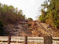
Charpa Falls is a waterfall located in Athirappilly panchayath in Thrissur district of Kerala. Located on the west-flowing Chalakudy River, this waterfall lies in between the more famous Athirappilly Falls and Vazhachal Falls. [1] It is a popular stopover for tourists who are visiting the Athirappilly and Vazhachal Falls. It is located close to the road, [2] and during monsoon months (June to August), the water splashes onto the road. [3] During the dry season, the water stops flowing.

Contents

See also

Related Research Articles

Thrissur Metropolis in Kerala, India

Thrissur, formerly Trichur, also known by its historical name Thrisshivaperur, is a city and the headquarters of the Thrissur district in Kerala, India. It is the fourth largest city in Kerala after Trivandrum, Kochi and Kozhikode, and the 21st largest in India. It is famous for the Thrissur Pooram festival. The city is built around a 65-acre (26 ha) hillock called the Thekkinkaadu Maidaanam which seats the Vadakkumnathan temple. It is located 304 kilometres (189 mi) north-west of the state's capital city, Trivandrum. Thrissur was once the capital of the Kingdom of Cochin. Thrissur is known as "Cultural Capital of Kerala" due of its cultural, spiritual and religious leanings throughout history. One of its main cultural events is the Thrissur Pooram, which attracts quite a number of tourists and travellers.

Dudhsagar Falls

Dudhsagar Falls is a four-tiered waterfall located on the Mandovi River in the Indian state of Goa. It is 60 km from Panaji by road and is located on the Belgaum–Vasco da Gama rail route about 46 km east of Madgaon and 80 km south of Belagavi. Dudhsagar Falls is amongst India's tallest waterfalls with a height of 310 m (1017 feet) and an average width of 30 metres (100 feet).

Chalakudy Town in Kerala, India

Chalakudy is a municipal town situated on the banks of Chalakudy River in Thrissur district of the Kerala state in India. It is the headquarters of Chalakudy taluk. It is the base camp for travellers to Athirappilly Falls and Vazhachal Falls. Chalakudy lies on National Highway 544 and located about 47 km (23 mi) north of the city of Kochi, and 30 km (19 mi) south of Thrissur.

Chalakudy River

Chalakudy River or Chalakudy Puzha is the fifth longest river in Kerala, India. The river flows through Thrissur district, Palakkad district and Ernakulam district of Kerala. The total drainage area of the river is 1704 km2. out of this 1404 km2 lies in Kerala and the rest 300 km2 in Tamil Nadu. The length of the river is 145.5 km. Though Chalakudy river in strict geological sense is a tributary of the Periyar river, for all practical purposes it is treated as a separate river by Government and other agencies. The River has gained its name, since it flows along the banks of the Chalakudy Town, the major settlement along the course of the river. It is perhaps the most unpolluted and pristine river in the state and even in India due to the limited amount of industries and wastage disposal around it. Chalakudy River and its basin area were one of the most affected rivers during the 2018 Kerala floods.

Thrissur district District in Kerala, India

Thrissur is a district of Kerala situated in the central part of that state. Spanning an area of about 3,032 km2 (1,171 sq mi), Thrissur district is home to over 9% of Kerala's population.

Vazhachal Falls

Vazhachal Falls is situated in Athirappilly Panchayath of Thrissur district in Kerala on the southwest coast of India. Located on the west-flowing Chalakudy River near the Vazhachal Forest Division and at the edge of the Sholayar ranges, it is just 5 km from entrance of Athirappilly Falls. It is located 36 km from Chalakudy.

Valparai Town in Tamil Nadu, India

Valparai is a Taluk and hill station in the Coimbatore district of Tamil Nadu, India. It consists of Anamalai Tiger Reserve. It is located 7,502 feet (2,287 m) above sea level on the Anaimalai Hills range of the Western Ghats. The foothill starts exactly from Monkey Falls which is at a distance of 38 kilometres (24 mi) to Valparai. The route to Valparai from the foothills consists of 40 hairpin bends. The Kerala state border town of Malakkappara is at a distance of 26 miles from Valparai. While major portions of the land are owned by private tea companies, large forest areas continue to be out of bounds.

Athirappilly Village in Kerala, India

Athirappilly is a first grade Grama Panchayath with 489.00 km2 area in Chalakudy Taluk, Thrissur district in Kerala, India. It is located 60 km from Thrissur city, 70 km northeast of Kochi city, 55 km northeast of Cochin International Airport, and 30 km from Chalakudy town.

Athirappilly Falls Waterfall in Athirappilly, India

Athirappilly Falls, is situated in Athirappilly Panchayat in Chalakudy Taluk of Thrissur District in Kerala, India on the Chalakudy River, which originates from the upper reaches of the Western Ghats at the entrance to the Sholayar ranges. It is the largest waterfall in Kerala, which stands tall at 80 feet. Just a short drive from Athirappilly to the Vazhachal falls, which is close to dense green forests that are home to many endangered and endemic species of flora and fauna.

Sholayar Dam Dam in Malakkappara, Thrissur, Kerala, India 20px

Sholayar Dam is a concrete dam built across the Chalakkudi River in Malakkappara, Thrissur district, Kerala state of India. The dam consists of main Sholayar Dam, Sholayar Flanking and Sholayar Saddle Dam. It also contains Sholayar Hydro Electric Power Project of Kerala State Electricity Board who owns the dam. Total installed capacity of the project is 54MW with 3 penstock pipes. The maximum storage capacity is 2663 feet. Sholayar is 65 km from Chalakudy town. The dam above Sholayar dam was Upper Solaiyar Dam owned by Tamilnadu.

Potta

Potta is a tiny village 30 miles north of Kochi, also known as Cochin. It comes under the municipality of Chalakudy in the Thrissur district in the state of Kerala, India. Potta is a town in the Thrissur district in the state of Kerala, India. Potta was the temple land under the Irinjalakuda Koodalmanikyam Temple. In the past, the crops needed for the temple were cultivated at Potta. The Pambambot temple is very famous, other two temples in Potta are the Parakottilinkal Bhagavathi Temple and the Mathilthkavu Bhagavathi Temple. Cherupushpam Shrine, a Christian church, is famous. There are educational institutions like Panampilly Memorial Government College, Vyasa Vidyaniketan Central School, Kuriakos Chavara UP School and Dhanya Mission Hospital.

State Highway 21 is a State Highway in Kerala, India that starts in Chalakudy and ends at the state boundary at Malakkappara. The highway is 86.0 km long.

Hundru Falls

The Hundru Falls is a waterfall located in Ranchi district in the Indian state of Jharkhand. It is the 34th highest waterfall in India. It is one of the most famous tourist places in the region.

Malakkappara Hill station in Kerala, India

Malakkappara or Malakhappara is a small hill station Thrissur district, state of Kerala, India. This place is situated in the border of Kerala and Tamil Nadu.

Nirmala College of Engineering

Nirmala College of Engineering is a private engineering college situated in Kunnappilly, Thrissur district of Kerala, India. The college is affiliated to APJ Abdul Kalam Technological University and University of Calicut. It is situated near the banks of Chalakudy River in the valleys of Athirappilly-Vazhachal range.

Pattathippara Falls is a cascade waterfall located in Pananchery Grama Panchayat in Thrissur district of Kerala, India. The entry into waterfalls area is blocked since it is inside the reserve forest. Unauthorized entry will attract imprisonment 1 to 5 years and up to ₹5000 as fine. The waterfall is three-tiered but appears in rainy seasons as a single fall.

Administration of Thrissur district

Thrissur District has four types of administrative hierarchies:

References

  1. Sajith (9 May 2009). "Kerala tourism: Vazhachal falls & Charpa falls". Keralatourism-kns.blogspot.in. Retrieved 5 September 2012.
  2. "Waterfalls - Charpa Falls - Tourist Information of India - Lakes, Waterfalls, Beaches, Monuments, Museums, Places, Cities - By". Tripsguru.com. Archived from the original on 16 May 2012. Retrieved 5 September 2012.
  3. MustSeeIndia.com. "Thrissur: Charpa Falls, Thrissur Tourist Places to Visit for". Mustseeindia.com. Archived from the original on 10 October 2012. Retrieved 5 September 2012.