A dam is a barrier that stops or restricts the flow of surface water or underground streams. Reservoirs created by dams not only suppress floods but also provide water for activities such as irrigation, human consumption, industrial use, aquaculture, and navigability. Hydropower is often used in conjunction with dams to generate electricity. A dam can also be used to collect or store water which can be evenly distributed between locations. Dams generally serve the primary purpose of retaining water, while other structures such as floodgates or levees are used to manage or prevent water flow into specific land regions.

A diversion dam is a dam that diverts all or a portion of the flow of a river from its natural course. Diversion dams do not generally impound water in a reservoir; instead, the water is diverted into an artificial water course or canal, which may be used for irrigation or return to the river after passing through hydroelectric generators, flow into a different river or be itself dammed forming an onground or groundwater reservoir or a storm drain.

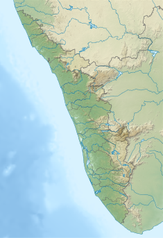
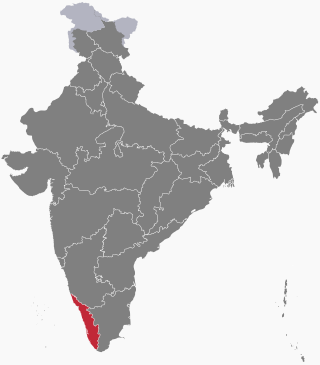
Periyar, IPA: [peɾijɐːr], is the longest river and the river with the largest discharge potential in the Indian state of Kerala. It is one of the few perennial rivers in the region and provides drinking water for several major towns. The Periyar is of utmost significance to the economy of Kerala. It generates a significant proportion of Kerala's electrical power via the Idukki Dam and flows along a region of industrial and commercial activity. The river also provides water for irrigation and domestic use throughout its course besides supporting a rich fishery. Due to these reasons, the river has been named the "Lifeline of Kerala". Kochi city, in the vicinity of the river mouth draws its water supply from Aluva, an upstream site sufficiently free of seawater intrusion. Twenty five percent of Kerala's industries are along the banks of river Periyar. These are mostly crowded within a stretch of 5 kilometres (3 mi) in the Eloor-Edayar region (Udhyogamandal), about 10 kilometres (6 mi) north of Kochi harbor.

The Idukki Dam is a double curvature arch dam constructed across the Periyar River in a narrow gorge between two granite hills locally known as Kuravan and Kurathi in Idukki, Kerala, India. At 168.91 metres (554.2 ft), it is one of the highest arch dams in Asia. It is constructed and owned by the Kerala State Electricity Board. It supports a 780 MW hydroelectric power station in Moolamattom, which started generating power on 4 October 1975. The dam type is a concrete, double curvature parabolic, thin arc dam. The Indo-Canadian project was inaugurated by the Prime Minister Indira Gandhi on February 17, 1976.

Nagarjuna Sagar Dam is a masonry dam across the Krishna River at Nagarjuna Sagar which straddles the border between Palnadu district in Andhra Pradesh and Nalgonda district in Telangana. The dam provides irrigation water to the districts of Palnadu, Guntur, Nalgonda, Prakasam, Khammam, Krishna, and parts of West Godavari. It is also a source of electricity generation for the national grid.

The Conowingo Dam is a large hydroelectric dam in the lower Susquehanna River near the town of Conowingo, Maryland. The medium-height, masonry gravity dam is one of the largest non-federal hydroelectric dams in the U.S., and the largest dam in the state of Maryland.
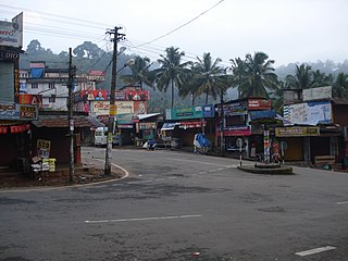
Cheruthoni is a town on the banks of Cheruthoni River, a major tributary of the Periyar River, the second longest river in Kerala state, India. The area is known by Cheruthoni Dam, which is a part of Idukki reservoir, which provide hydroelectric power to the region.
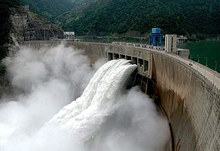
The Xiaowan Dam is an arch dam on the Lancang (Mekong) River in Nanjian County, Yunnan Province in southwest China. The primary purpose of the dam is hydroelectric power generation and it supports a 4,200 MW power station. Constructed between 2002 and 2010 by Huaneng Power International at a cost of ¥32 billion, it is the world's second highest arch dam at 292 m (958 ft). It is also third highest among dams of all types behind Jinping-I and Nurek and the third largest hydroelectric power station in China.
The Ertan Dam is an arch dam on the Yalong River, a tributary of the Yangtze River in Sichuan Province, in southwest China.

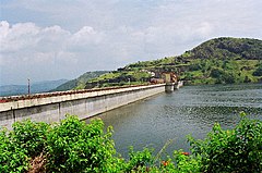
The Ponmudi Dam is a concrete gravity dam built across the Panniyar river which is a tributary of Periyar river at Konnathady panchayath of Konnathadi village in Idukki district of Kerala, India. The dam was constructed in 1963 as a part of a hydroelectric project. Construction was led by E.U.Philipose, Superintending Engineer, Kerala State Electricity Board. It has a length of 288.80 metres (947.5 ft). The hydropower component of the dam has an installed capacity of 30 MW with firm power of 17 MW, generating 158 GWh annually. Taluks through which the river flow are Udumbanchola, Devikulam, Kothamangalam, Muvattupuzha, Kunnathunadu, Aluva, Kodungalloor and Paravur.

Basava Sagar Dam, previously known as Narayanpura Dam, is a dam constructed across the Krishna River at Yadgir District, Karnataka State, India. The reservoir that it impounds is known as Basava Sagar, and has a total storage capacity of 37.965 tmcft (1.075 km³), with 30.5 tmcft (0.85 km³) live storage. The full reservoir level is 492.25 m MSL and the minimum draw down level is 481.6 m MSL. It was a single purpose project meant only for irrigation, but downstream electrical generation and drinking water considerations enter into its management. The dam is 29 meters high and over 10.637 kilometres (6.610 mi) long, and has 30 gates for water release. 22 Spillway Gates are present in the Dam It took Rs. 50.48 crore to complete.

Malankara dam is a gravity dam constructed across Thodupuzha river for irrigation purposes. The dam is constructed to make use of the tail water from the Moolamattom power house. The project is run under the Muvattupuzha Valley Irrigation Project and KSEB. The artificial lake covers an area of around 11 square km.

Kulamavu Dam is a gravity/masonry dam on Kilivillithode which is a tributary of the Periyar river in Arakkulam village, Idukki district of Kerala, India. It is one of the three dams associated with the Idukki hydro electric power project in the Indian state of Kerala. This dam is located towards the western side of the Idukki Arch Dam. This is a gravity dam with the top portion in concrete and the bottom in masonry.
On 16 August 2018, severe floods affected the south Indian state Kerala, due to unusually high rainfall during the monsoon season. It was the worst flood in Kerala in nearly a century. Over 483 people died, and 15 went missing. About a million people were evacuated, mainly from Chengannur, Pandanad, Edanad, Aranmula, Kozhencherry, Ayiroor, Ranni, Pandalam, Kuttanad, Malappuram, Aluva, Chalakudy, Thrissur, Thiruvalla, Eraviperoor, Vallamkulam, North Paravur, Chellanam, Vypin Island and Palakkad. All 14 districts of the state were placed on red alert. According to the Kerala government, one-sixth of the total population of Kerala had been directly affected by the floods and related incidents. The Indian government had declared it a Level 3 Calamity, or "calamity of a severe nature". It is the worst flood in Kerala after the great flood of 99 that took place in 1924.
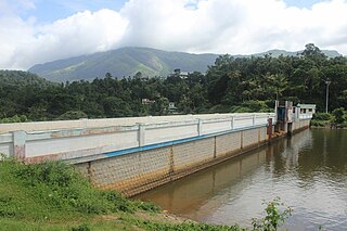
Azhutha Dam is a small diversion dam built on the Azhutha river which is a tributary of the Pamba River, at Azhutha in Peerumed Grama Panchayat of Idukki District, Kerala, India. It is a small concrete gravity dam that is only 72 metres (236 ft) long and 14 metres (46 ft) high. It acts mainly as a diversion dam to supply water to the Idukki Dam. Azhutha dam is constructed as an augmentation dam for the Idukki Hydro Electric Project. Construction of the project started in 1987 and was expected to be commissioned in 1991. But the project overrun and was only partially commissioned in June 1998. The year of completion was 2007. The release of the water from the dam is to Azhutha river and it flows through Ranni and Ayroor taluks.

Kallarkutty Dam is a gravity dam built on the Muthirapuzha river, a tributary of the Periyar river, as part of the Neriamangalam Hydroelectric Project at Kallarkutty in Vellathooval panchayat of Idukki district in Kerala, India. The water discharged from the Chenkulam dam's powerhouse and the Muthirapuzha river is diverted to the Neriamangalam powerhouse near Panamkutty above the Pambla dam. The Hydroelectric Project was commissioned on 27 January 1961 to generate 45 MW of power using 3 turbines with a capacity of 15 MW. In 2006, the project was upgraded from 45 MW to 52.65 MW. Taluks through which release flow are Udumbanchola, Devikulam, Idukki, Kothamangalam, Muvattupuzha, Kunnathunadu, Aluva, Kodungalloor and Paravur.

Kundala Dam, also known as Setuparvatipuram Dam, is a masonry gravity dam built on Muthirapuzha River in Mattupetty panchayat of Idukki district in Kerala, India. It is part of the Pallivasal Hydroelectric Project, the first hydroelectric project in Kerala. The dam is considered to be Asia's first arch dam. It has a height of 46.93 m (154.0 ft) and length of 259.38 m (851.0 ft). Release from dam is to river Palar and taluks through which release flow are Udumbanchola, Devikulam, Kothamangalam, Muvattupuzha, Kunnathunadu, Aluva, Kodungalloor and Paravur.
Chenkulam Dam is a gravity dam located on the Muthirapuzha river in Vellathooval panchayat of Idukki district in the Indian state of Kerala. It spans 144.50 metres (474.1 ft) long and stands 26.82 metres (88.0 ft). It hosts a 48 MW power plant.
Narakakkanam Weir is a diversion dam constructed across Narakakkanam River in Mariyapuram panchayath of Thankamani Village in Idukki district in Kerala, India. Narakakkanam weir is an augmentation weir for the Idukki Hydro Electric Project. Narakakkanam, Azhutha, Vazhikkadavu, Vadakkepuzha and Kuttiar diversion schemes were later added to augment the Idukki reservoir. The height of the dam is 11.50 metres (37.7 ft) from the deepest foundation and length is 45.20 metres (148.3 ft).
Vadakkepuzha Weir is a diversion dam of Earthen type constructed across Vadakkepuzha which is a tributary of Muvattupuzha river in Arakkulam village in Idukki district of Kerala, India. Vadakkepuzha weir is a part of an augmentation scheme for the Idukki Hydro Electric Project. Narakakkanam, Azhutha, Vazhikkadavu, Vadakkepuzha and Kuttiar diversion schemes were later added to Idukki HEP to augment the reservoir. Water from the reservoir is pumped in to Idukki reservoir through a pump house with three pumps.