Alappuzha district, is one of the 14 districts in the Indian state of Kerala. It was formed as Alleppey district on 17 August 1957, the name of the district being changed to Alappuzha in 1990, and is the smallest district of Kerala. Alleppey town, the district headquarters, was renamed Alappuzha in 2012, even though the anglicised name is still commonly used to describe the town as well as the district.
Alappuzha or Alleppey is the administrative headquarters of Alappuzha district in state of Kerala, India. The Backwaters of Alappuzha are one of the most popular tourist attractions in India which attracts millions of domestic and international tourists.
The Main Central Road popularly known as MC Road is the arterial State Highway starting from Kesavadasapuram in Trivandrum city and ends at Angamaly, a suburb of Kochi city in Ernakulam District, in the state of Kerala, India. It is designated as State Highway 1 by the Kerala Public Works Department. The highway was built by Raja Kesavadas, Dewan of Travancore, in the 1790s. Plan for a new highway called Thiruvananthapuram–Angamaly Greenfield Highway, which runs parallel to the MC Road is proposed and is under early stage of development.

Greater Cochin Development Authority (GCDA) is the statutory body overseeing the development of the city of Kochi in the state of Kerala, India. Headquartered at Kadavanthra, GCDA oversees the development of the major part of Greater Cochin area which consists of the Kochi Municipal Corporation, surrounding municipalities and 21 intervening panchayats covering an area of 632 km2.
Aroor is a census town at the southern entry of Kochi city and the southern part of Kochi in the state of Kerala, India. It is a seafood related industrial area of Kochi. Aroor–Thuravoor Elevated Highway will be India's longest elevated highway upon completion.
Panavally is a village in India that is north part of Cherthala taluk and Alappuzha district in Kerala state. It is about 25 minutes(19 km) drive from Kochi city.
Pallippuram is a village located 5 kilometres (3.1 mi) from Cherthala in the Alappuzha district of the Indian state of Kerala.
Thycattusserry is a village in the Cherthala taluk of the Alappuzha district in the Indian state of Kerala.

Vechoor is a village in Vaikom taluk, Kottayam district in the state of Kerala, India. Vechoor is a short drive away from one of Kerala's tourist destinations, Kumarakom. The Vechur Cow breed of cattle is named after this village.
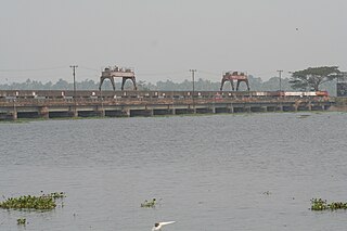
The Thanneermukkom Bund was constructed as a part of the Kuttanad Development Scheme to prevent tidal action and intrusion of salt water into the Kuttanad low-lands across Vembanad Lake between Thannermukkom on west and Vechur on east. Thanneermukkom Bund was constructed in 1974 and is functional since 1976. It is the largest mud regulator in India. This barrier essentially divides the lake into two parts - one with brackish water perennially and the other half with fresh water fed by the rivers draining into the lake.

The West Coast Canal or National Waterway No 3 is a 205 km (127 mi) long inland navigational route located in Kerala, India, which runs from Kollam to Kottapuram. It was declared a National Waterway in 1993. In addition to the main stretch, Champakara and Udyogmandal canals are navigable and connect the industrial centers of Kochi to Kochi port Inland Waterways Authority of India (IWAI) under the Ministry of Shipping is coordinating the task for developing, monitoring and administering national waterways. It is the first National Waterway in the country with 24-hour navigation facilities along the entire stretch. It has been extended to Kozhikode by the National Waterways Act, 2016. The National Waterway 3 mainly passes through the previous Thiruvananthapuram–Shoranur canal.
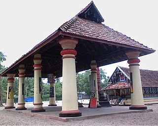
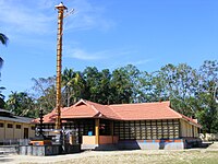
Nalppathenneeswaram Sree Mahadeva Temple is a Mahadevar temple situated in Nalppathenneswaram, in Panavally village of Cherthala taluk in Alleppy district of Kerala state; this place is 20 kilometers from Cherthala and 11 kilometers from Aroor on the Cherthala Arookutty bus route.
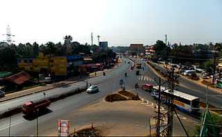
Vyttila, IPA:[ʋɐjt̺ːilɐ], is a ward of Kochi, Kerala. The Vyttila junction is one of the busiest as well as one of the largest intersections in Kerala. This node intersects the main north–south artery of the state of Kerala, namely, the Kochi Bypass, with three city roads of Kochi viz, the S. A. Road, the Vyttila-Petta Road, and the Thammanam Road.

Thuravoor is a gram panchayat in the Pattanakkad Block of Cherthala Taluk of the Alappuzha District, State of Kerala, India. It comes under Aroor Assembly constituency. Thuravoor lies under Kochi UA in future. A four lane(six lane is progressing) National Highway 66 passes through the village, which along with a railway station gives it excellent connectivity with the remainder of the state. Thuravoor is famous for the Narasimha Swamy temple which is dedicated to the fourth incarnation (avatara) of Vishnu, the Narasimha. The temple has two main deities, the Vadakkanappan and the Tekkanappan, which is rare among the temples of Kerala. The new 6 lane elevated highway is from thuravoor to aroor. It is the largest 6 lane elevated highway in the country. Thuravoor is a rapid developing town. It is lies in Aroor Assembly constituency. Thuravoor Kumbalangi road is a main road parallel to NH 66. Thuravoor is the major entry to Kochi city.
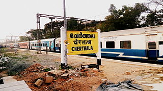
Ernakulam–Kayamkulam coastal line is a railway line which runs along the coastal areas of Alappuzha, Ernakulam districts in Kerala state of India. The coastal railway line starts as a branch line from Ernakulam Junction railway station towards Alappuzha and joins with the route via Kottayam at Kayamkulam Junction. This is the only main track in Kerala yet to be doubled and the single line traffic causes major delays in the route. The coastal line has a total distance of 102 km (63 mi).
Educational organizations in Cherthala, Kerala, India include multiple primary, secondary and tertiary institutions.
The following are some of the industries in Cherthala, Kerala, India.
Alappuzha District has four types of administrative hierarchies:
Waterways have always been an important mode of transport in Kerala. The total length of navigable route in Kerala was 1,900 kilometres and the navigable rivers constitute about 54 per cent of the waterways. The 41 West-flowing rivers together with the backwaters are an integrated part of the inland navigation system in Kerala. In Kerala water transportation through these channels are mainly small distant passenger services, informal country boats, freight transportation to PSU's such as Fertilisers and Chemicals Travancore, Kochi etc.